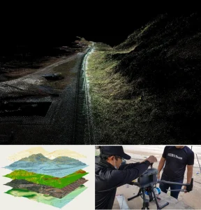
LiDAR Mapping Service
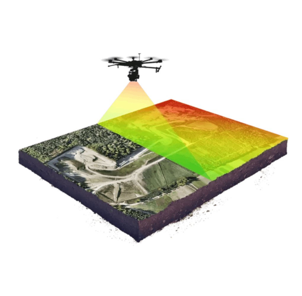
LiDAR Drone
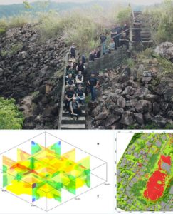
A LiDAR drone is a UAV with a laser-based LiDAR sensor that scans the ground to create accurate 3D maps. It’s widely used in topographic surveys, construction, forestry, flood analysis, and infrastructure mapping.
- Civil Engineering
- Enviromental Studies
- Plantation Management
- Mining & Quarry Mapping
- Utility and Infrastructure Projects
- Aerial Inspection Municipal Council
LiDAR Airbone
Airborne LiDAR uses laser pulses from an aircraft or drone to capture high-resolution 3D data of terrain, buildings, and vegetation.
- Flood Risk Analysis
- Urban Planning & Smart Cities
- Forest Canopy & Biomass Studies
- Terrain Modeling & Contour Mapping
- Powerline & Utility Corridor Mapping
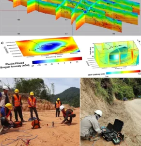
LiDAR Software
LiDAR software processes and analyzes 3D data from LiDAR sensors, turning raw point clouds into accurate maps and models for surveying, engineering, and planning.
- LAStools – Fast Point Cloud Processing
- Pix4D – LiDAR & Photogrammetry
- CloudCompare – Open-source 3D Data Visualization
- ArcGIS / QGIS – GIS platforms with LiDAR plugins
- TerraScan – Advanced Classification & Modeling
")
 (1)")
")
")
 (1)")


Integrity | Dedication | Excellence | Adaptability
www.geotechnica.com.my
Navigation Panel
Contact Us
GEOTECHNICA SDN BHD
48-1, Jalan Aman Sinaria 4,
Bandar Tropicana Aman,
42500 Rimbayu, Selangor
Tel: 03-8683 6682
Email: admin@geotechnica.com.my
All rights reserved. Copyright © 2025 GEOTECHNICA SDN BHD