Outcome / Problem (+)
What it helps determine
Identifies which slopes, sites and structures are at risk of landslide, erosion or slope failure — before rainfall, construction or time turns a risk into a failure.
Specific evidence
Slope angle and soil strength, rainfall-triggering thresholds, historical landslide and failure data, geological and structural weaknesses, seismic ground-shaking potential.
Definition / Methodology
Core concepts
Slope hazard refers to the risk of landslides, soil erosion, and slope failure — especially in hilly or unstable terrain. Malaysia's heavy rainfall, steep slopes and weak soils make certain areas highly vulnerable.
Technical components
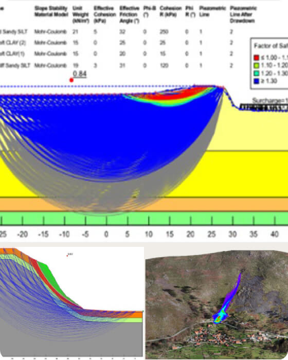
Geotechnical investigation, remote sensing and terrain mapping, rainfall-threshold and slope stability analysis, and risk/hazard zoning to guide safe design and mitigation.
Applications
Where this service is used
01
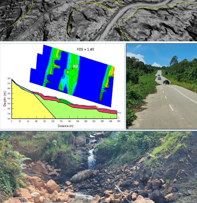
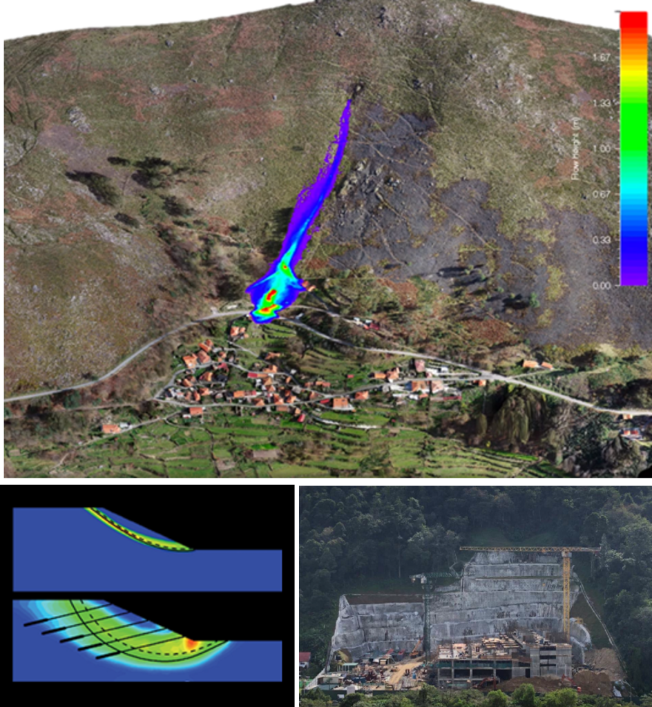
Debris Flow Assessment
Identifies areas at risk of fast-moving soil and rock movement, especially during intense rainfall in hilly terrain.
- Rainfall Threshold Modelling
- Catchment & Channel Analysis
- Site Inspection & Slope Profiling
- Flow Path & Impact Mapping
02
Geoforensic Assessment
Investigates the cause of ground failures or slope-related damage for legal, insurance, or engineering purposes.
- Expert Witness Reporting
- Construction Failure Analysis
- Ground Movement Investigation
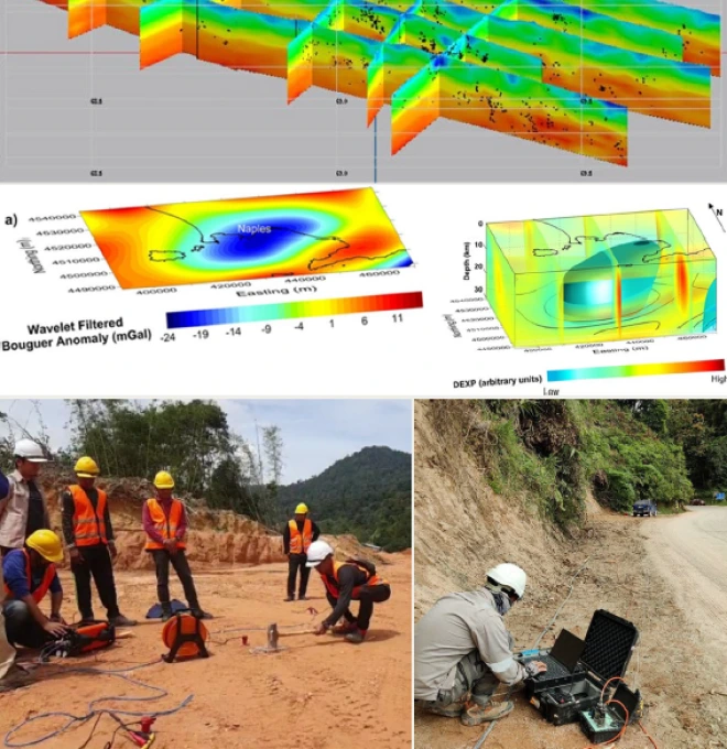
- Subsurface Testing (GPR, ERT)
03
Landslide Hazard Analysis
Assesses slope stability and landslide-prone zones to support safe design, planning, and mitigation.
- Risk Classification Mapping
- Terrain & Geological Mapping
- Historical Landslide Data Analysis
- Slope Angle & Soil Strength Evaluation
04
Geohazard-Risk Assessment
Comprehensive evaluation of geological hazards, including landslides, erosion and fault movements, for safe land-use decisions.
- Multi-Hazard Mapping
- Geohazard Zoning & Reporting
- Vulnerability & Exposure Analysis
- Field Reconnaissance & Data Collection
05
Seismic Hazard Assessment
Evaluates ground-shaking or fault movement risks in development areas, especially near regional fault lines.
- Soil Amplification Study
- Ground Motion Analysis
- Earthquake Risk Modelling
- Seismic Source Identification
06
Root-Cause Failure Analysis
- Rainfall & Loading Back-Analysis
- Failure Mechanism Identification
- Subsurface Investigation (borehole, lab tests)
- Repair & Mitigation Recommendations
Process
How the assessment is carried out
01
Desktop Study & Terrain Review
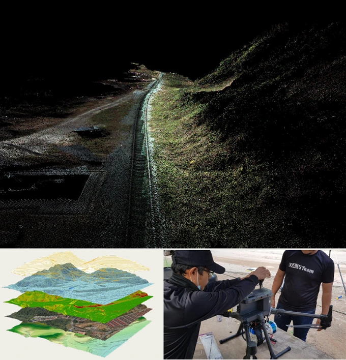
Review historical imagery, LiDAR/DEM data, rainfall records and existing geological maps to identify candidate hazard zones.
02
Field Reconnaissance & Mapping
Site inspection, slope profiling, and geological / geomorphological mapping.
03
Stability & Risk Analysis
Slope stability, rainfall-threshold and hazard/risk zonation analysis.
04
Reporting & Mitigation
Deliver a hazard/risk map with practical, terrain-appropriate mitigation recommendations.
Equipment & Technology Capabilities / Methods
What we use in the field


Outputs / Deliverables
What you receive
Slope hazard / risk map
Landslide risk classification
Geohazard zoning report
Expert-witness / geoforensic report
Mitigation recommendations
Malaysian Context
Why this matters here
Local condition
Malaysia's tropical climate, intense monsoon rainfall and widespread hillside development significantly raise landslide and slope failure risk across many regions.
Implication
Hillside developments and infrastructure should include slope hazard screening as standard practice, since rainfall-triggered failures can occur with little warning on inadequately assessed slopes.
Integration / Related Services
Often paired with
LiDAR
Terrain models from LiDAR feed directly into slope stability and hazard analysis.
Soil Investigation
Subsurface soil strength data supports slope stability modelling.
Geological Map Assessment
Structural geology mapping informs hazard zoning and failure mechanisms.
Case Study
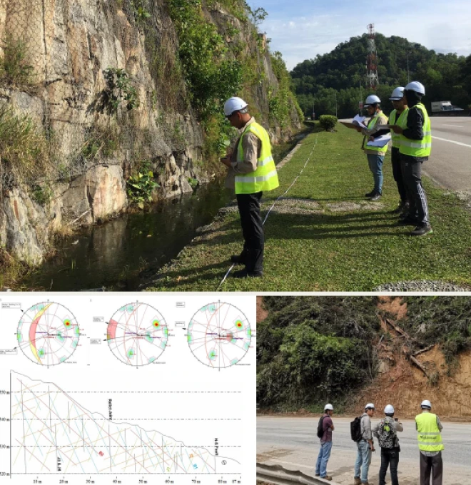
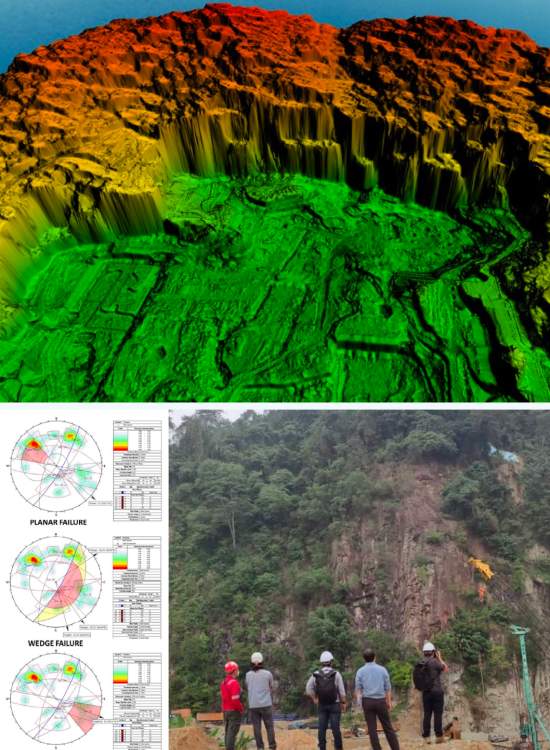
Rock Slope Assessment at PJU8 Bukit Lanjan
2022 · Vestland / Max Engineering Sdn Bhd
Challenge
The rock mass at the site is subject to primary structures (beddings, unconformities) and secondary structures (foliation, joints, faults) that act as planes of discontinuity — weak regions where intersecting structures can trigger rock slope failure by falls or slides.
Approach
Mapped all structures attributing to the rock mass integrity to identify the physical geologic characteristics and processes of the area.
Finding
Identified geological features and processes that could induce hazards to the proposed development and to human lives and activities.
Outcome
Findings facilitated the design and selection of the most suitable mitigation measures for landslide and rock slope failure risk.
Standards / Compliance
Slope hazard assessment is carried out with reference to JKR Slope Guidelines and delivered under a geologist registered under the Geologists Act 2008.
authorized by
Signed off by a registered professional

P.Geol Gs. Hairil Azwan
P.Geol · Registered Geologist, Board of Geologists Malaysia
All slope hazard assessments and technical reports are reviewed and authorized by a Professional Geologist registered with the Board of Geologists Malaysia (BoG), in compliance with the Geologists Act 2008.
BoG
REGISTERED
Geologists Act 2008
Standards / Compliance
Proof points
01
High-End Equipment — equipped with the latest geotechnical, remote sensing and terrain mapping equipment for 100% accuracy of data & statistics.
02
National-Level Project Experience — since 2020, we've handled 20+ state and national-level slope hazard and geotechnical projects.
03
Certified Engineers & Surveyors — our engineers & surveyors are international and local graduates with extensive geo-engineering experience.
04
Custom Report & GIS Integration — you'll receive 100% accurate reporting documents with GIS integration where needed.
FAQ
Frequently asked questions
What is a slope hazard?
A slope hazard is the risk of slope failure such as landslides, debris flow, or soil erosion—especially in hilly or steep terrain.
Why is slope hazard a major concern in Malaysia?
Malaysia’s tropical climate, heavy rainfall, and hillside developments increase the risk of landslides and slope failures in many regions.
What causes slope failure?
Common causes include intense rainfall, weak soil, poor drainage, steep slopes, construction activity, and natural ground movement.
How can slope hazards be identified?
Through geotechnical investigations, terrain mapping, rainfall data, and tools like slope stability analysis and hazard zoning.
What is landslide hazard analysis?
It’s the process of studying slopes to assess the likelihood of landslides and identify at-risk zones for prevention and planning.
How does Geotechnica help manage slope hazards?
Geotechnica offers services like slope risk assessment, landslide analysis, debris flow studies, and geotechnical reporting to guide mitigation.
What is debris flow and how is it different from a landslide?
Debris flow is a fast-moving mixture of water, soil, and rocks, while landslides usually involve slower ground movement without flowing water.
Can slope hazard be monitored over time?
Yes. Slope monitoring systems using instruments and remote sensing can track ground movement and trigger early warnings.
Who needs slope hazard assessment in Malaysia?
Developers, consultants, engineers, government agencies, and anyone involved in hillside construction or infrastructure planning.
How does slope hazard mapping support safe development?
It helps identify high-risk areas early, allowing better design, safer construction, and informed decision-making in slope-prone zones.
gallery
Project photography