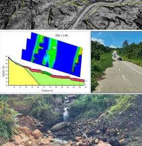
Geological Map

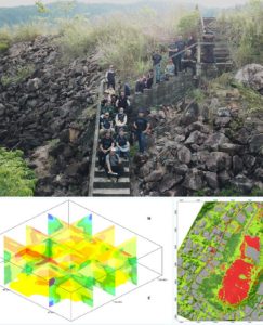
Detailed Geological Mapping
Detailed mapping provides high-resolution geological information about rock types, structures, and surface features for engineering, research, and resource planning.
- Rock Unit Identification
- Faults & Fractures Mapping
- Field Data Collection
- GIS Integration
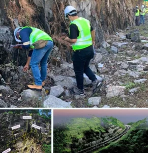
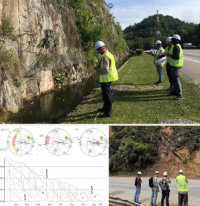
Structural Geological Mapping
Focuses on mapping geological structures like folds, faults, and fractures to understand deformation history and subsurface stress patterns.
- Fold Geometry Mapping
- Fault Lines & Joint Analysis
- Tectonic Stress Interpretation
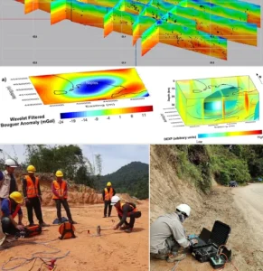
Mineral Exploration Mapping
Supports mineral exploration by identifying host rocks, alteration zones, and potential mineralization patterns through surface geology.
- Alteration Zone Identification
- Lithological Boundary Mapping
- Vein & Orebody Trace Detection
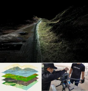
Preliminary Geological Mapping
A broad-scale survey to understand general geological settings before detailed investigation or site selection.
- Terrain Classification
- Regional Rock Distribution
- Initial Site Suitability Screening
Stratigraphic Mapping
Maps the vertical and lateral relationships of rock layers to interpret depositional history and age relationships.
- Layer Sequence Logging
- Basin & Sedimentation Analysis
- Fossil & Age Marker Identification
Geological Terrain Mapping
Combines geology with terrain features to classify land into terrain units for engineering and land-use planning.
- Slope & Material Correlation
- Engineering Geology Recommendations
- Terrain Unit Classification (GT1, GT2)


")
")
")
")


Integrity | Dedication | Excellence | Adaptability
www.geotechnica.com.my
Navigation Panel
Contact Us
GEOTECHNICA SDN BHD
48-1, Jalan Aman Sinaria 4,
Bandar Tropicana Aman,
42500 Rimbayu, Selangor
Tel: 03-8683 6682
Email: admin@geotechnica.com.my
All rights reserved. Copyright © 2025 GEOTECHNICA SDN BHD