Outcome / Problem
What it helps determine
Maps underground conditions — groundwater, bedrock depth, soft soil zones, and voids — without drilling or excavation, using a non-invasive and cost-effective geophysical method.
Specific evidence
Resistivity contrast between soil/rock layers, groundwater and aquifer boundaries, bedrock depth, saturated or weak zones, buried voids and cavities.
Definition / Methodology
Core concepts
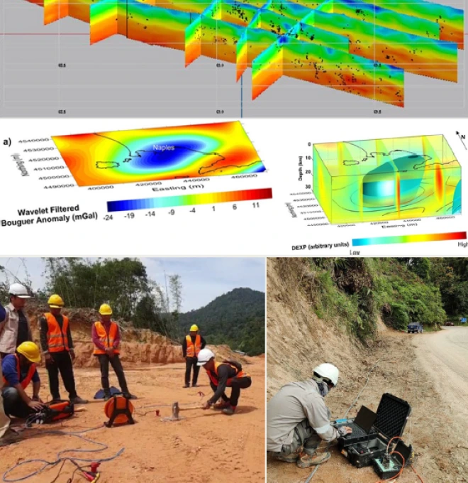
Electrical Resistivity Survey is a geophysical method that maps underground conditions by measuring how the ground resists electrical current — widely used in Malaysia to detect groundwater, bedrock depth, and soft soil zones or voids.
Technical components
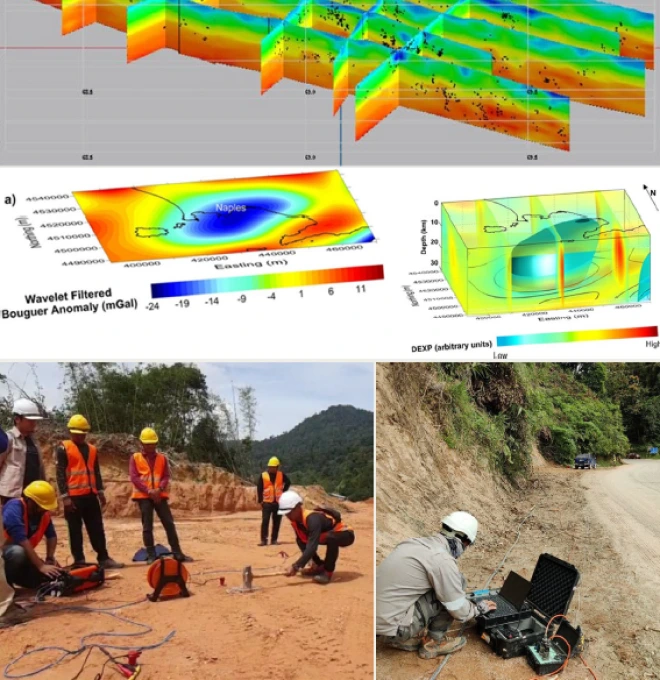
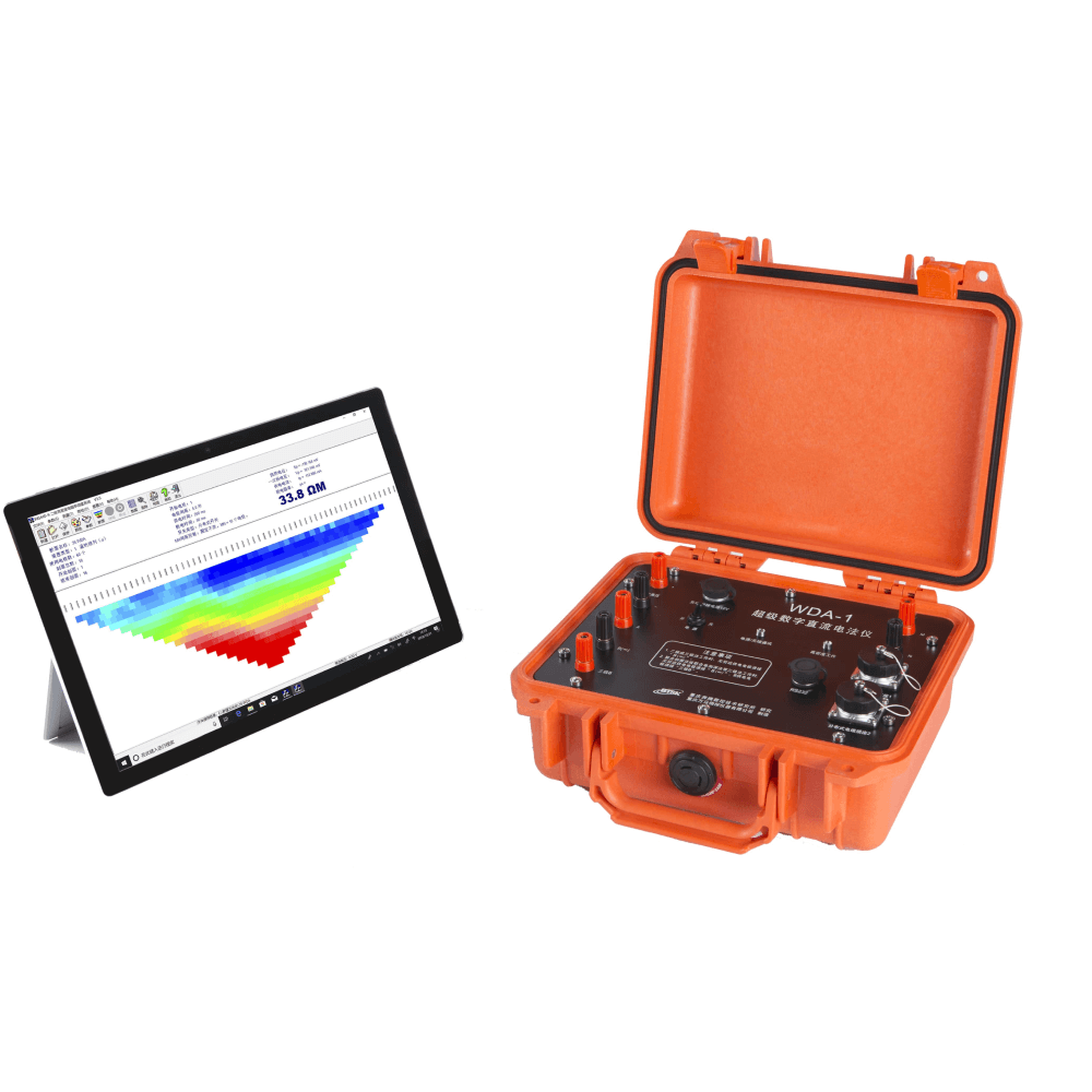
Electrode arrays injecting current into the ground, resistivity meter recording voltage response, and 2D/3D inversion software to build a subsurface resistivity model.
Applications
Where this service is used
01
Archaeology
Detects buried features like walls, graves, and ancient structures without excavation.
- Identifying Soil Disturbances
- Mapping Hidden Ruins / Artifacts
- Supporting Non-Destructive Cultural Heritage Studies
02
Subsurface Mapping
Maps underground layers, faults, and anomalies before construction or drilling.
- Bedrock Depth Estimation
- Soil & Rock Layer Profiling
- Detecting Faults & Subsurface Voids
03
Mineral Exploration
Locates zones of mineralization by detecting resistivity contrasts related to ore bodies.
- Identifying Alteration Zones
- Resistivity Mapping of Mineral Zones
- Supporting Target Selection for Drilling
04
Groundwater Detection
Locates groundwater sources, aquifer depth, and water-bearing zones.
- Well Siting Support
- Aquifer Boundary Mapping
- Locating Freshwater vs Saline Water
05
Environmental Studies
Assesses soil contamination, leachate movement, and landfill boundaries.
- Monitoring Industrial Waste Impact
- Mapping Contaminant Plumes
- Identifying Landfill Extent & Seepage
06
Landslide & Slope Analysis
Assesses slope stability by detecting water saturation, weak layers, and slip surfaces.
- Locating Potential Slip Zones
- Identifying Saturated/Soft Soils
- Supporting Landslide Hazard Mapping
Process
How the assessment is carried out
01
Survey Planning
Determine array type, electrode spacing, and line placement for the target depth.
02
Field Data Acquisition
Electrode array laid out on-site; resistivity meter records voltage response along each line.
03
Data Processing & Inversion
Raw readings processed into a 2D/3D resistivity model of the subsurface.
04
Interpretation & Reporting
Expert interpretation of resistivity contrasts, delivered as a technical report.
Equipment & Technology Capabilities / Methods
What we use in the field

Outputs / Deliverables
What you receive
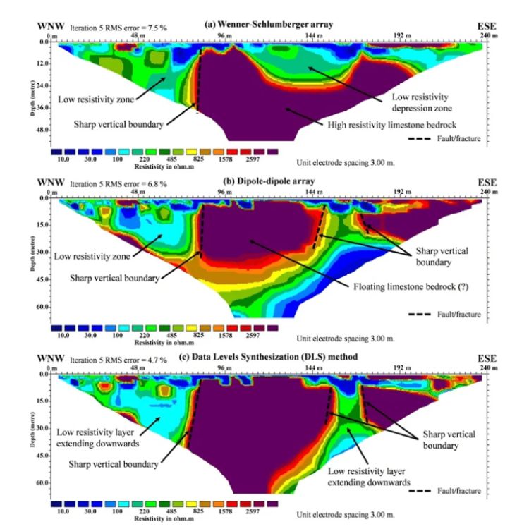
2D/3D resistivity model
Bedrock depth profile
Groundwater / aquifer boundary map
Void & cavity detection report
Technical interpretation report
Malaysian Context
Why this matters here
Local condition
Malaysia's tropical soils and diverse terrain make subsurface conditions difficult to predict from surface inspection alone.
Implication
Non-invasive resistivity surveys give reliable results up to tens of metres deep, making them a cost-effective option before committing to drilling on large or sensitive projects.
Integration / Related Services
Often paired with
Slope Hazard Assessment
Resistivity data identifies saturated zones and slip surfaces beneath slopes.
Geoforensics
ERT is a core geophysical tool used to investigate ground-related failures.
Soil Investigation
Resistivity results complement borehole data with continuous subsurface coverage.
Case Study
Geohazard Assessment at Ringlet, Cameron Highlands
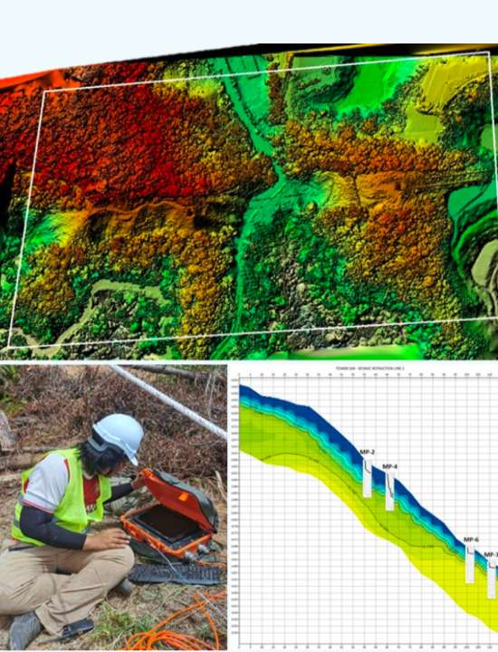
2021 · TNB / Minconsult Sdn Bhd
Challenge
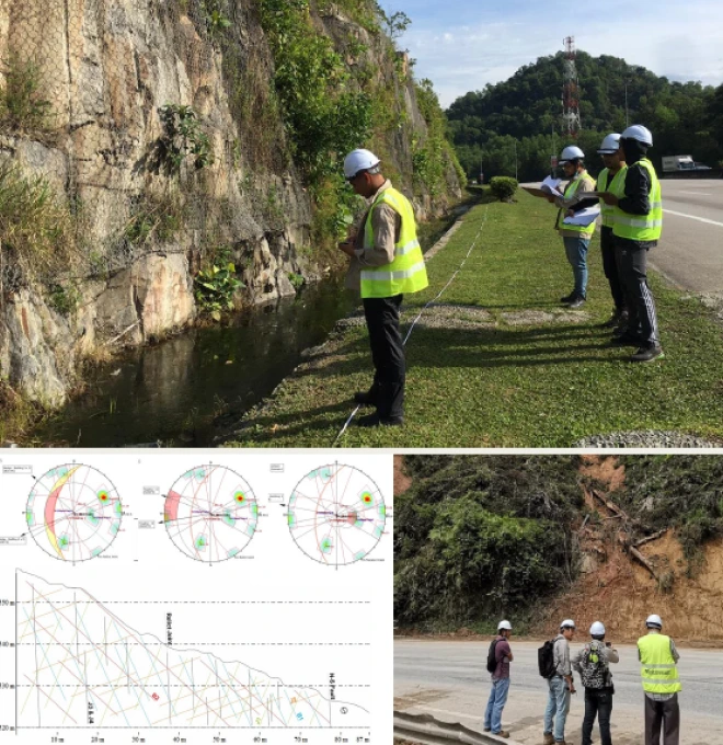
A section of the TNB 275kV right-of-way was identified as requiring urgent attention following landslide incidents in the area.
Approach
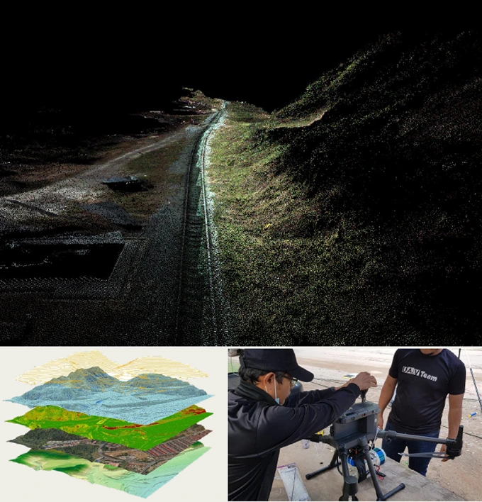
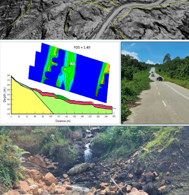
Assessment combined soil investigation, a geophysical seismic survey, and LiDAR acquisition — with the Slope Information Management System (SIMS) used to rate each slope's hazard level using topography, slope geometry and geological parameters.
Finding
Heavy rainfall, geomorphology, geologic material, human activity and adverse geological features were identified as the main contributors to the slope failures.
Outcome
Interim mitigation measures were proposed ahead of permanent rectification, combining short- and long-term solutions.
Standards / Compliance
Electrical resistivity surveys are conducted using industry-standard array configurations (Wenner, Schlumberger, Dipole-Dipole) with results interpreted by geologists registered under the Geologists Act 2008.
Standards / Compliance
Proof points
01
High-End Equipment — equipped with modern ERT equipment and interpretation software for 100% accuracy of data & statistics.
02
National-Level Project Experience — since 2020, we've handled 20+ state and national-level geophysical and geotechnical projects.
03
Certified Engineers & Surveyors — our engineers & surveyors are international and local graduates with extensive geo-engineering experience.
04
Custom Report & GIS Integration — you'll receive 100% accurate reporting documents with GIS integration where needed.
FAQ
Frequently asked questions
What is electrical resistivity survey?
An electrical resistivity survey is a geophysical method that measures how the ground resists electric current to map underground layers or features.
What is the electrical resistivity method used for?
It is used for subsurface mapping, groundwater detection, bedrock profiling, contamination studies, and slope analysis without the need for drilling.
Is electrical resistivity a non-invasive method?
Yes, it is a non-invasive and cost-effective method that does not damage the site and is suitable for construction, environmental, and archaeological work.
How accurate is an electrical resistivity survey in Malaysia?
When done correctly, it provides reliable results about subsurface conditions up to tens of meters deep—ideal for tropical soils and diverse terrains in Malaysia.
Can resistivity surveys detect groundwater?
Yes, electrical resistivity is commonly used to locate groundwater zones, aquifers, and freshwater–saline water boundaries.
What industries benefit from electrical resistivity?
It is widely used in construction, mining, environmental consulting, agriculture, slope hazard assessment, and utility planning.
What is the difference between ERT and soil resistivity test?
ERT (Electrical Resistivity Tomography) maps underground layers in 2D/3D, while a soil resistivity test usually checks surface soil resistance for grounding systems.
How long does an electrical resistivity survey take?
Depending on site size, it typically takes a few hours to a day for fieldwork, followed by 1–3 days for data processing and interpretation.
Do I need an electrical resistivity survey before construction?
Yes, especially for large or sensitive projects, it helps identify soft soils, rock depth, or groundwater issues that affect foundation design.
Why choose Geotechnica for electrical resistivity in Malaysia?
Geotechnica offers expert interpretation, modern ERT equipment, and reliable geophysical services tailored for Malaysian ground conditions and project needs.
gallery
Project photography