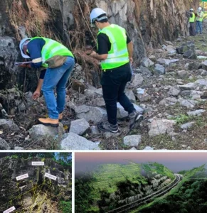
Geophysical Surveying

Seismic Methods
Seismic surveys use vibrations or waves to map subsurface layers by analyzing how they travel through different materials.
- Wave Velocity Profiling
- Slope Stability & Foundation
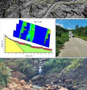
- Seismic Refraction & MASW
- Subsurface Stiffness & Depth Analysis
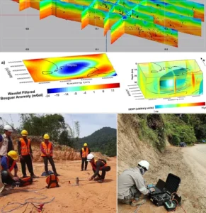
Gravity Surveys
Gravity surveys measure variations in Earth’s gravity to detect changes in subsurface density, useful for mapping large-scale structures.
- Density Contrast Interpretation
- Mineral & Oil Exploration
- Gravity Data Collection
- Mapping Bedrock & Deep Geological Features
Electromagnetic
EM surveys detect conductivity and magnetic changes in the ground to locate water, minerals, or buried objects.
- Utility Detection
- Conductivity Profiling
- Shallow Subsurface Mapping
- Groundwater & Contamination
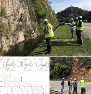
Electrical Resistivity
Electrical resistivity surveys inject current into the ground and measure resistance to map soil layers, water zones or voids.
- Borehole Correlation
- Groundwater Detection
- Foundation & Slope Investigations
- Electrical Resistivity Tomography (ERT)
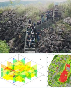
Magnetic Surveys
Magnetic surveys measure variations in Earth’s magnetic field to locate buried ferrous materials or geological features.
- Mapping Archaeological / UXO Targets
- Ground Magnetometer
- Supporting Geotechnical Risk Assessments
- Identifying Faults, Dykes & Mineral Zones
Ground Penetrating Radar
GPR sends radar waves into the ground to detect shallow features like pipes, voids, and pavement thickness.
- Locating Utilities & Voids
- Road & Bridge Deck Assessment
- Archaeological & Structural Forensics
- High-Resolution Subsurface Scanning


")
")
")


Integrity | Dedication | Excellence | Adaptability
www.geotechnica.com.my
Navigation Panel
Contact Us
GEOTECHNICA SDN BHD
48-1, Jalan Aman Sinaria 4,
Bandar Tropicana Aman,
42500 Rimbayu, Selangor
Tel: 03-8683 6682
Email: admin@geotechnica.com.my
All rights reserved. Copyright © 2025 GEOTECHNICA SDN BHD