Home » Services » Engineering Geological Mapping at Pulau Redang
Engineering Geological Mapping at Pulau Redang — Slope Hazard & Risk Assessment for Pusat Ummah
Engineering Geological Mapping at Pulau Redang
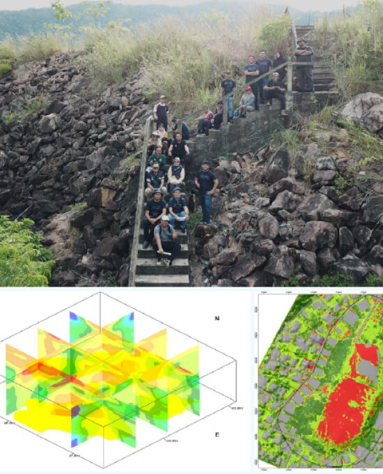
JKR Terengganu engaged Geotechnica Sdn Bhd to conduct a Slope Hazard and Risk Assessment for the proposed Pusat Ummah development at Kg. Baru, Pulau Redang — determining landslide failure likelihood, risk to surrounding assets, and mitigation recommendations ahead of development.
CLIENT
YEAR
JKR Terengganu / GoGEO Engineering
2022
Project Overview
Scope, conditions & requirements
Project Scope
Slope hazard and risk assessment for the proposed Pusat Ummah development at Kg. Baru, Pulau Redang, Terengganu.
Site Conditions
Coastal, topographically and geomorphologically variable terrain, requiring hazard and risk modelling appropriate to the island's specific conditions.
Investigation Requirements
Terrain information was needed to formulate a hazard and risk model, validated against actual site conditions before any development plan implementation.
Our Approach
How the site was assessed
Aerial Photogrammetry
Used to obtain terrain information forming the basis of the hazard and risk model.
Hazard & Risk Modelling
Formulated the likelihood of landslide failure and the consequence/risk to surrounding assets and facilities.
Field Data Collection
Carried out to confirm assigned risk ratings reflected actual site conditions.
Key Findings
What the assessment showed
Finding 1
Multiple locations across the site were rated Very High risk for landslide failure.
Finding 2
Field-validated risk ratings accurately reflected the actual conditions observed on site.
Project Outcomes
How the findings are used
A conceptual design for mitigation measures appropriate to the site's topographical and geomorphological conditions was proposed for all Very High-risk locations, informing JKR Terengganu's development plan ahead of implementation.