Outcome / Problem (+)
What it helps determine
Captures precise elevation and terrain data in complex, forested or hard-to-reach areas — with minimal ground disturbance and faster turnaround than traditional survey.
Specific evidence
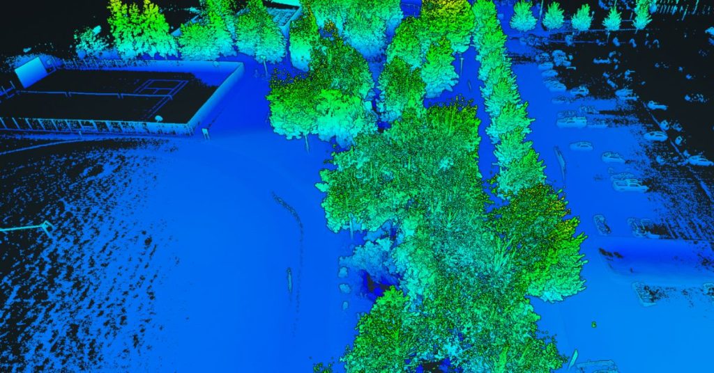
Point cloud density and ground elevation beneath canopy, corridor clearance measurements, volumetric and cut-and-fill accuracy, floodplain and catchment boundaries.
Definition / Methodology
Core concepts
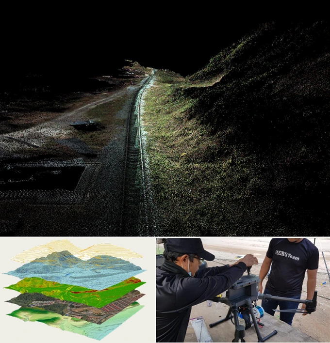
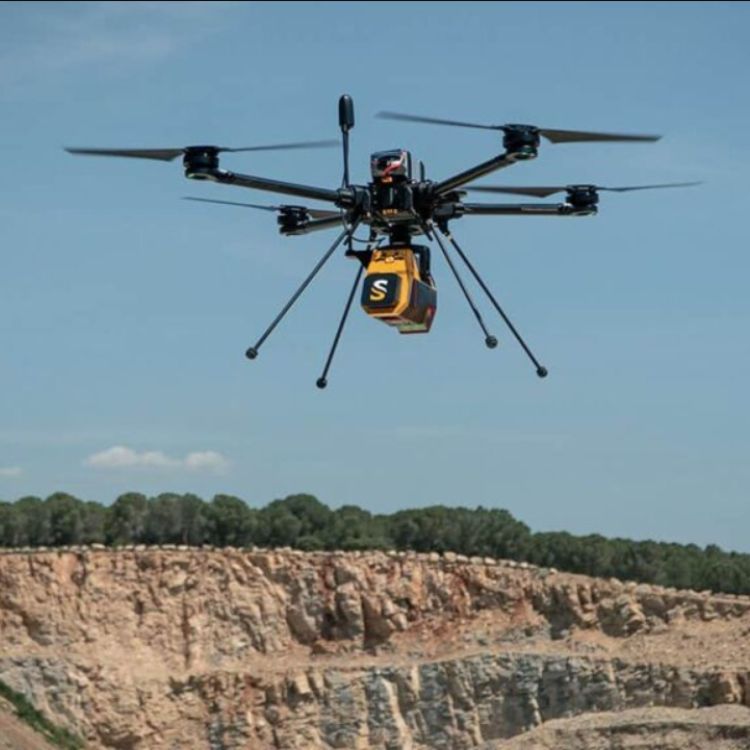
A LiDAR drone is an unmanned aerial vehicle (UAV) fitted with a LiDAR sensor that emits laser pulses to scan and map the earth's surface in 3D — capturing high-resolution data even in dense forest or hard-to-reach terrain.
Technical components
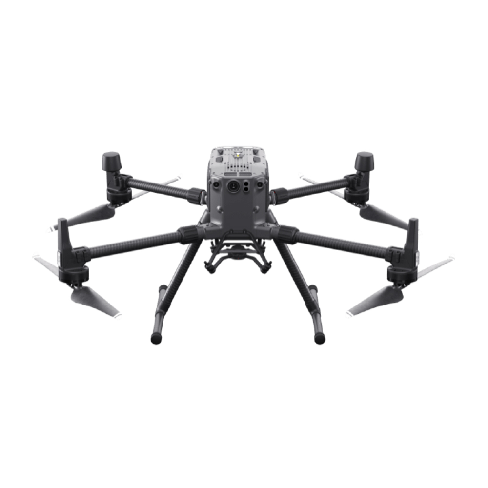
UAV-mounted laser sensor, GNSS/IMU positioning, point cloud generation and classification, and DEM/DTM/contour output compatible with all major GIS platforms.
Applications
Where this service is used
01
Topographic LiDAR Mapping
Capture high-resolution elevation data for land surface modeling.
- Digital Terrain Models (DTM)
- Digital Elevation Models (DEM)
- Contour Generation
- Slope & Aspect Analysis
02
Corridor Mapping
- Clearance Measurement
- LiDAR Scanning Along Corridors
- Vegetation Encroachment Analysis
- Detection for Asset Management
03
Flood Risk & Hydrology Analysis
Assess terrain for water flow modeling and flood mitigation.
- Floodplain Delineation
- Hydrologic Surface Modeling
- High-Accuracy Elevation Models
- Catchment & Watershed Mapping
04
Forestry & Plantation Mapping
Analyze forest structure and monitor biomass or tree health.
- Canopy Height Models
- Forest Inventory Support
- Tree Count & Density Analysis
- Change Detection for Deforestation
05
Mining & Quarry Site Mapping
Monitor excavation volumes and site safety.
- Volumetric Analysis
- Cut-and-Fill Calculations
- Slope Stability Assessment
- Surface Change Monitoring
06
Environmental & Coastal Monitoring
Support conservation and erosion control efforts.
- Habitat Mapping
- Terrain & Vegetation Models
- Shoreline Change Detection
- Baseline Environmental Data Capture
Process
How the assessment is carried out
01
Flight Planning & CAAM Clearance
Site scoping, flight path design, and airspace approval by licensed UAV pilots before mobilisation.
02
Data Acquisition
The LiDAR drone flies the site, capturing thousands of laser pulses per second.
03
Point Cloud Processing
Raw laser data is cleaned, aligned, and classified into ground, vegetation and structure points.
04
Deliverable Generation
Final DEM, DTM, orthophotos, contours and volume reports prepared for handover.
Equipment & Technology Capabilities / Methods
What we use in the field

Outputs / Deliverables
What you receive
Digital Elevation Models (DEM)
Digital Terrain Models (DTM)
Contour lines
LAS point cloud files
Orthophotos
Volume & area reports
Malaysian Context
Why this matters here
Local condition
Malaysia's tropical forest canopy and monsoon-driven terrain change make ground-based survey slow, while all UAV operations fall under CAAM airspace regulation.
Implication
Canopy-penetrating LiDAR is essential for true ground elevation beneath dense vegetation, and every flight is conducted by licensed UAV pilots under full CAAM compliance.
Integration / Related Services
Often paired with
LiDAR Airborne
For large-area coverage beyond what a drone can efficiently survey in one flight.
Slope Hazard Assessment
Drone LiDAR terrain models form the base data for slope failure and factor-of-safety analysis.
Aerial Photogrammetry
Often paired with LiDAR drone data for full terrain and hazard risk modelling.
Case Study
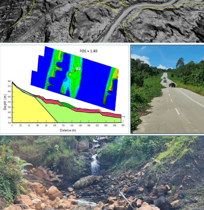
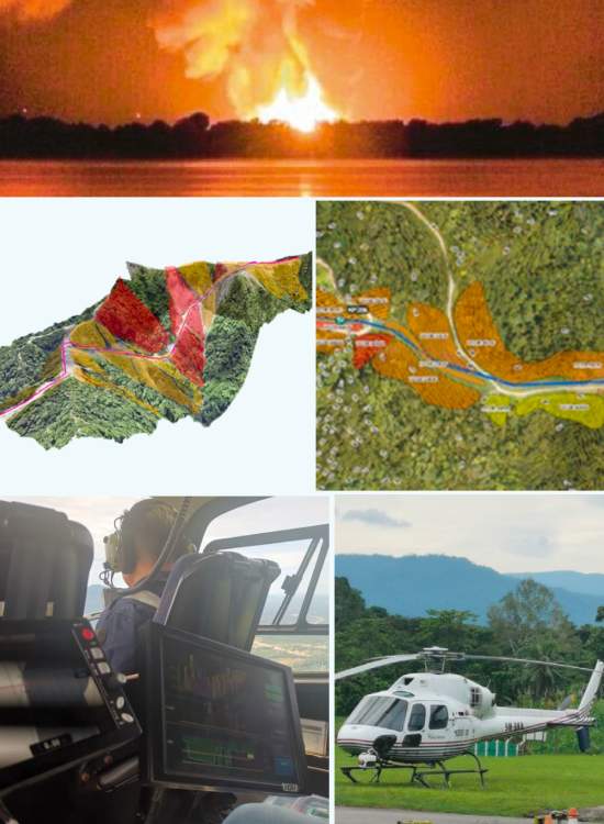
SSGP Hazard & Risk Assessment using LiDAR
2022 · JKR Terengganu / GoGEO Engineering
Challenge
JKR Terengganu required a slope hazard and risk assessment for the proposed Pusat Ummah development at Kg. Baru, Pulau Redang — to determine landslide failure likelihood and risk to surrounding assets and facilities.
Approach
Aerial terrain capture was used to build the hazard and risk model, supported by field data collection to confirm the assigned risk ratings reflected actual site conditions.
Finding
The assessment identified specific locations across the site rated Very High risk.
Outcome
Conceptual mitigation designs were proposed for all Very High-risk locations, informing the development plan before implementation.
Standards / Compliance
All LiDAR drone operations are flown under full compliance with Civil Aviation Authority Malaysia (CAAM) regulations, by licensed UAV pilots adhering to strict safety protocols.
authorized by
Signed off by a registered professional

P.Geol Gs. Hairil Azwan
P.Geol · Registered Geologist, Board of Geologists Malaysia
All LiDAR drone survey outputs and technical reports are reviewed and authorized by a Professional Geologist registered with the Board of Geologists Malaysia (BoG), in compliance with the Geologists Act 2008.
BoG
REGISTERED
Geologists Act 2008
Standards / Compliance
Proof points
01
High-End Equipment — equipped with the latest, high-end LiDAR equipment and software for 100% accuracy of data & statistics.
02
National-Level Project Experience — since 2020, we've handled 20+ state and national-level projects through LiDAR in geotechnical and geo-engineering.
03
Certified Engineers & Surveyors — our engineers & surveyors are international and local graduates with extensive geo-engineering experience.
04
Custom Report & GIS Integration — you'll receive 100% accurate reporting documents with GIS integration where needed.
FAQ
Frequently asked questions
What is a LiDAR drone and how does it work in Malaysia?
A LiDAR drone is a UAV equipped with a laser sensor that emits thousands of pulses per second to capture 3D spatial data. In Malaysia, it’s widely used for topographic mapping, infrastructure design, and environmental monitoring—especially in areas that are hard to access.
How accurate is LiDAR drone mapping in Malaysia?
LiDAR drone mapping in Malaysia can achieve centimeter-level accuracy, depending on the equipment and flight parameters. It’s highly reliable for engineering, construction, and survey-grade projects that require precise elevation data.
What are the benefits of using LiDAR drones over traditional land surveys?
LiDAR drones offer faster data collection, high-resolution terrain modeling, and reduced manpower costs. They are perfect for large, remote, or dangerous sites—helping Malaysian companies save time and resources without compromising data quality.
Can LiDAR drones in Malaysia capture data through dense vegetation?
Yes. One of the biggest advantages of LiDAR drone Malaysia technology is its ability to penetrate tree canopies and deliver ground-level elevation data, making it ideal for tropical forest mapping and plantation management.
How much does a drone LiDAR survey cost in Malaysia?
The cost of a drone LiDAR survey in Malaysia depends on area size, project complexity, and deliverables (e.g., DEM, point clouds). Contact Geotechnica for a personalized quote and a free consultation session.
What deliverables can I expect from a LiDAR drone mapping project?
Typical outputs from a LiDAR drone mapping project include:
1. Digital Elevation Models (DEM)
2. Digital Terrain Models (DTM)
3. Contour lines
4. LAS point cloud files
5. Orthophotos
6. Volume and area reports
Are drone LiDAR surveys legal and safe in Malaysia?
Yes, Geotechnica operates under full compliance with Civil Aviation Authority of Malaysia (CAAM) regulations. All LiDAR drone flights are conducted by licensed UAV pilots with strict adherence to safety protocols.
How long does it take to complete a LiDAR drone project in Malaysia?
Project duration depends on site size and complexity. However, most UAV LiDAR mapping projects in Malaysia can be completed within a few days, including flight planning, data acquisition, and post-processing.
Why choose Geotechnica for LiDAR drone services in Malaysia?
Geotechnica combines over 10 years of experience in geospatial engineering with advanced LiDAR drone systems. Our certified team delivers reliable, high-accuracy mapping for infrastructure, environmental, and industrial projects throughout Malaysia.
gallery
Project photography