
Augmented Reality Sandbox Malaysia
Home » Products
Augmented Reality Sandbox
What Is an Augmented Reality Sandbox?
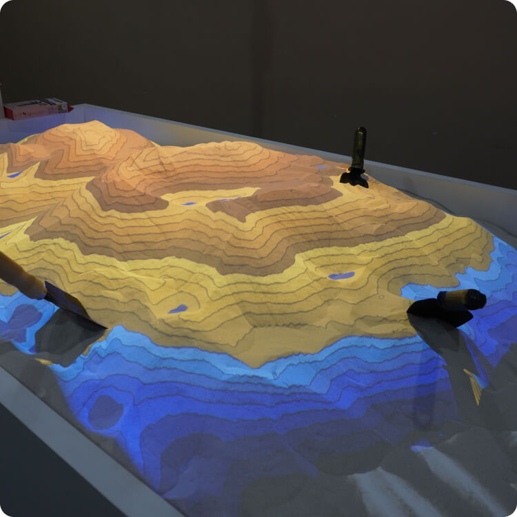
The AR Sandbox is an interactive tool that combines real sand with 3D topographic projections to simulate elevation, contour lines, and water flow in real time.
It’s perfect for visualizing terrain behavior, slope stability, erosion, and flood simulations, ideal for geotechnical training and education.
Suitable for universities, consultants, training centres, and government agencies looking to enhance engagement in geology, geography, and environmental studies.
AR Sandbox Features
-
1
Real-Time 3D Terrain Projection
Visualizes contour lines and elevation levels directly on the sand surface using a projector and depth sensor. -
2
Dynamic Water Simulation
Simulates water flow and rainfall in real-time, showing how water moves through different terrains. -
3
Interactive & Hands-On
Users can shape the sand with their hands to instantly create mountains, valleys, rivers, or basins. -
4
Color-Coded Elevation Mapping
Uses color gradients to represent elevation changes, making it easy to understand topography. -
5
Educational & Fun
Designed to enhance learning for students and visitors through interactive geoscience experiences. -
6
Portable & Customizable
Built with mobility in mind and can be tailored to fit different institutions or exhibition setups.
Who It’s For
Universities & Colleges
For teaching geology, geography, hydrology, and environmental science with interactive 3D visual tools.
Primary & Secondary School
For making earth science and geography lessons more fun, engaging, and hands-on.
Research Institutions
For simulating terrain, water flow, and slope behavior in real-time for geotechnical or environmental studies.
Training Centers
To enhance workshops and courses on topography, soil behavior, and hazard education.
Government Agencies
For community awareness programs, disaster education (like flood simulations), and planning support.
Engineering & Geotechnical Firms
As a demonstration tool to help clients and stakeholders visualize terrain or project impact.
What’s Included
- HD Projector
- User Manual & Setup Guide
- High-Quality Sandbox Frame
- High-Performance PC System
- On-Site Installation & Calibration
- Depth Sensor (Kinect or equivalent)
- Pre-Configured AR Sandbox Software
Augmented Reality Sandbox
See the AR Sandbox in Action
A cutting-edge tool that transforms sand into a live 3D topographic map using advanced projection and depth-sensing technology.

FAQ
Read our FAQ about augmented reality sandbox below.
Who is this AR sandbox for?
Perfect for schools, universities, research centers, government, training academies, and science exhibitions.
What are the AR sandbox features?
Real-time terrain modeling, water simulation, color-coded elevation, and interactive learning — all in one sandbox.
How can I order this AR sandbox?
Contact us via WhatsApp at 019-423 4342 or email to us at admin@geotechnica.com.my.
What is included with the AR sandbox?
Sandbox frame, projector, depth sensor, PC with software, user guide, and support — ready to use.
What is an augmented reality sandbox?
A hands-on 3D tool that projects real-time elevation and water flow onto sand for education and simulation.
Order your AR Sandbox
Perfect for visualizing terrain, slope stability, erosion, and flood simulations