Outcome / Problem (+)
What it helps determine
Evaluates subsurface soil and rock stiffness — critical for foundation design, seismic site classification, and liquefaction risk — without drilling into the ground.
Specific evidence
Shear wave velocity profile with depth, soil/bedrock layer boundaries, Vs30 for seismic site classification, low-velocity zones indicating liquefaction risk.
Definition / Methodology
Core concepts
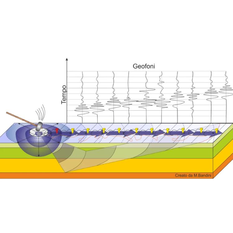
Multichannel Analysis of Surface Waves (MASW) is a geophysical method used to evaluate subsurface stiffness by measuring the velocity of surface (shear) waves — a non-invasive technique providing vital data about soil and rock strength.
Technical components
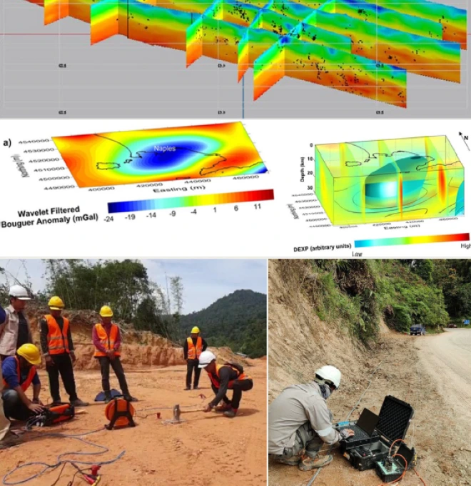
A linear array of geophones records surface waves generated by a hammer source; dispersion curves are extracted and inverted into a 1D or 2D shear wave velocity (stiffness) profile.
Applications
Where this service is used
01
Layer Detection
Detects subsurface soil and rock layers by analyzing wave velocity changes at different depths.
- Wave Velocity Change Analysis
- Identifying Depth of Each Layer
- Mapping Soil & Bedrock Boundaries
02
Site Classification
Supports seismic site classification based on shear wave velocity, helping assess ground behavior during earthquakes.
- Seismic Site Class Identification
- Reporting for Structural Design Codes
- Vs30 Calculation (Shear Wave Velocity to 30m Depth)
03
Non-Invasive Testing
A non-destructive method that does not require drilling, ideal for sensitive or developed sites.
- Sensor Array Setup (Geophones)
- Surface Wave Generation With Hammer
- Data Collection Without Ground Disturbance
04
Soil Stiffness Profiling
Provides stiffness (shear modulus) profiles of soil layers, crucial for foundation and slope design.
- Analyzing Wave Dispersion Curves
- Generating 1D & 2D Stiffness Models
- Supporting Geotechnical Interpretations
05
Liquefaction Risk Assessment
Identifies soft or loose saturated soils vulnerable to liquefaction during strong ground shaking.
- Supporting Earthquake-Resilient Design
- Comparing Data with Liquefaction Thresholds
- Identifying Low Shear Wave Velocity Zones
06
Surface Wave Speed
Measures the speed of Rayleigh waves across different depths, reflecting material type and stiffness.
- Calculating Velocity Profiles
- Interpreting Ground Condition Changes
- Recording Wave Travel Time & Distance
Process
How the assessment is carried out
01
Survey Planning
Determine geophone spacing and array length for the target investigation depth.
02
Field Data Acquisition
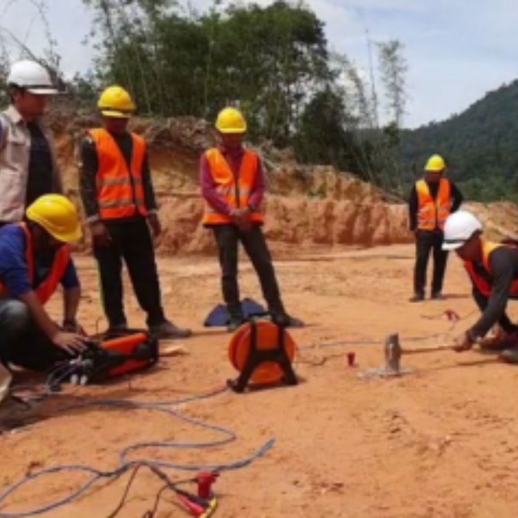
Geophone array laid out on-site; surface waves generated with a hammer source and recorded.
03
Dispersion Curve Processing
Recorded waves processed and inverted into a shear wave velocity profile.
04
Interpretation & Reporting
Expert interpretation of stiffness profile and Vs30, delivered as a technical report.
Equipment & Technology Capabilities / Methods
What we use in the field
Outputs / Deliverables
What you receive
Shear wave velocity (Vs) profile
Vs30 & seismic site classification
Soil/bedrock layer boundaries
Liquefaction risk zones
Technical interpretation report
Malaysian Context
Why this matters here
Local condition
Malaysia sits near active regional fault systems and has soft, saturated soils in many low-lying areas — both factors that affect how ground shakes during an earthquake.
Implication
MASW gives engineers the Vs30 and stiffness data needed for seismic site classification and liquefaction screening, supporting earthquake-resilient design under structural design codes.
Integration / Related Services
Often paired with
Soil Investigation
MASW stiffness profiles complement borehole and SPT data for foundation design.
Electrical Resistivity
Often paired with MASW for a fuller non-invasive subsurface picture.
Slope Hazard Assessment
Stiffness and site class data feed into seismic and slope stability analysis.
Case Study
Geohazard Assessment at Ringlet, Cameron Highlands
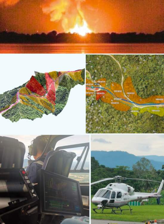
2021 · TNB / Minconsult Sdn Bhd
Challenge
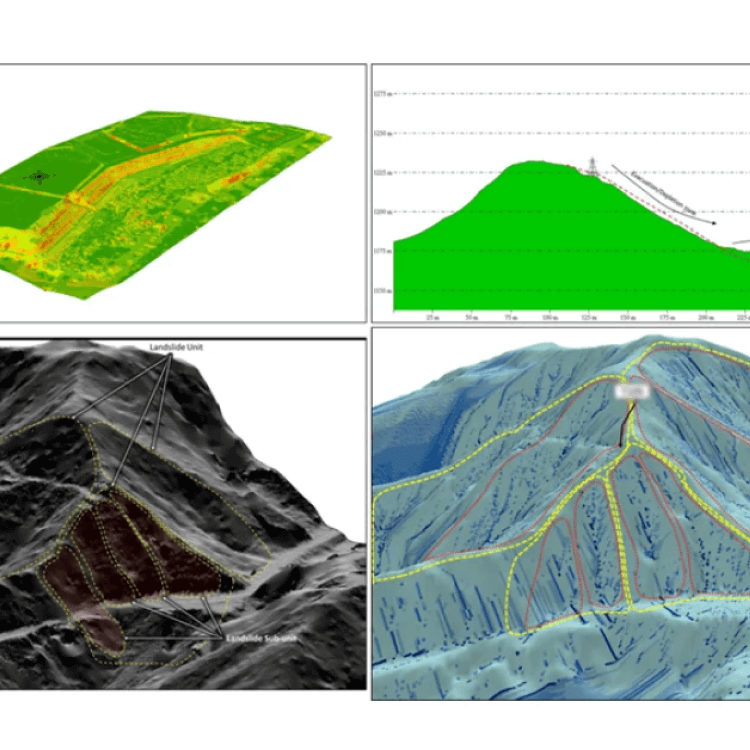
A section of the TNB 275kV right-of-way was identified as requiring urgent attention following landslide incidents in the area.
Approach
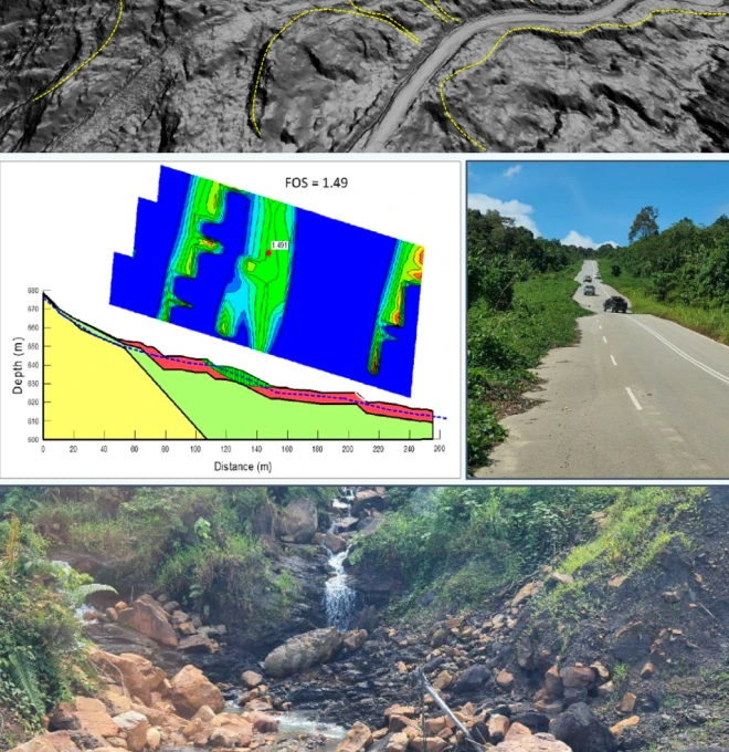
Assessment combined soil investigation, a geophysical seismic survey, and LiDAR acquisition — with the Slope Information Management System (SIMS) used to rate each slope's hazard level using topography, slope geometry and geological parameters.
Finding
Heavy rainfall, geomorphology, geologic material, human activity and adverse geological features were identified as the main contributors to the slope failures.
Outcome
Interim mitigation measures were proposed ahead of permanent rectification, combining short- and long-term solutions.
Standards / Compliance
MASW surveys follow standard seismic refraction/surface wave methodology, with Vs30 classification referenced against structural design code seismic site categories, interpreted by geologists registered under the Geologists Act 2008.
Standards / Compliance
Proof points
01
High-End Equipment — using modern MASW equipment and expert data processing for 100% accuracy of data & statistics.
02
National-Level Project Experience — since 2020, we've handled 20+ state and national-level geophysical and geotechnical projects.
03
Certified Engineers & Surveyors — our engineers & surveyors are international and local graduates with extensive geo-engineering experience.
04
Custom Report & GIS Integration — you'll receive 100% accurate reporting documents with GIS integration where needed.
FAQ
Frequently asked questions
What is Multichannel Analysis of Surface Waves (MASW)?
MASW is a non-invasive method to measure how fast waves move through the ground, helping engineers understand the stiffness of soil layers.
Why is MASW used in site investigation?
MASW is a non-invasive method to measure how fast waves move through the ground, helping engineers understand the stiffness of soil layers.
What does MASW measure?
MASW measures the speed of surface (Rayleigh) waves to calculate shear wave velocity and soil stiffness profiles.
Is MASW safe for developed or sensitive sites?
Yes. MASW is a non-destructive method that doesn’t damage the ground, so it’s safe for buildings, roads, and protected areas.
How deep can MASW detect soil layers?
Yes. MASW is a non-destructive method that doesn’t damage the ground, so it’s safe for buildings, roads, and protected areas.
What is shear wave velocity and why is it important?
Shear wave velocity shows how stiff the ground is. It’s important for building safety, especially during earthquakes or heavy loading.
Can MASW be used for liquefaction risk assessment?
Yes. MASW helps identify soft, loose soils that are more likely to liquefy during seismic activity or strong vibrations.
What is Vs30 and how is it related to MASW?
Vs30 is the average shear wave velocity in the top 30 meters of soil. MASW is the most common method to measure Vs30 for seismic site classification.
How is MASW different from drilling or SPT testing?
Vs30 is the average shear wave velocity in the top 30 meters of soil. MASW is the most common method to measure Vs30 for seismic site classification.
Why choose Geotechnica for MASW in Malaysia?
Geotechnica uses advanced MASW equipment and experienced geophysicists to deliver accurate, site-specific data for safe and efficient ground analysis.
gallery
Project photography