Electrical Resistivity

Archaeology
Electrical resistivity is used in archaeology to detect buried features like walls, graves, and ancient structures without excavation.
- Identifying Soil Disturbances
- Mapping Hidden Ruins / Artifacts
- Supporting Non-Destructive Cultural Heritage Studies
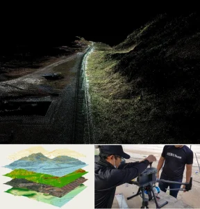
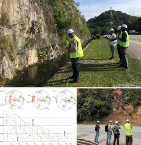
Subsurface Mapping
Resistivity surveys help map underground layers, faults, and anomalies to understand ground conditions before construction or drilling.
- Bedrock Depth Estimation
- Soil & Rock Layer Profiling
- Detecting Faults & Subsurface Voids
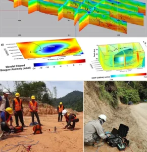
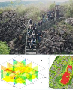
Mineral Exploration
Used to locate zones of mineralization by detecting resistivity contrasts in rock and soil related to ore bodies.
- Identifying Alteration Zones
- Resistivity Mapping of Mineral Zones
- Supporting Target Selection for Drilling
Groundwater Detection
Electrical resistivity helps locate groundwater sources, aquifer depth, and water-bearing zones in both shallow and deep settings.
- Well Siting Support
- Aquifer Boundary Mapping
- Locating Freshwater vs Saline Water
Environmental Studies
Used to assess soil contamination, leachate movement, and landfill boundaries for environmental monitoring and cleanup.
- Monitoring Industrial Waste Impact
- Mapping Contaminant Plumes
- Identifying Landfill Extent & Seepage
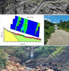
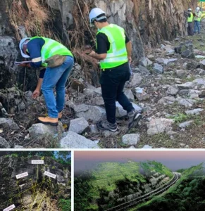
Landslide & Slope Analysis
Resistivity surveys help assess slope stability by detecting water saturation, weak layers, and slip surfaces beneath slopes.
- Locating Potential Slip Zones
- Identifying Saturated/Soft soils
- Supporting Landslide Hazard Mapping


")
")
")


Integrity | Dedication | Excellence | Adaptability
www.geotechnica.com.my
Navigation Panel
Contact Us
GEOTECHNICA SDN BHD
48-1, Jalan Aman Sinaria 4,
Bandar Tropicana Aman,
42500 Rimbayu, Selangor
Tel: 03-8683 6682
Email: admin@geotechnica.com.my
All rights reserved. Copyright © 2025 GEOTECHNICA SDN BHD