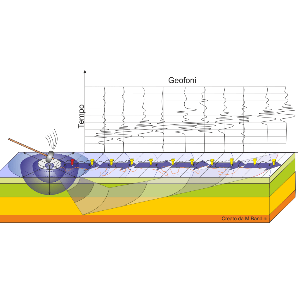
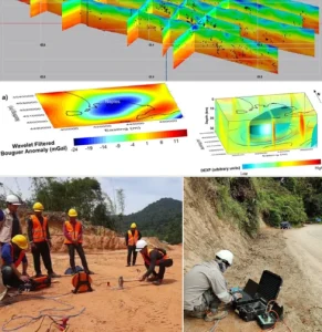
Multichannel Analysis of Surface Waves (MASW)
Layer Detection
MASW helps detect subsurface soil and rock layers by analyzing wave velocity changes at different depths.
- Collecting Surface Wave Data
- Identifying Depth of Each Layer
- Mapping Soil & Bedrock Boundaries
Site Classification
MASW supports seismic site classification based on shear wave velocity, helping assess ground behavior during earthquakes.
- Seismic Site Class Identification
- Reporting for Structural Design Codes
- Vs30 Calculation (Shear Wave Velocity to 30m Depth)
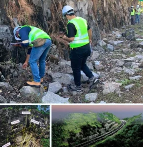
Non-Invasive Testing
MASW is a non-destructive method that does not require drilling, making it ideal for sensitive or developed sites.
- Sensor Array Setup (Geophones)
- Surface Wave Generation With Hammer
- Data Collection Without Ground Disturbance
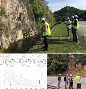
Soil Stiffness Profiling
MASW provides stiffness (shear modulus) profiles of soil layers, crucial for foundation and slope design.
- Analyzing Wave Dispersion Curves
- Generating 1D & 2D Stiffness Models
- Supporting Geotechnical Interpretations
Liquefaction Risk Assessment
By identifying soft or loose saturated soils, MASW helps assess areas vulnerable to liquefaction during strong ground shaking.
- Supporting Earthquake-Resilient Design
- Comparing Data with Liquefaction Thresholds
- Identifying Low Shear Wave Velocity Zones
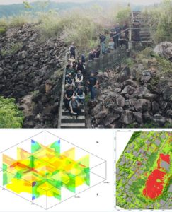
Surface Wave Speed
MASW measures the speed of Rayleigh waves across different depths, which reflects material type and stiffness.
- Calculating Velocity Profiles
- Interpreting Ground Condition Changes
- Recording Wave Travel Time & Distance

")
")
")


Integrity | Dedication | Excellence | Adaptability
www.geotechnica.com.my
Navigation Panel
Contact Us
GEOTECHNICA SDN BHD
48-1, Jalan Aman Sinaria 4,
Bandar Tropicana Aman,
42500 Rimbayu, Selangor
Tel: 03-8683 6682
Email: admin@geotechnica.com.my
All rights reserved. Copyright © 2025 GEOTECHNICA SDN BHD