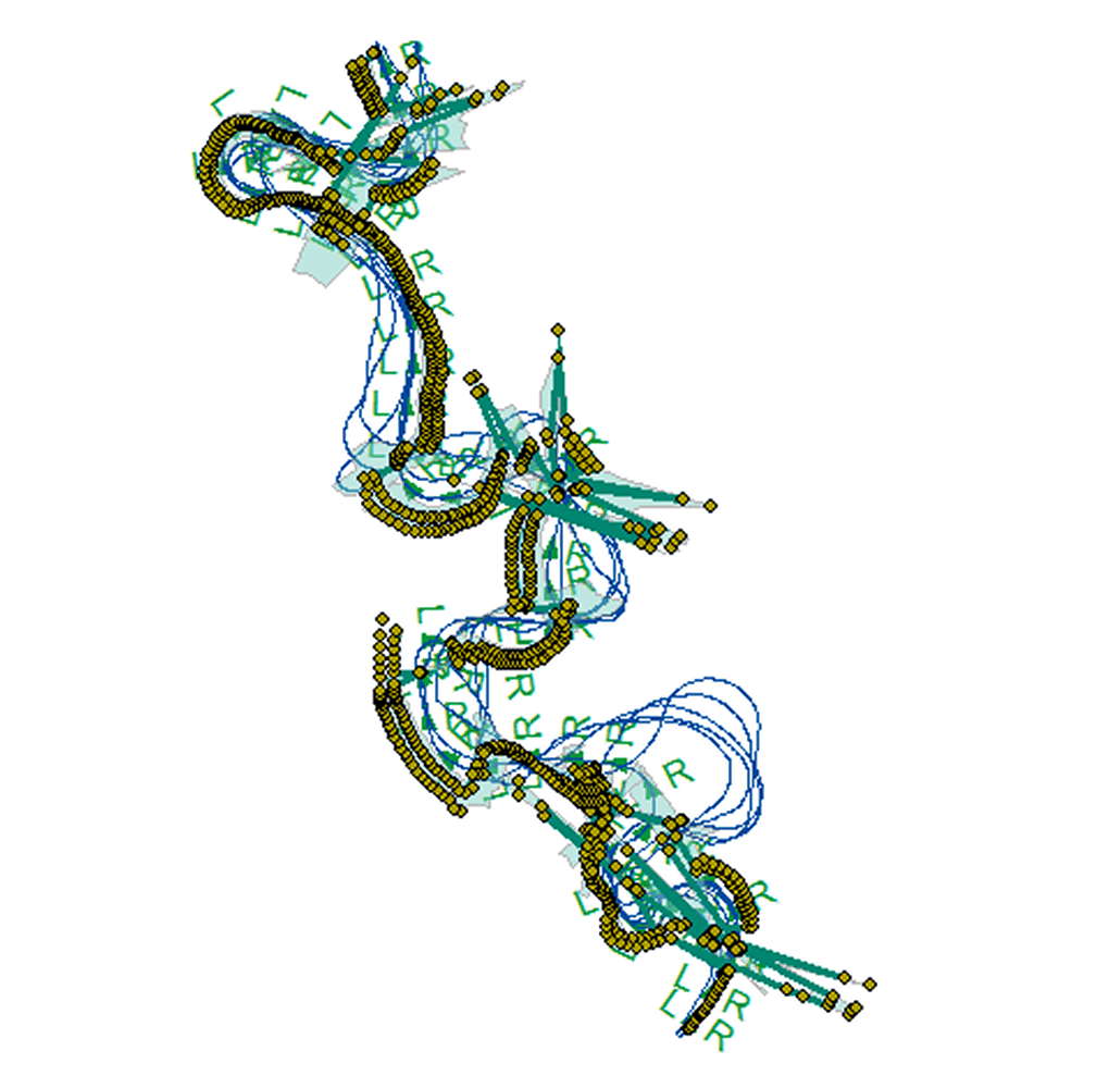
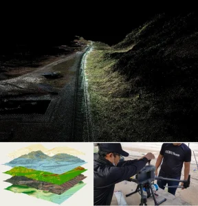
Digital Shoreline Analysis System (DSAS)
Shoreline Data Collection
Gathering accurate spatial data from various sources to track shoreline positions over time.
- Digitizing Shorelines in GIS
- Geo-Referencing Historical Shoreline Data
- Satellite Imagery, Aerial Photos, or Historical Maps
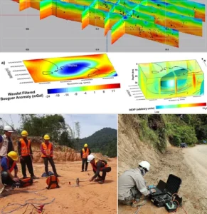
Shoreline Change Analysis
Measuring shoreline movement to calculate erosion and accretion trends.
- Identifying Hotspots , Erosion or Deposition
- Calculating Change Statistics (EPR, NSM, LRR)
- Creating Transects (Perpendicular Lines)
Geospatial Mapping & Visualization
Presenting shoreline change data visually through interactive maps and models.
- GIS-Based Map Generation
- Thematic Mapping for Reports & Planning
- Visualization of Change Rates & Shoreline Positions
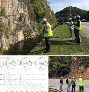
Statistical & Rate Computation
Applying statistical models to understand long-term shoreline behavior.
- Calculating End Point Rate (EPR)
- Linear Regression Rate (LRR) Analysis
- Standard Deviation & Confidence Interval Estimation
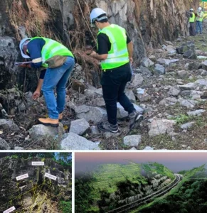
Coastal Risk Assessment & Reporting
Using DSAS output to evaluate risks for planning and development decisions.
- Identifying Erosion-Prone Zones
- Generating Coastal Vulnerability Reports
- Providing Recommendations Shoreline Management
Coastal Planning & Engineering
Integrating DSAS results into engineering, conservation, or policy decisions.
- Input for Shoreline Protection Design
- Coastal Setback Planning & Zoning Support
- Supporting Environmental Impact Assessments (EIA)
")
")
 (1)")
")


Integrity | Dedication | Excellence | Adaptability
www.geotechnica.com.my
Navigation Panel
Contact Us
GEOTECHNICA SDN BHD
48-1, Jalan Aman Sinaria 4,
Bandar Tropicana Aman,
42500 Rimbayu, Selangor
Tel: 03-8683 6682
Email: admin@geotechnica.com.my
All rights reserved. Copyright © 2025 GEOTECHNICA SDN BHD