
In this ultimate guide, we dive deep into MASW, Multichannel Analysis of Surface Waves, examining its definition, purpose, and role in geotechnical engineering, especially within the Malaysian context.
Unfortunately, in Malaysia, MASW is often misunderstood. Some think it’s only for seismic hazard zones, others believe it’s too expensive or complex, and a few assume it’s redundant since boreholes are standard. These are common stigma and misconceptions surrounding MASW.
But here’s the truth: with the right application, MASW is cost effective, non-invasive, and crucial for resolving subsurface uncertainties especially in reclaimed land or urban developments.
This article will help to clear misconceptions, understand best practices, and solve critical geotechnical challenges using MASW in Malaysia’s unique terrain.
“MASW stands for Multichannel Analysis of Surface Waves and it can be used to determine depth to bedrock, shear strength or soil stability, liquefaction studies assessing earthquake resilience” – Guideline Geo
What is MASW?
MASW, short for Multichannel Analysis of Surface Waves is a geophysical method that uses surface wave dispersion to derive shear wave velocity (Vs) profiles of the subsurface.
By impacting the ground via sledgehammer or weight drop and recording Rayleigh waves through geophone arrays, engineers interpret the data to build 1D or 2D Vs profiles. This reveals vital information about soil stiffness, bedrock depth, and dynamic properties within the upper 30 metres.
MASW Survey in Malaysia
MASW is making inroads in Malaysia. Our Geotechnica teams have already implemented it for hazard mapping, foundation design, and urban infill assessment. Malaysian engineers now use MASW for projects in reclaimed land (e.g. Penang) along coastal developments and in major infrastructure sites.
With increasing regulatory emphasis like Vs30 site classification MASW is becoming essential.
How Much Does MASW Survey Cost in Malaysia?
Typical Malaysian MASW surveys cost between RM 8– RM15/linear metre, depending on accessibility, depth requirements, and data processing complexity.
A 200 m line often ranges RM 1,600 – RM3,000. Including analysis/reporting, expect RM 3,000– RM6,000 per line. MASW offers a strong value to cost ratio compared to boreholes or downhole testing.
Differences Between MASW & Seismic Refraction
- Wave Type: MASW targets surface (Rayleigh) waves; refraction uses P- or S-wave refractions.
- Data Output: MASW yields Vs profiles; refraction gives layer velocities and interfaces.
- Resolution & Depth: MASW excels in shallow, high-resolution shear profiles (0–30 m); refraction is better for deeper interfaces.
- Noise Sensitivity: MASW handles urban noise better since surface waves are stronger
Can MASW Be Done On Reclaimed Land?
Absolutely. In fact, MASW thrives in reclaimed zones, offering key insights into compaction, reclamation fill quality and liquefaction potential. Its high spatial coverage makes it ideal for areas like those in Johor Bahru and Penang’s reclaimed corridors.
MASW vs Other Geophysical Methods
Seismic Refraction Survey
Seismic refraction measures P‑wave or S‑wave travel times to map layer boundaries and estimate velocities. However, it struggles in low-velocity zones, such as soft clays or recycled-fill sites, where slower material lies beneath stiffer layers it simply fails to “see” through them reliably. This makes refraction less dependable in Malaysia’s reclaimed land or heterogeneous urban fill.
Electrical Resistivity Survey
Resistivity surveys detect subsurface moisture content and lithology via underground electrical conductivity contrasts. While excellent for mapping zones with varying moisture or clay content, they don’t provide direct information on stiffness or shear‑wave velocity meaning they can’t yield key parameters like vs or shear modulus essential for dynamic design.
Why MASW Is Popular in Malaysia?
MASW has gained widespread popularity in Malaysia’s geotechnical and seismic industry for a good reason, it delivers high value data without disturbing the ground. Here’s why engineers and geologists across the country are choosing MASW over conventional methods:
Accurate Shear Wave Velocity (Vs) Profiling
MASW provides reliable estimates of shear wave velocity (Vs), a critical parameter in understanding soil and rock stiffness, strength, and dynamic response. Accurate Vs profiling is essential for foundation design, liquefaction analysis and seismic loading assessments
Non-Invasive & Cost-Effective
MASW requires no drilling, no excavation, and no disruption to the site. It uses surface waves, making it a practical and affordable alternative to borehole tests. This is especially useful in urban zones with limited access, reclaimed land where drilling is difficult and also environmental sensitive sites.
Fast and Scalable Execution
The MASW method is built for speed and coverage. With geophone arrays that can be easily moved along survey lines, MASW enables rapid data collection, broad area coverage and efficient large scale profiling. It is perfect for tight project timelines and large development areas like Penang South Islands or Iskandar Malaysia.
Site-Specific Soil Characterization
MASW doesn’t give generic data, it delivers site specific subsurface insights. Engineers get detailed stiffness profiles for soil and rock layers, enabling :-
- Smart foundation selection
- Soil-structure interaction modeling
- Custom seismic response design
This reduces overdesign and increases safety.
Broad Engineering & Environmental Applications
From highways to high rises, MASW supports :-
- Slope stability evaluations
- Liquefaction potential assessments
- Seismic site classification (e.g., Vs30)
- Subsurface risk zoning
- Environmental ground hazard screening
Workflow of a MASW Survey
Survey Planning
Every MASW test starts with a well defined plan. Engineers determine the length of the survey line, spacing between geophones, and target investigation depth based on project needs. Site constraints like terrain, accessibility and existing infrastructure are also assessed to optimize data accuracy.
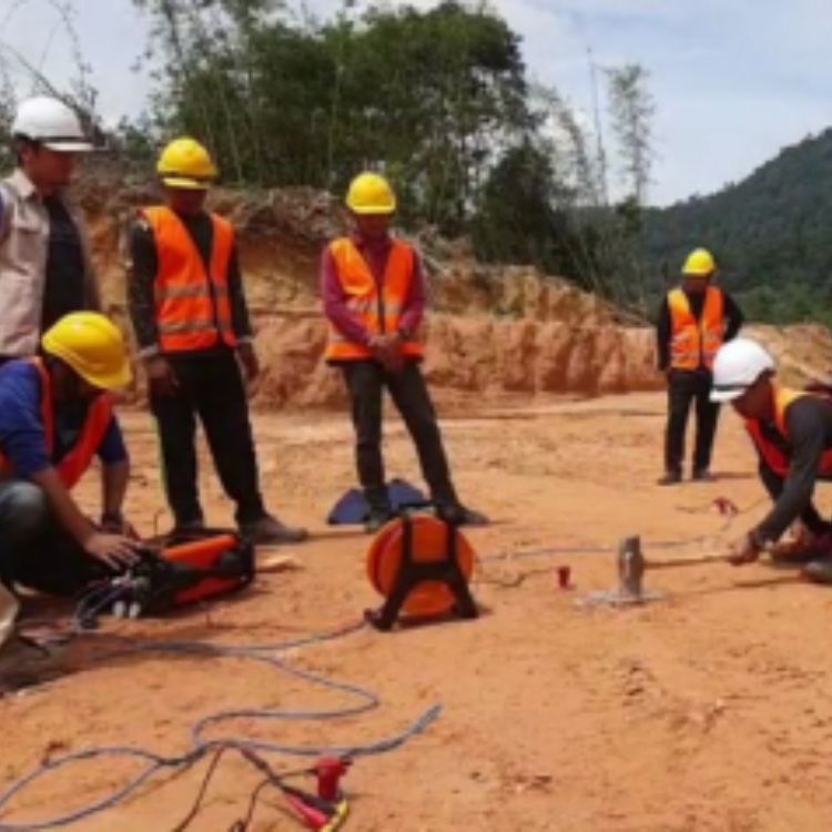
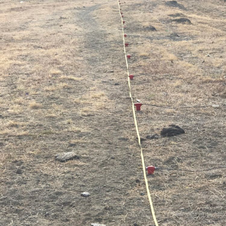
Field Data Acquisition
An array of geophones or seismometers is deployed in a straight line along the ground surface. A seismic source typically a sledgehammer, vibrator truck, or similar device is used to create ground vibrations. These vibrations generate surface waves, which are captured by the geophones as they propagate through the subsurface.
Waveform Analysis
The collected waveforms are processed to extract dispersion curves, which show how seismic wave velocity changes with frequency. These curves provide key insights into subsurface stiffness variations and are critical for accurate modeling.
Inversion Process
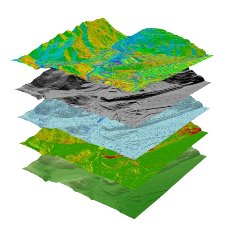
Using specialized software such as ParkSEIS or Geopsy, the dispersion data is inverted to produce a shear-wave velocity (Vs) profile. This profile reveals the vertical distribution of soil and rock stiffness, depth to bedrock, and potential weak zones, essential for geotechnical design and seismic classification.
Reporting
Once analysis is complete, the results are compiled into a comprehensive report. This includes :-
- Vs profiles and interpreted layers
- Subsurface profiling and bedrock mapping
- Soil and rock classification
- Liquefaction potential assessment
- Seismic site response analysis (e.g., Vs30)
- Engineering recommendations for foundations, pavements or slope design
This structured workflow ensures that MASW surveys provide clear, actionable insights for any geotechnical or seismic project.
Pedas Hot Spring (2023)
In Pedas, Negeri Sembilan, researchers utilized MASW alongside ERT, IP and TEM methods to assess subsurface conditions for planned tourism facilities. MASW slicing revealed a hard bedrock layer between ~10–30 m, while overlying materials exhibit low shear wave velocity, indicating active groundwater paths along fault structures.
The study recommended placing new facilities away from hot water conduits, in zones with higher Vs values, for structural safety
Pulau Pinang Site Response Mapping (2024)
A study on Seberang Prai Selatan (2019) focused on mapping Vs profiles of quaternary marine clays and silts using Active, Passive, and Hybrid MASW. The findings show Vs30 values between ~112–174 m/s, classifying these deposits as soft (soil class D–E) a key metric for seismic site response analysis. The use of MASW for Vs30 across reclaimed and coastal zones likely continued into 2024, demonstrating its importance in seismic site classification for urban and infrastructure planning.
Seberang Prai Selatan (2019)
The 2019 study used MASW to investigate soft quaternary deposits in Seberang Prai. Results showed:
- Vs30 (Active MASW): 111.6 m/s
- Vs30 (Hybrid approach): 173.6 m/s
This strongly indicated soft clays (Vs < 150 m/s), a red flag for roadway development. Consequently, ground improvement or alternative foundation strategies were implemented to ensure stability under infrastructure loads
Kajang Rock Quarry (2015)
At Kajang Rock Quarry (Semenyih, Selangor), MASW and SASW surveys were used to model shear‑wave velocity (Vs) across weathered and intact rock zones. The study identified multiple weathering layers with Vs ranging from 300–2,300+ m/s, enabling accurate rock quality classification (RQD ~96–99%). These data helped geotechnical engineers assess bedrock integrity, inform slope stability analysis, and design safer blasting and reclamation procedures
“Shear wave velocity is a crucial parameter for evaluating the mechanical properties of soils and rocks. Accurate determination of Vs is essential for designing foundations, assessing soil response to seismic loading.” – Geophysics GPR International
Ready to get reliable subsurface data without the hassle of drilling? At Geotechnica, we deliver accurate, site specific MASW testing that meets seismic design standards, saves time, and fits your budget. Whether you’re building on reclaimed land, soft ground, or in dense urban areas our expert team ensures you get the data you need, fast. Contact Geotechnica today and unlock the full potential of your site with trusted geophysical solutions.

