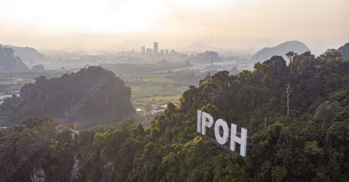
Imagine this: You’re spearheading a multi-billion Ringgit highway project, carving a vital artery through the dense, unforgiving jungles of Borneo. Your team is on the ground, battling steep inclines and impenetrable vegetation. Your timelines are tight, your budget is stretched, and every decision is based on topographic maps that are years, if not decades, old. Suddenly, you hit an unforeseen ravine, a hidden swamp, or a dangerously unstable slope that your old maps completely missed.
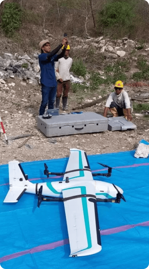
The project grinds to a halt. Costs spiral. The dream turns into a logistical nightmare. This scenario is a chilling reality for many, but it doesn’t have to be. There is a better way, a faster way, a profoundly more accurate way to see the unseen. The solution is an airborne LiDAR survey, a game-changing technology that is rewriting the rulebook for development, agriculture, and resource management across Malaysia.
Surveying Method Problem in Malaysia
For decades, project planners in Malaysia have relied on traditional surveying methods. While valuable, these techniques are painfully slow, labor-intensive, and often dangerous in challenging terrains. In a country where rapid development is a national priority, the old ways simply can’t keep up. According to the Department of Statistics Malaysia (DOSM), the value of construction work done in the first quarter of 2025 alone was a staggering RM32.9 billion, a testament to our nation’s relentless progress. But how much of that progress is hampered by inefficiency and inaccuracy?
Traditional surveys struggle to penetrate the dense canopy of our tropical rainforests, effectively hiding the true nature of the ground beneath. The resulting data is often incomplete, leading to flawed designs and costly surprises during construction.
Read : LiDAR Mapping Service in Malaysia by Geotechnica
The Agony : Inaccurate Maps Cause Disasters
The consequences of working with subpar data are not just financial. They are catastrophic.
“We thought we had a solid plan for the residential development based on the existing surveys,” shares a (hypothetical) project director from a Klang Valley project. “But we completely missed a series of old mining gullies hidden by thick undergrowth. During the first major earthworks, a small landslide occurred. It was a wake-up call. The cost of remedial work and the project delay nearly sank the company. We were building on a foundation of guesswork.”

This isn’t just about construction. Inaccurate flood modeling based on outdated elevation data can lead to ineffective mitigation channels, putting communities at risk. Poorly planned agricultural layouts can result in soil erosion and inefficient water use, crippling a plantation’s profitability from day one. The risk of relying on old data is a gamble modern projects can no longer afford.
Solution: Seeing in High Definition
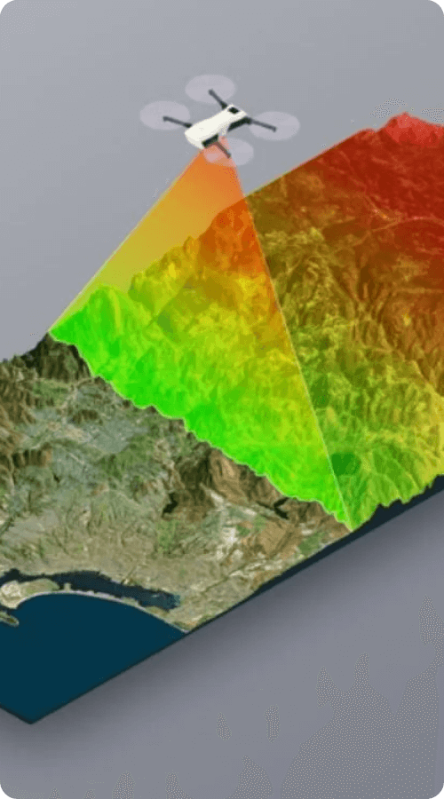
What if you could strip away every tree, every building, every leaf of vegetation with the click of a button and see the bare, naked earth beneath? That’s the power of a LiDAR survey.
LiDAR, which stands for Light Detection and Ranging, is a remote sensing method. An aircraft equipped with a LiDAR sensor flies over an area, sending out thousands of laser pulses every second. These pulses bounce off the earth’s surface and objects on it, returning to the sensor. By measuring the time it takes for each pulse to return, we can calculate the precise distance, creating a stunningly detailed 3D map called a “point cloud.”
Read : Guide to MRT Construction Soft Soil Treatment in Malaysia
Why LiDAR Survey Is The Future :
- Unmatched Accuracy: LiDAR provides vertical accuracy down to a few centimeters, giving you a true representation of your site.
- Incredible Speed: A single flight can cover hundreds of square kilometers in a day, a task that would take ground crews months or even years.
- Vegetation Penetration: The laser pulses can find gaps in the tree canopy to map the actual ground level, a feature indispensable for projects in Malaysia’s forested landscapes.
- Cost-Effectiveness: By identifying problems before they happen and optimizing design, the upfront investment in a LiDAR survey saves millions in the long run.
This detailed data is crucial for creating accurate Digital Elevation Models (DEMs), which are fundamental for modern terrain mapping in Malaysia.
Transformation: From Guesswork to Precision
Consider the Central Spine Road project in Malaysia. To design a safe and efficient highway through the mountainous Titiwangsa Range, engineers needed a perfect understanding of the terrain. An airborne LiDAR survey provided a high-resolution 3D map that revealed potential landslide zones, optimized the road alignment to minimize earthworks, and ensured the design accounted for natural drainage paths. This proactive approach, based on solid data, is the new standard. As cited by the Jabatan Ukur dan Pemetaan Malaysia (JUPEM), the adoption of modern geospatial technologies like LiDAR is critical for national development and disaster management.
The raw output of this process is complex. To truly unlock its potential, you need to understand how to interpret it. For more on this, see our guide below.
Read : 2 LiDAR Services for Accurate 3D Soil Mapping in Malaysia (2025)
Ultimately, a LiDAR survey is more than just a map. It’s an insurance policy. It’s a strategic tool that replaces uncertainty with clarity, risk with confidence. In the competitive landscape of 2025, it provides the unseen advantage that sets successful projects apart from the ones that fail. If your project demands precision, speed, and a true understanding of the ground you’re working on, it’s time to look up.
The Geotechnica team can help you analyze this complex data, ensuring your project is built on a foundation of certainty. Let us guide you through the process of conducting a LiDAR survey, transforming your project planning from a guessing game into a precise science. Contact our experts today to discover how we can give your project the vision it needs to succeed.

