Understanding and Use LiDAR Data in 10 Minutes for Malaysia
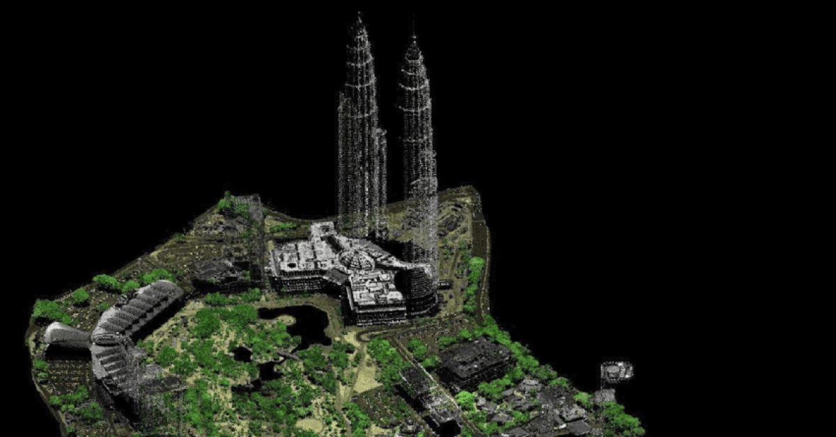
You’ve just received the results from your airborne LiDAR survey. It’s a massive digital file, millions—perhaps billions of tiny points […]
You’ve just received the results from your airborne LiDAR survey. It’s a massive digital file, millions—perhaps billions of tiny points […]

Imagine this: You’re spearheading a multi-billion Ringgit highway project, carving a vital artery through the dense, unforgiving jungles of Borneo.

If you’re an engineer or geologist in Malaysia, you’ve probably heard about Multichannel Analysis of Seismic Waves (MASW), but maybe

If you’ve ever asked, “What is the method of resistivity survey?” or “How reliable is the electrical resistivity survey method

This guide reveals the 6 essential processes in a soil investigation report that every Malaysian geologist and engineer must know.

As Malaysia accelerates its move toward digital infrastructure and data-driven decision-making, technologies like LiDAR are becoming increasingly vital. For those

Have you ever wondered how engineers map out hillsides before building roads, or how experts predict landslides in mountainous regions?
