
If you’re a geologist or engineer in Malaysia, you already know that precision is everything. That’s why in 2025, LiDAR services are no longer “nice-to-have”, they’re the backbone of accurate 3D soil mapping.
At Geotechnica, we’ve spent years refining our LiDAR drone and airborne LiDAR workflows to deliver unmatched topographic and soil data, ensuring every geotechnical decision is backed by hard science and millimeter accuracy.
But here’s the problem in Malaysia, many still think LiDAR is “just for mapping forests” or “only for big-budget projects.” Others assume LiDAR services are overkill compared to conventional surveys.
These myths have cost projects millions in rework, delays and even structural failures, all because decision-makers underestimated what LiDAR can do in soil investigation and land development.
This guide will strip away the myths, show you why LiDAR services have become a game-changer in Malaysian geo-engineering and walk you through the two key LiDAR methods Geotechnica uses to deliver flawless 3D terrain and soil data, faster, more accurately and more cost-effectively than anyone else in the market.
“LiDAR data and their derivative metrics are fundamental inputs to many areas of scientific research, including flood, erosion, and coastal modeling.” — USGS, 2023
What is LiDAR?
LiDAR (Light Detection and Ranging) is a remote sensing technology that uses pulsed laser light to measure distances between a sensor and the Earth’s surface. By combining these laser returns with GPS and other positioning data, LiDAR generates highly accurate 3D models of terrain and surface features.
Unlike conventional mapping methods, LiDAR can penetrate vegetation cover, capture inaccessible areas and reveal subtle landforms that are often invisible to the naked eye. It is widely applied in geology, engineering and environmental studies to better understand both natural and man-made landscapes.
LiDAR History in Malaysia
LiDAR applications in Malaysia became more prominent in the mid-2010s, particularly for environmental and geohazard studies. In 2014, Kuala Lumpur City Hall (DBKL) utilized LiDAR-derived Digital Terrain Models (DTM) for landslide and flood susceptibility mapping.
By 2019, LiDAR-based geohazard assessments were carried out along the SUKE Highway in Ulu Kelang, Selangor, producing high-resolution point clouds, contour maps and digital elevation models for slope risk evaluation.
LiDAR has also been applied in geological studies such as rock slope stability mapping at the Kinta Valley Geopark in Perak using Terrestrial Laser Scanning (TLS). Today, LiDAR is a vital tool in Malaysia for flood modeling, slope stability assessment and infrastructure planning, especially in rugged and densely vegetated terrain.
Why Use LiDAR for Soil Mapping?
High-Resolution Terrain and Soil Data
LiDAR provides detailed digital elevation models with resolutions as fine as 5–10 cm, allowing engineers and geologists to capture soil surface characteristics and topography with far greater precision than conventional survey methods.
Efficient Coverage of Large and Remote Areas
What might take weeks with traditional ground surveys can be completed in just hours using LiDAR. Whether it’s a 50-hectare slope in Sabah or a new infrastructure corridor in Selangor, LiDAR makes it possible to map vast areas quickly and accurately.
Penetration Through Dense Vegetation
Malaysia’s tropical rainforest often limits visibility for ground-based surveys, but LiDAR overcomes this challenge. By using multiple laser returns, it penetrates thick canopy cover to record accurate ground points, an essential factor in slope stability analysis, erosion studies and flood risk modeling.
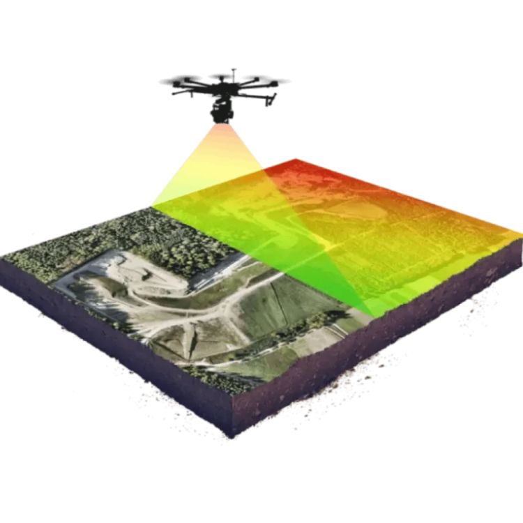
2 LiDAR Services You Need in Malaysia
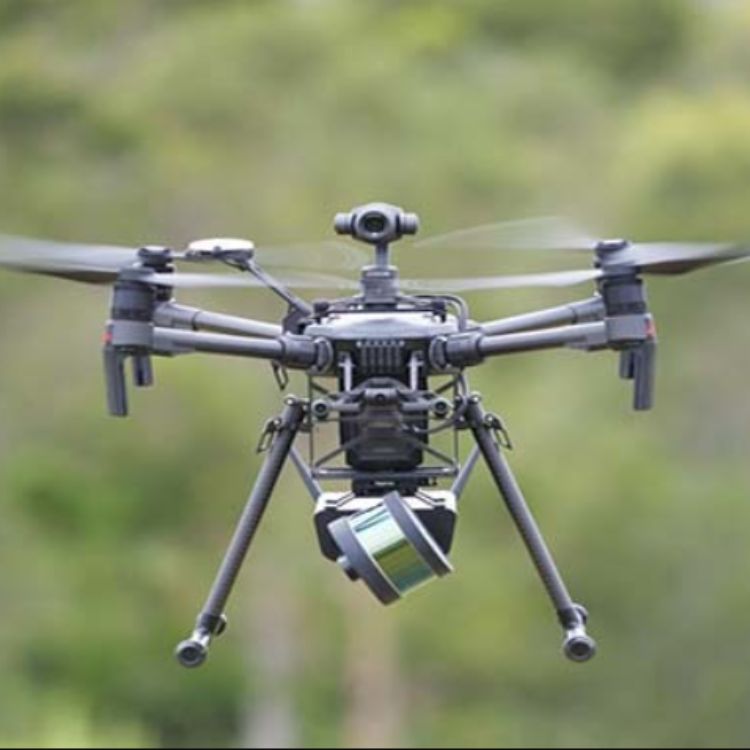
1. UAV LiDAR (Drone-Based LiDAR)
Benefits of UAV LiDAR:
- Perfect for sites under 500 hectares.
- Highly maneuverable, ideal for steep slopes and narrow corridors.
- Cost-effective for smaller budgets.
Implementation of UAV LiDAR:
At Geotechnica, UAV-based LiDAR surveys generate dense point clouds with an accuracy of up to ±3 cm. This level of precision provides engineers with reliable terrain and soil data, enabling confident decision-making in the design of retaining walls, slope reinforcement systems and large-scale earthworks.
2. Airborne LiDAR
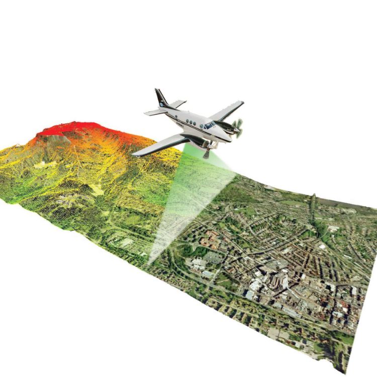
Benefits of Airborne LiDAR:
- Massive coverage: Ideal for regional planning and large infrastructure.
- Captures millions of data points per second.
- Great for floodplain mapping and geological hazard assessment.
Implementation of Airborne LiDAR:
At Geotechnica, airborne LiDAR is deployed for large-scale projects exceeding 1,000 hectares. This technology is particularly effective for expressway route planning, dam catchment area studies and regional-scale soil stability mapping, where wide coverage and high-resolution terrain data are essential for accurate engineering assessments.
Why Geotechnica Is Trusted in LiDAR Service?
Local Geotechnical Experts
Geotechnica is more than a LiDAR service provider, we are Malaysian geotechnical engineers who understand the country’s diverse terrains, from rainforest-covered slopes to coastal lowlands.
With a strong foundation in geotechnical and geo-engineering, we ensure every LiDAR dataset is interpreted in the context of real soil and slope conditions.
Latest LiDAR Sensors & Geospatial Technology
We use state-of-the-art LiDAR systems, including UAV (drone) LiDAR, aerial scanning and industry-leading sensors such as Riegl and Velodyne.
These technologies allow us to capture high-density point clouds with centimeter-level accuracy, ensuring reliable data for slope hazard assessments, infrastructure monitoring and geo-hazard mapping.
Understanding of Malaysia Soil Mapping
Unlike general mapping companies, we integrate LiDAR results with geotechnical investigations. This means our deliverables don’t just show surface topography but they also include soil parameters, slope stability insights and engineering recommendations tailored to Malaysia’s unique geological conditions.
Over 10 Years of Terrain Mapping Experience
Since 2020, Geotechnica has successfully delivered over 20 LiDAR-based projects across Malaysia, ranging from hillside condominium developments to expressway alignments and state-level soil stability studies. Our proven track record demonstrates both technical expertise and consistent reliability in handling projects of national importance.
Why Should You Consider LiDAR Service?
Need to Monitor Erosion or Ground Movement
In Malaysia’s tropical climate, heavy rainfall and deforestation often accelerate soil erosion and slope movements. LiDAR provides high-resolution surface data that enables engineers to detect even subtle terrain changes over time.
At Geotechnica, we use repeated LiDAR surveys to create comparative models that help clients monitor erosion risks and ground shifts before they escalate into landslides or costly structural damage.
Require Accurate Digital Elevation Models (DEM)
Traditional survey methods can be slow and sometimes inaccurate in rugged or forested areas. LiDAR eliminates these challenges by generating Digital Elevation Models (DEM) with centimeter-level precision.
Geotechnica integrates these DEMs with geotechnical parameters, giving planners and engineers the reliable foundation they need for flood modeling, catchment studies and large-scale construction projects.
Want to Evaluate Slope Stability Before Excavation
Excavation in hilly or sensitive terrain can be risky without a clear understanding of soil and slope conditions. LiDAR penetrates dense vegetation to map the ground surface beneath, allowing Geotechnica’s engineers to assess slope angles, potential failure zones and reinforcement requirements. This approach provides safer, data-driven decisions before excavation begins, reducing project risks.
Applying for Permits That Require Terrain Verification
Large infrastructure and property developments in Malaysia often require government approvals that involve terrain verification and environmental assessments. LiDAR offers regulators a transparent, verifiable dataset of site conditions.
With Geotechnica’s expertise in both LiDAR and geotechnical reporting, our clients receive terrain verification outputs that align with regulatory expectations, helping to streamline approval processes.
Need 3D Terrain Data for GIS, BIM or Engineering Software
Modern engineering and planning increasingly rely on 3D environments, whether for GIS-based land management, BIM integration or advanced engineering simulations.
LiDAR data collected by Geotechnica seamlessly integrates into these platforms, delivering accurate 3D terrain models. This enables engineers, architects and developers to design with precision, test scenarios virtually and reduce costly errors in the construction phase.
“By significantly reducing geological model uncertainty, LiDAR-enabled geotechnical analysis leads to safer and more cost-effective engineering designs.” — Yeh et al., ASCE Geotechnical Special Publication, 2021
Book LiDAR Service by Geotechnica Today
In short, LiDAR services are no longer optional, they’re essential for accurate soil mapping in Malaysia. Whether you choose UAV LiDAR for precision on smaller sites or airborne LiDAR for vast terrain, Geotechnica guarantees high-accuracy 3D models that take the guesswork out of engineering decisions.
If you want the best LiDAR mapping in Malaysia, combining cutting-edge tech, deep local knowledge and affordable pricing, Geotechnica is your answer. Don’t gamble with terrain data.
Contact Geotechnica today and get LiDAR results that are sharper, faster and more reliable than the rest of the market.

