Outcome / Problem (+)
What it helps determine
Determines the cause of ground movement, structural failure, or contamination in a scientifically sound and legally defensible way — for disputes, litigation, or insurance claims.
Specific evidence
Root cause of failure or contamination, subsurface anomalies, historical site and land-use data, soil and rock composition, timeline of ground change.
Definition / Methodology
Core concepts
Geoforensics assessment applies geological and geotechnical techniques to investigate and resolve legal or environmental disputes — commonly used in landslides, construction defects, erosion, illegal excavation, and boundary disputes.
Technical components
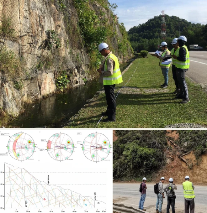
Site inspection, subsurface geophysical testing, soil and rock analysis, remote sensing, and historical data review, compiled into a legally defensible expert report.

Applications
Where this service is used
01
Land Case Applications
Applying geoscience and geotechnical knowledge to solve real-world, site-specific challenges.
- Ground Stability Studies
- Geo-Disaster Evaluation
- Engineering Geology Reports
- Site-Specific Risk Assessment
- Landslide & Slope Failure Investigation
02
Geophysical Methods
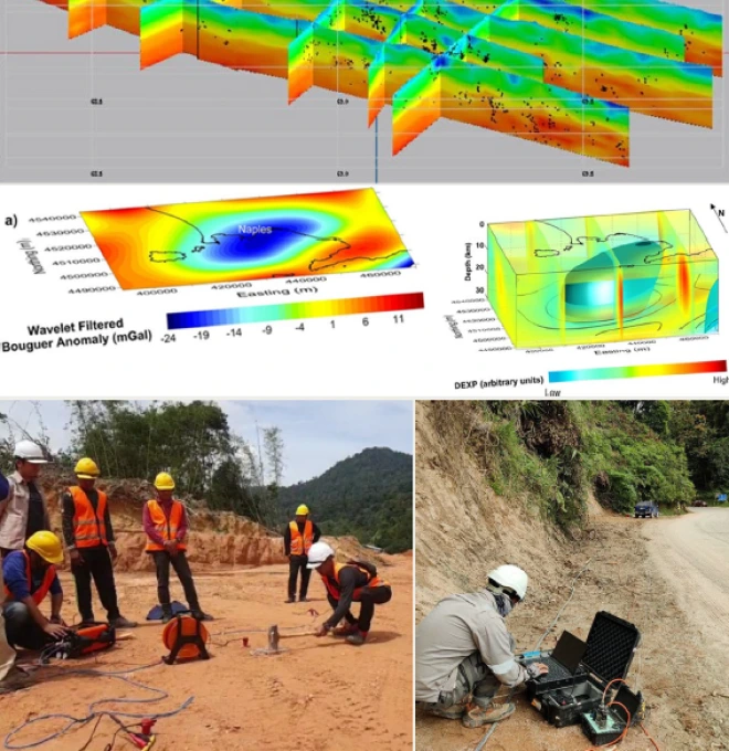
Non-invasive techniques to image underground conditions without drilling or excavation.
- Magnetic & Gravity Surveys
- Subsurface Anomaly Detection
- Ground Penetrating Radar (GPR)
- Electrical Resistivity Tomography (ERT)
- Seismic Refraction & Surface Waves (MASW)
03
Provenance Studies
Examining the origin and transport history of sediments to understand geological evolution.
- Basin Evolution Studies
- Stratigraphic Correlation
- Sediment Source Tracing
- Paleogeographic Reconstruction
- Heavy Mineral & Petrographic Analysis
04
Remote Sensing & GIS
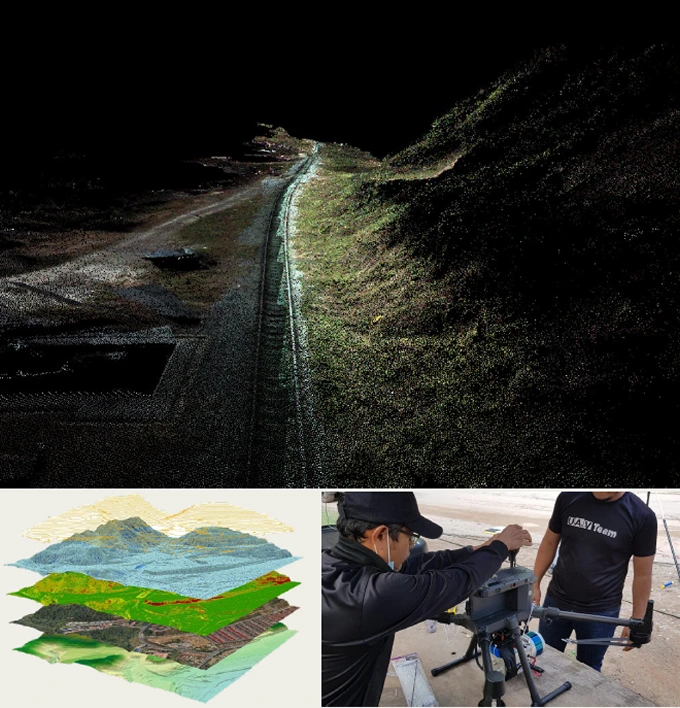
Analyzing satellite imagery and spatial data to monitor land changes and support planning.
- Hazard & Flood Mapping
- Environmental Change Detection
- Geospatial Database Development
- Land Cover & Land Use Mapping
- Terrain & Elevation Modeling (DEM/DTM)
05
Geomorphology Analysis
Studying landforms and surface processes to assess natural hazards and landscape evolution.
- Watershed Analysis
- Erosion Risk Assessment
- Terrain & Slope Mapping
- River & Coastal Morphology
- Landslide Susceptibility Mapping
06
Soil & Sediment Analysis
Detailed testing of soil and sediment properties for geotechnical, agricultural, or environmental purposes.
- Soil Contamination Screening
- Grain Size & Texture Analysis
- Sediment Sampling & Core Analysis
- Organic Content & Moisture Testing
- Atterberg Limits & Soil Classification
Process
How the assessment is carried out
01
Desktop Study & Historical Review
Review site history, prior records, and available geological/geospatial data.
02
Site Inspection & Data Collection
Field inspection combined with geophysical and subsurface testing.
03
Multidisciplinary Analysis
Geologists, geotechnical and geospatial experts jointly analyse findings to determine root cause.
04
Expert Reporting
Deliver a legally defensible report suitable for litigation, insurance, or technical audits.
Equipment & Technology Capabilities / Methods
What we use in the field


Outputs / Deliverables
What you receive
Expert geoforensic report
Root-cause determination
Geophysical survey data (GPR/ERT)
Soil & sediment lab results
Litigation / insurance-ready documentation
Malaysian Context
Why this matters here
Local condition
Malaysia's landslides, construction defects, erosion and boundary disputes often require scientifically sound, legally defensible ground investigation to resolve.
Implication
Geoforensic assessment gives engineers, lawyers, developers and government agencies an evidence-based, court-admissible basis for litigation, insurance claims and technical audits.
Integration / Related Services
Often paired with
Soil Investigation
Borehole and lab data provide physical evidence to support forensic findings.
Electrical Resistivity
ERT/GPR subsurface imaging is a core geophysical tool used in geoforensic work.
Slope Hazard Assessment
Often the trigger for a geoforensic investigation when a slope failure occurs.
Case Study
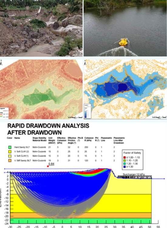
Geoforensic Assessment at Lawas (KP139), SSGP
2021 · Petronas Carigali Sdn Bhd / DNASB
Challenge
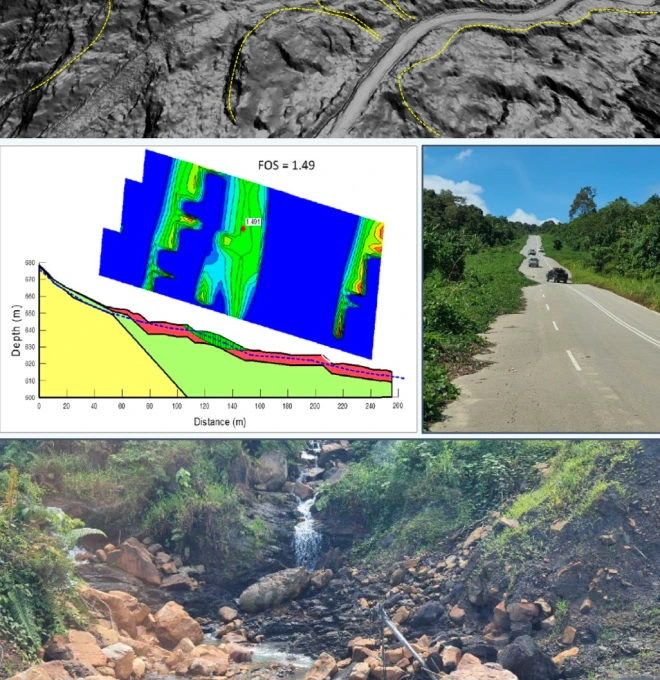
In December 2020, a pipeline failure was reported at the SSGP right-of-way in Lawas, Sarawak, resulting in a loss of production capacity — initially suspected to have been triggered by a landslide.
Approach
A multidisciplinary team spanning geology, geotechnics, geospatial analysis and hydrology investigated the incident to determine the possible root cause(s) of the failure.
Finding
Identified the contributing geological and hydrological factors behind the pipeline failure.
Outcome
Delivered a root-cause determination to inform remedial action and reduce recurrence risk along the corridor.
More relevant work: Geoforensic Assessment at TULIP Pipeline ROW · Detailed Geological Assessment at KP220 of SSGP
Standards / Compliance
Geoforensic assessments are delivered with scientifically sound, court-admissible methodology, drawing on GPR, ERT and MASW geophysical standards where applicable, under geologists registered per the Geologists Act 2008.
Standards / Compliance
Proof points
01
High-End Equipment — equipped with the latest geophysical and forensic testing equipment for 100% accuracy of data & statistics.
02
National-Level Project Experience — since 2020, we've handled 20+ state and national-level geoforensic and geotechnical projects.
03
Certified Engineers & Surveyors — our engineers & surveyors are international and local graduates with extensive geo-engineering experience.
04
Custom Report & GIS Integration — you'll receive 100% accurate, legally defensible reporting with GIS integration where needed.
FAQ
Frequently asked questions
What is geoforensics assessment?
Geoforensics assessment is the use of geological and geotechnical methods to investigate causes of ground-related problems like slope failure, cracks, or subsidence.
When is geoforensics assessment needed?
It’s needed when there are disputes, accidents, or failures involving soil, slopes, foundations, or land movement—especially when legal or insurance action may follow.
What does a typical geoforensic investigation include?
It includes site inspection, subsurface testing, data analysis, and a detailed report explaining the cause of the ground or structural issue.
Can geoforensics be used in slope failure cases?
Yes, forensic assessment is commonly used to find out why slope failures or landslides occur, especially in hilly or high-risk areas in Malaysia.
Is geoforensics useful for construction defects?
Absolutely. It helps identify whether construction-related ground movement or settlement is due to design issues, soil problems, or external factors.
What tools are used in geoforensics assessment?
Common tools include Ground Penetrating Radar (GPR), Electrical Resistivity (ERT), borehole sampling, and lab testing for soil strength and properties.
Who uses geoforensics assessment in Malaysia?
It is used by developers, engineers, lawyers, insurance companies, and local councils when there’s a need for expert analysis of ground-related problems.
Does geoforensics involve legal reporting?
Yes, the assessment often includes reports that can be used in court cases or insurance claims, with expert witness support when needed.
How long does a forensic ground investigation take?
Depending on the complexity, it can take a few days to several weeks, including fieldwork, testing, and final reporting.
Why choose Geotechnica for geoforensics in Malaysia?
Geotechnica offers experienced geoscience professionals, advanced tools, and legally defensible reporting for accurate and trusted geoforensics assessments.
gallery
Project photography