

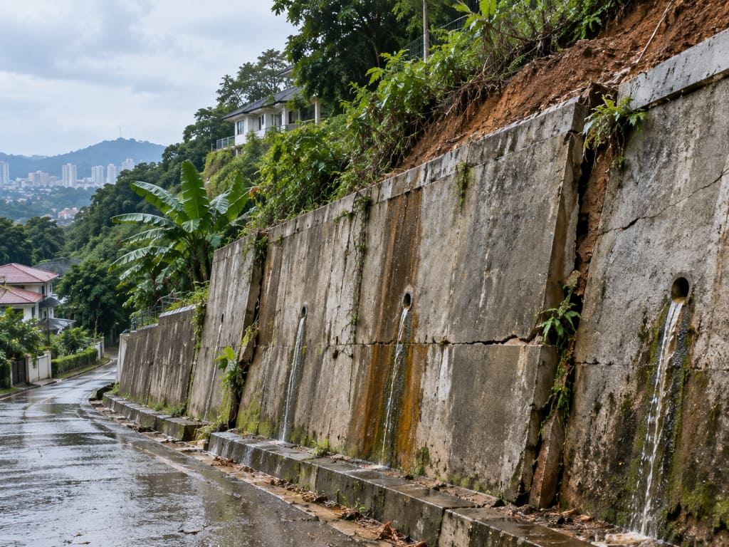
- Retaining wall failure means a wall can no longer hold back the ground it was built to retain.
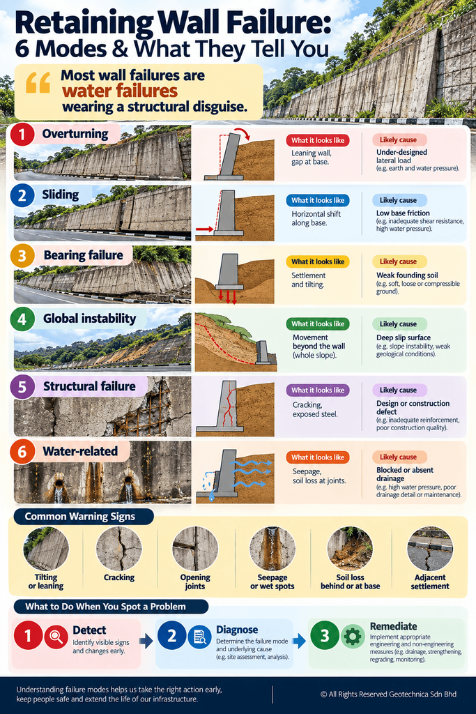
- Common modes are overturning, sliding, bearing failure, global slope instability and structural cracking.
- In Malaysia, water pressure behind the wall — not the wall itself — is the most common driver.
- Warning signs include tilting, bulging, cracking, joint opening, seepage and loss of soil through joints.
- Assessment cost is scoped per wall; extent, height, access and investigation depth drive it.
Introduction
Retaining walls are among the most common structures on Malaysian cut slopes, hillside developments, highway platforms and industrial sites — and among the most frequently taken for granted. Most retaining wall failures are not sudden structural collapses. They develop over months through cracking, seepage and movement that is visible long before the wall gives way. This article explains what retaining wall failure is, how to recognise the warning signs, how an assessment is carried out, and what drives cost. It is general guidance only; every wall requires site-specific engineering judgement.
What Is Retaining Wall Failure?
A retaining wall fails when it can no longer safely hold back the retained ground. This can be geotechnical — the wall rotates (overturning), slides forward, or the ground beneath it settles or shears (bearing failure); or global, where the entire slope including the wall becomes unstable; or structural, where the wall’s own elements crack, corrode or break.
The critical distinction is this: many walls reported as “failing” are actually being pushed by water. Where drainage is inadequate, pore water pressure builds behind the wall and imposes loads far beyond what was designed for. Ineffective drainage and clay-rich fill have been repeatedly identified as contributors to slope and wall distress in Malaysian investigations.
Why and When Is an Assessment Needed?
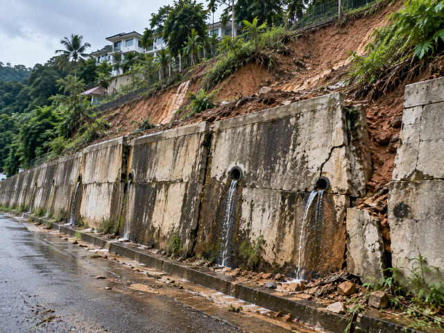
Assess a wall when any of these appear:
- Visible tilting, leaning or bulging of the wall face.
- Horizontal, vertical or diagonal cracking, or opening joints between panels.
- Seepage, wet staining, or water emerging at the wall base.
- Loss of soil through joints or weepholes — a sign of internal erosion.
- Settlement, cracking or movement of the retained platform or adjacent structures.
- The wall is aged, undocumented, or has no as-built drawings available.
- An adjacent excavation, new loading or change in surface drainage is proposed.
Distress is often progressive rather than sudden, which is why early assessment is materially cheaper than post-failure remediation.
Who Needs It?
Developers and hillside landowners need it for liability and planning; consultants and engineers for design verification and remediation input; contractors for temporary works and sequencing; architects where retaining structures interface with building platforms. Asset owners are the largest repeat category — highway concessionaires, pipeline and utility operators, power utilities, quarries, plantations and industrial site operators, along with JMB and MC bodies responsible for stratified hillside properties.
How Does the Assessment Process Work?
1. Desk study and as-built review
Drawings, past reports, historical imagery and terrain models are reviewed to establish wall type, geometry, retained height and drainage arrangement.
2. Condition survey and visual inspection
The wall face, joints, weepholes, drainage channels and the retained ground are inspected and documented, with any distress mapped and photographed.
3. Terrain mapping and remote sensing
Geological terrain mapping establishes the surrounding ground conditions, slope geometry and instability features. Where the wall sits within a larger slope, LiDAR provides DSM, DTM and change detection to show whether movement is local or part of a wider failure.
4. Subsurface investigation and geophysics
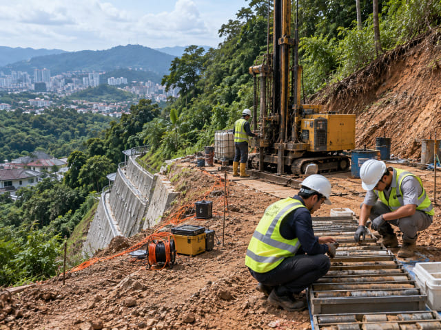
Boreholes with in-situ and laboratory testing establish retained soil and foundation properties. Non-invasive geophysics — resistivity, seismic refraction, MASW and GPR — helps locate groundwater, weak layers, voids and the foundation profile without excavation.
5. Analysis
Soil slopes use limit equilibrium and finite element analysis to check the factor of safety, while bearing capacity, global stability and structural capacity of the wall itself are assessed. Where rock is involved, structural mapping and kinematic analysis identify sliding, wedge and toppling mechanisms.
6. Remediation design and monitoring
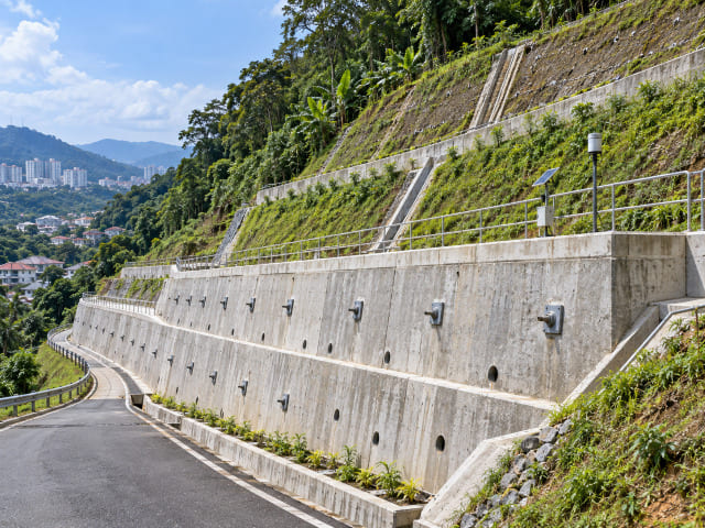
Options range from drainage improvement and ground reinforcement to structural strengthening or reconstruction. Instrumentation and real-time monitoring then track movement and water behaviour so intervention is timely.
Malaysia-Specific Considerations
Malaysia’s rainfall — up to roughly 4,500 mm annually plus intense storms — makes water the dominant driver of wall distress. Surface runoff that is not intercepted above the wall finds its way behind it.
Ground conditions compound this. Tropical weathering produces deep residual soils over granitic terrain, and sedimentary and metasedimentary sequences such as phyllite, slate, shale and sandstone also host instability. Fill platforms placed without adequate compaction or drainage are a recurring weak point. Walls built on or near dormant landslides may be reacting to deep-seated movement rather than local ground pressure, which changes the remediation approach entirely.
Failure Modes and What They Tell You
Identifying the correct mode matters, because treating the symptom without the mechanism rarely holds.
| Failure mode | Typical indicator | Likely cause | Remediation direction |
|---|---|---|---|
| Overturning | Wall leaning forward, gap opening at base | Under-designed lateral load, water pressure | Drainage, ground anchors, reconstruction |
| Sliding | Horizontal shift along base | Low base friction, inadequate embedment | Base improvement, anchors, keyway |
| Bearing failure | Settlement, tilting, base heave | Weak founding soil | Foundation treatment or redesign |
| Global instability | Movement extending beyond the wall | Deep slip surface in the wider slope | Slope-scale stabilisation, not wall repair |
| Structural failure | Cracking, spalling, exposed or corroded steel | Design, material or construction defect | Structural strengthening or replacement |
| Water-related | Seepage, staining, soil loss through joints | Blocked or absent drainage system | Drainage reinstatement, backfill replacement |
Cost and Deliverables
Wall assessment is scoped per structure. No responsible consultant quotes from a rate table, because a single low wall and a multi-tiered wall on a failing hillside sit an order of magnitude apart. Cost drivers to expect:
- Number of walls and total retained height.
- Access difficulty and whether the retained ground can be exposed.
- Number and depth of boreholes, and extent of laboratory testing.
- Geophysical lines where groundwater or foundation conditions are unclear.
- Analysis complexity, including global stability modelling.
- Monitoring duration, if instrumentation is included.
Match the assessment level to the decision you are making. Where the wall is part of a wider slope, scoping only the wall will miss the actual mechanism. Judge proposals on methodology, the registration of professionals signing off, and the deliverable list — not lowest fee.
You should receive a technical report with conclusions; an assessed failure mode with supporting analysis; factor of safety results; remediation recommendations prioritised by risk; and monitoring protocols where ongoing movement is present.
Malaysian Requirements, Standards and Regulations
Where a retaining wall forms part of a development or cut slope, geological terrain mapping is regularly required for planning applications under Section 21 of the Town and Country Planning Act 1976 (Act 172), and along linear infrastructure by authorities including JMG, JKR, DOE and PLANMalaysia.
JKR’s slope engineering guidance sets the practical benchmark for slope design and stability review in Malaysia, and SIMS-based hazard rating is widely used in slope inventory management. Works should be led or reviewed by registered professionals — Board of Engineers Malaysia, Board of Geologists Malaysia and IGRSM for professional geospatialists. Specific clause references and limiting values must be verified against current published documents before being relied upon.
Common Mistakes
- Repairing the wall without finding the mechanism — a drainage problem rebuilt as a stronger wall will fail again.
- Treating a local wall issue as unrelated to the wider slope.
- Ignoring blocked weepholes and silted drains.
- Assessing the wall without investigating the retained soil and groundwater.
- Assuming an old wall is adequate because it has stood for years.
- Skipping monitoring after remediation.
Practical Checklist
Before appointing: record the visible signs with dates and photographs; locate as-built drawings and any previous reports; count walls and note retained heights; verify consultant registration; agree the deliverable list.
During assessment: confirm the retained material and foundation are investigated; confirm groundwater and drainage are characterised; confirm the analysis covers both the wall and the wider slope.
After reporting: prioritise the highest-risk items; restore drainage before adding structural strength; assign owners and dates; set a re-inspection cycle; keep the report with the asset records.
Frequently Asked Questions
What causes retaining wall failure?
Most commonly water — pore pressure building behind the wall due to blocked or absent drainage. Other causes are under-designed lateral loads, weak founding soil, base sliding, deep-seated slope movement beyond the wall, and structural defects.
What are the warning signs?
Tilting or bulging, cracking and opening joints, seepage or staining, loss of soil through joints or weepholes, and settlement or cracking of the retained ground and adjacent structures.
Who should assess a retaining wall?
A geotechnical or engineering geology team with geohazard capability, particularly where the wall forms part of a larger slope. Providers should be CIDB and MOF registered, with registered professionals signing off.
Can a wall failure be repaired instead of rebuilt?
Often yes — drainage reinstatement and ground reinforcement can resolve water-driven and shallow instability cases. Where global slope movement or structural capacity loss is involved, strengthening or reconstruction may be required.
Myth: if the wall looks straight, it is fine
Reality: distress is often progressive and internal. Seepage, soil loss through joints and drainage blockage can be present well before visible tilting, which is why condition surveys matter.
Why Choose Geotechnica?
Geotechnica integrates the full assessment stack: geohazard and risk assessment including landslide assessment, QRA/sQRA and root-cause failure analysis; engineering geological and terrain mapping; LiDAR, aerial photogrammetry and geophysics; and geotechnical services including soil investigation, slope hazard and instrumentation. We have delivered slope stabilisation design, rectification and site supervision, alongside multi-location slope assessment programmes across pipeline networks, highway sections and transmission corridors. CIDB and MOF registered, nationwide coverage. Talk to us about your wall or slope.
Conclusion
Retaining wall failure is usually a drainage or ground problem wearing a structural disguise. Read the warning signs early, find the actual mechanism, and fix the cause rather than the symptom. Do not wait for the wall to move.
References
1- Guidelines for Slope Design – Jabatan Kerja Raya Malaysia (JKR). https://jpedia.jkr.gov.my/images/e/ee/Design_Guideline.pdf
2- Guidelines on Slope Maintenance in Malaysia (CERUN 1) – Jabatan Kerja Raya Malaysia (JKR). https://crr.kkr.gov.my/en/dokumen/umum/WJ.1.2006.127
3- Garis Panduan Pemetaan Geologi Terain (Geological Terrain Mapping), JMG.GP.06 – Department of Mineral and Geoscience Malaysia (JMG). https://elib.jmg.gov.my/cgi-bin/koha/opac-detail.pl?biblionumber=21271
4- Garis Panduan Perancangan Pembangunan di Kawasan Bukit dan Tanah Tinggi – PLANMalaysia. https://mytownnet.planmalaysia.gov.my/ver2/gp/GPP_TANAH_TINGGI.pdf
5- Garis Panduan Perancangan Bandar Berdaya Tahan Bencana di Malaysia – PLANMalaysia. https://www.planmalaysia.gov.my/uploads/content-downloads/file_20251114203026.pdf
This article had been technically reviewed by P.Geol. Gs. Hairil Azwan, Geohazard Specialist and Managing Director at Geotechnica Sdn. Bhd., with 15 years of professional experience in geology, geotechnical engineering and geospatial technology.
Next Review: 10 February 2027

