

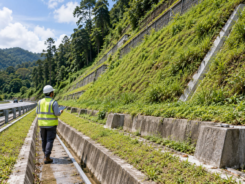
- A slope inspection checklist is a structured set of items to look for so early signs of instability are caught before failure.
- It is not a stability assessment — it is a screening tool that triggers one when needed.
- Key items are tension cracks, seepage, bulging, drainage condition and structural distress.
- Frequency should be risk-based, not fixed; higher-rated slopes are inspected more often.
- In Malaysia, rain-driven drainage failure is the most common precursor to slope problems.
Introduction
Most slope failures in Malaysia do not arrive without warning. Distress appears first — a crack in the pavement, new seepage on a face, a blocked drain, soil washing through a joint. The problem is that these signs are usually noticed only after someone is looking for them in a consistent way. A slope inspection checklist fixes that. It converts informal observation into a repeatable record that shows change over time, and it flags when a visual inspection is no longer sufficient and a formal landslide assessment is required. This article sets out what the checklist should cover, who should use it, and how it fits into a maintenance regime. It is general guidance only; every slope requires site-specific engineering judgement.
What Is a Slope Inspection Checklist?
A slope inspection checklist is a defined list of observable conditions recorded at regular intervals and compared against previous records. It covers surface features: cracks, movement, seepage, drainage function, vegetation condition, erosion and the condition of any retaining or protective structures.
The critical distinction is that an inspection is a screening activity, while an assessment is an engineering analysis. An inspection identifies that something has changed. It cannot determine the factor of safety, estimate the depth of a slip surface, or confirm which failure mechanism is governing — that requires subsurface investigation, testing and stability analysis.
Using a checklist correctly means knowing precisely when to escalate, and escalating without delay.
Why and When Is It Needed?
Inspection value comes from frequency and consistency. A single inspection tells you the current condition; a series tells you the rate of change, which is far more informative. Commission a formal assessment rather than a routine inspection when a checklist records any of the following:
- Continuous or widening tension cracks, especially across pavements or platforms.
- Seepage that is new, increasing, or emerging at a different elevation.
- Bulging or deformation at the toe of a slope or wall.
- Displacement, cracking or distress in drains, kerbs, retaining structures or adjacent buildings.
- Soil loss through joints or weepholes.
- Rapid or accelerating change between inspections.
Who Needs It?
Anyone responsible for a slope asset needs a checklist, not only a specialist. Developers and hillside landowners should inspect during construction and post-handover. Consultants and engineers use records to support design and remediation recommendations. Contractors should inspect during earthworks, when slopes are most exposed. Architects rely on inspection findings where slopes adjoin building platforms.
Asset owners are the largest user group: highway concessionaires, pipeline and utility operators, power utilities with hillside tower platforms, quarries, plantations and industrial site operators, and JMB or MC bodies managing stratified hillside properties. Where slopes are already entered into a registry or critical slope inventory, those records depend on this level of inspection discipline to stay current.
How the Inspection Works
1. Define the slope inventory
List every slope, wall and cut face you are responsible for, and record its location, geometry, age and any known history.
2. Set risk-based frequency
Assign inspection frequency by risk rating and by season. Higher-rated or actively moving slopes are inspected more frequently and after every significant storm; stable, low-risk slopes need less.
3. Inspect and record systematically
Follow the checklist across the whole slope — crest, face, toe, drainage and adjacent assets — and record observations with dates and photographs from consistent viewpoints.
4. Compare against previous records
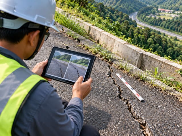
Change matters more than condition. Trend is what tells you whether a slope is behaving normally or deteriorating.
5. Escalate
Where triggers are met, commission a formal landslide assessment and, if risk is significant, implement interim measures and monitoring while that proceeds.
Malaysia-Specific Considerations
Malaysia’s rainfall — up to roughly 4,500 mm annually plus intense storms — makes water the dominant precursor. Inspection frequency should increase during monsoon periods, and a storm-triggered inspection should follow any intense rainfall event.
Terrain matters too. Tropical weathering produces deep residual soils over granitic terrain, and sedimentary and metasedimentary sequences host instability, often with clay-rich fill and poor drainage implicated in failures. Debris accumulating in channels can form temporary dams that release during heavy rain, and logging or clearing near catchments contributes to instability. Peat, soft clay, karst and ex-mining ground each behave differently and may require technically distinct inspection criteria.
The Slope Inspection Checklist
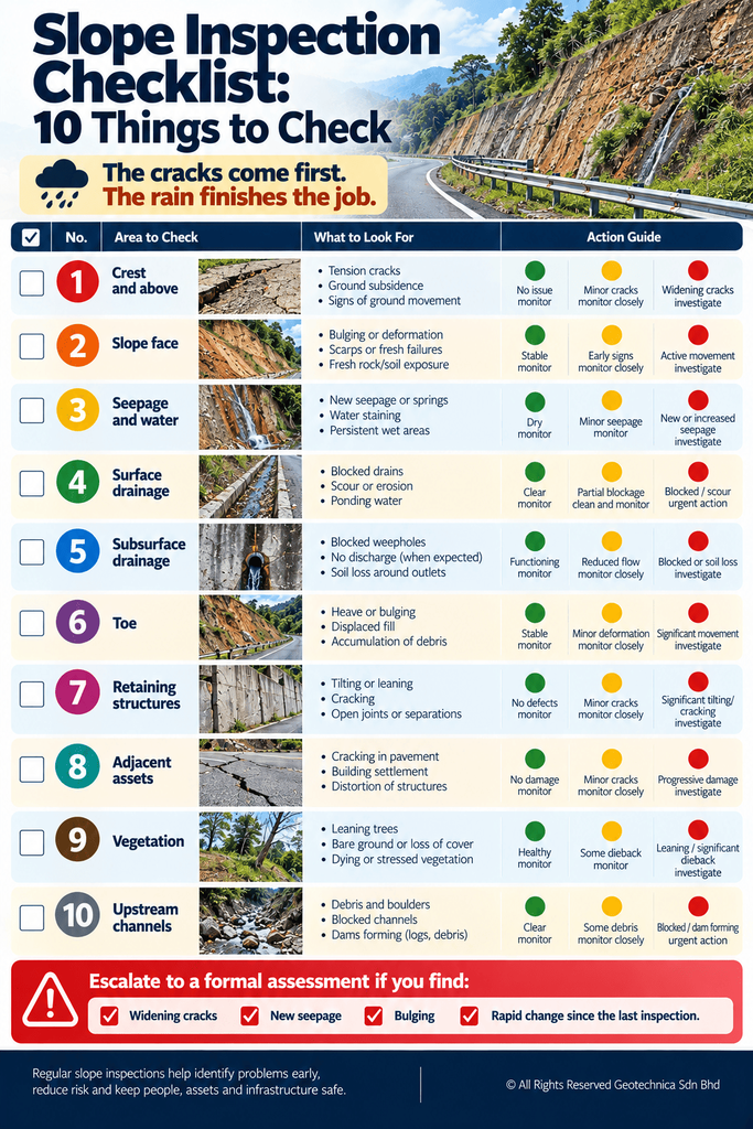
Use the items below as the core structure. Adapt thresholds and frequency to the asset and its risk rating.
| Area | What to look for | Why it matters | Action if found |
|---|---|---|---|
| Crest and above | Tension cracks, subsidence, ground gaps | Earliest indicator of movement | Record, monitor, commission assessment |
| Slope face | Bulging, scarps, fresh soil or rock exposure, erosion | Shows active or recent movement | Assess; restrict access below |
| Seepage and water | New seepage, wet patches, staining, springs | Water pressure is a leading trigger | Check drainage immediately |
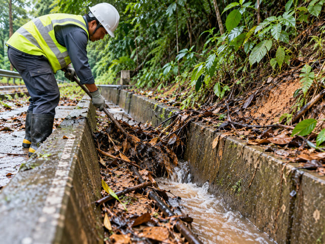
| Surface drainage | Blocked drains, silt traps, scour, ponding | Poor drainage loads the slope | Clear and reinstate |
| Subsurface drainage | Weepholes blocked, no discharge, soil loss | Hidden cause of wall and slope distress | Reinstate; assess if soil is migrating |
| Toe | Heave, bulging, displaced fill | Suggests bearing or deep-seated movement | Assess before further loading |
| Retaining structures | Tilting, cracking, open joints, deformation | Structural response to ground movement | Structural and geotechnical review |
| Adjacent assets | Cracking in pavements, kerbs, buildings, services | Movement extending beyond the slope | Map extent; assess the wider slope |
| Vegetation | Leaning or fallen trees, bare ground, dieback | Evidence of ground creep or erosion | Record; investigate |
| Channels upstream | Debris, boulders, dams forming | Debris flow source potential | Clear; consider debris flow assessment |
Cost and Escalation
Routine inspection is low cost — largely staff time, plus a camera and a consistent record format. Its value is that it is the cheapest available way to detect change early, when remediation is still small and targeted.
Where the checklist triggers an escalation, a formal landslide assessment is scoped per site rather than quoted from a rate table. Cost drivers are the number of slopes, extent of terrain mapping, whether LiDAR is required, borehole numbers and depth, geophysical lines, analysis complexity and monitoring duration. Match the level of assessment to the decision you are making, and evaluate proposals on methodology and the registration of the professionals signing off — not on lowest fee.
Malaysian Requirements, Standards and Regulations
Where slopes form part of a development, geological terrain mapping is regularly required for planning applications under Section 21 of the Town and Country Planning Act 1976 (Act 172), and along linear infrastructure by authorities including JMG, JKR, DOE and PLANMalaysia. JKR’s slope engineering guidance sets the practical benchmark for slope design and review, and SIMS-based hazard rating is widely used in slope inventory management — which depends on inspection records being maintained. Works should be led or reviewed by registered professionals — Board of Engineers Malaysia, Board of Geologists Malaysia and IGRSM for professional geospatialists. Specific clause references and inspection intervals must be verified against current published documents and the asset owner’s own regime before being relied upon.
Common Mistakes
- Inspecting only the slope face and ignoring crest, toe and drainage.
- Not recording findings, so no trend can be established.
- Inspecting on a fixed calendar rather than risk-based and post-storm frequency.
- Treating an inspection as a stability assessment.
- Clearing blocked drains without asking why they blocked.
- Deferring escalation because the slope “has always been like that”.
- No interim measures while an assessment is being arranged.
Frequently Asked Questions
What is a slope inspection checklist?
A structured list of observable conditions — cracks, seepage, bulging, drainage and structural distress — recorded at intervals and compared against previous records to detect change before failure.
How often should slopes be inspected?
Frequency should be risk-based, not fixed. Higher-rated or actively moving slopes need more frequent inspection plus post-storm checks; low-risk stable slopes need less. Confirm against your asset owner’s regime.
Who should carry out a slope inspection?
A trained person following a consistent checklist can carry out routine inspection. Interpretation, escalation decisions and any formal assessment should involve a geotechnical or engineering geology specialist.
Can a checklist prevent slope failure?
Not by itself. It detects change early so that assessment, mitigation and monitoring can be applied before failure. Prevention comes from acting on what the checklist finds.
Myth: if nothing looks wrong, the slope is safe
Reality: many failure mechanisms develop below the surface. Visible condition is an indicator, not proof of stability — which is why drainage, seepage and trend matter as much as appearance.
Why Choose Geotechnica?
Geotechnica integrates the capabilities that inspection escalation requires: geohazard and risk assessment including landslide hazard analysis and root-cause failure investigation; engineering geological and terrain mapping; LiDAR, aerial photogrammetry and geophysics; and geotechnical services including soil investigation, slope engineering and instrumentation. We have re-assessed critical slope inventories against hazard-rating schemes across multiple local authority areas, delivered slope hazard assessment programmes across pipeline networks, highway sections and transmission corridors, and provided mitigation design with site supervision. CIDB and MOF registered, nationwide coverage. Talk to us about your slope inventory.
Conclusion
The checklist is cheap; the failure is not. Inspect consistently, record what you find, compare against last time, and escalate the moment something changes — because in Malaysian terrain, the cracks come first and the rain finishes the job. Do not wait until the slope tells you in a way you cannot ignore.
References
1- Guidelines on Slope Maintenance in Malaysia (CERUN 1) – Jabatan Kerja Raya Malaysia (JKR). https://jpedia.jkr.gov.my/images/b/b1/Guidelines_of_slope_maintenence.pdf
2- Guidelines for Slope Design – Jabatan Kerja Raya Malaysia (JKR). https://jpedia.jkr.gov.my/images/e/ee/Design_Guideline.pdf
3- Slope Remedial Works in Malaysia – Jabatan Kerja Raya Malaysia (JKR), Cawangan Kejuruteraan Cerun. https://crr.kkr.gov.my/en/dokumen/umum/WJ.1.2020.93
4- Engineering Geology and Geological Disaster Management – Department of Mineral and Geoscience Malaysia (JMG). https://www.jmg.gov.my/en/expertise-engineering-geology-disaster.html
5- Garis Panduan Perancangan Pembangunan di Kawasan Bukit dan Tanah Tinggi – PLANMalaysia. https://mytownnet.planmalaysia.gov.my/ver2/gp/GPP_TANAH_TINGGI.pdf
This article had been technically reviewed by P.Geol. Gs. Hairil Azwan, Geohazard Specialist and Managing Director at Geotechnica Sdn. Bhd., with 15 years of professional experience in geology, geotechnical engineering and geospatial technology.
Next Review: 10 February 2027

