

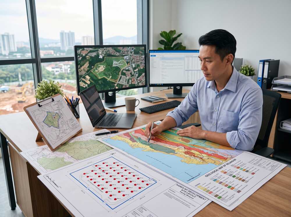
- The site investigation process is a phased approach to examining ground conditions before construction — from desktop research to fieldwork to laboratory testing and final reporting.
- In Malaysia, site investigation is required for most development plan submissions and is standard practice across residential, commercial and infrastructure projects.
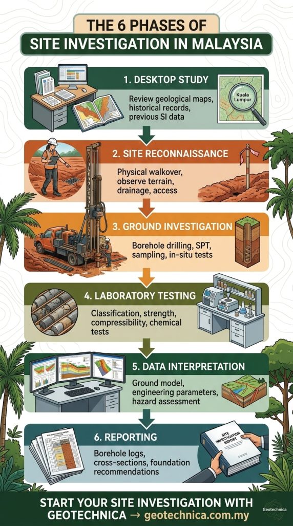
- Key phases include desktop study, site walkover, borehole drilling (with SPT), in-situ and laboratory testing, and geotechnical reporting.
- Skipping phases or under-scoping the investigation is one of the most common causes of foundation problems and construction cost overruns in Malaysia.
- The process is governed by BS 5930, Eurocode 7 and Malaysian regulatory guidelines from JKR, JMG and local authorities.
What Is Site Investigation?
Site investigation — also called ground investigation or geotechnical investigation — is the systematic process of collecting, analysing and reporting information about ground conditions, groundwater and site characteristics at a proposed development location.
It goes beyond just drilling boreholes. A complete site investigation includes reviewing existing geological data, physically inspecting the site, conducting fieldwork (drilling, sampling, testing), analysing samples in the laboratory, and producing a geotechnical report with design recommendations.
The goal is simple: give engineers, designers and project owners the ground truth they need to make safe, cost-effective decisions about foundations, earthworks and construction methods.
Why the Site Investigation Process Matters
Reduces Foundation & Construction Risk
Every building sits on the ground, and every ground is different. The site investigation process reveals what the ground is made of, how strong it is, where water sits, and whether any geological hazards exist. Without this information, foundation design is guesswork — and the consequences of getting it wrong range from settlement cracking to structural failure.
Prevents Budget Overruns
Unexpected ground conditions are consistently ranked among the top causes of construction cost overruns globally. In Malaysia, encountering soft clay where firm ground was assumed, hitting rock prematurely, or discovering an old mining void can add weeks of delay and hundreds of thousands of ringgit in remedial costs. A thorough site investigation eliminates most of these surprises.
Satisfies Regulatory Requirements
Local authorities in Malaysia require geotechnical reports for development plan submissions. For hillside and slope developments, JKR’s guidelines mandate comprehensive ground investigation. Projects near water bodies, in flood-prone areas, or on problematic soils will also face regulatory scrutiny without adequate site investigation data.
Who Needs Site Investigation?
The site investigation process is relevant to everyone involved in a construction project:
- Developers — to understand site constraints, inform project feasibility studies and avoid unforeseen ground-related costs.
- Consulting engineers (structural & geotechnical) — to design foundations, retaining structures and earthworks based on actual ground data.
- Architects — to adapt building design to site conditions, particularly for hillside developments, basements and sites with variable ground.
- Contractors — to price earthworks, piling and temporary works accurately during tendering.
- Government agencies — for public infrastructure projects including roads, bridges, drainage, utilities and public buildings.
- Industrial & energy developers — for factories, warehouses, solar farms, data centres and pipeline corridors.
The Site Investigation Process — Step by Step
Phase 1 — Desktop Study
The desktop study is the first and most cost-effective phase. It involves reviewing all available existing information about the site and surrounding area:
- Geological maps — from Jabatan Mineral dan Geosains (JMG) showing rock types, faults, and geological formations.
- Topographic maps & survey data — terrain, contours, drainage patterns.
- Historical aerial photographs & satellite imagery — to identify past land use, old ponds, filled areas or previous development.
- Previous site investigation reports — if any investigations were conducted nearby.
- Flood maps & hazard maps — from JPS (Jabatan Pengairan dan Saliran) and other agencies.
- Land title and development records — from local authorities.
The desktop study helps the geotechnical consultant plan the fieldwork phase — deciding where to drill, how deep, and what tests are needed.
Phase 2 — Site Reconnaissance
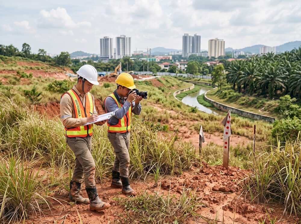
A physical visit to the site to observe conditions first-hand:
- Surface geology — exposed rock, soil types, slope gradients.
- Drainage and water features — streams, ponding, seepage, high water table indicators.
- Vegetation patterns — certain plants indicate waterlogged or peaty ground.
- Adjacent structures — signs of settlement, cracking or distress in nearby buildings.
- Access for drilling equipment — road conditions, overhead obstructions, site clearance needed.
- Environmental and safety considerations — contamination indicators, unstable slopes, nearby utilities.
The reconnaissance informs the fieldwork plan and highlights any conditions that may affect investigation scope or cost.
Phase 3 — Ground Investigation (Fieldwork)
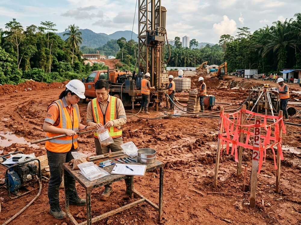
This is the core of the site investigation process. Fieldwork typically includes:
Borehole drilling — the primary method. Rotary wash boring or percussion drilling is used to advance boreholes to the required depth. During drilling:
- Soil and rock samples are collected at every 1.5 m interval.
- The Standard Penetration Test (SPT) is performed to measure soil resistance (N-values).
- Rock cores are obtained using diamond core barrels when bedrock is encountered, with core recovery and RQD recorded.
- Groundwater levels are measured and standpipe piezometers may be installed.
Supplementary investigation methods may include:
- Mackintosh Probe — for rapid assessment of soft ground conditions.
- Cone Penetration Test (CPT) — for continuous soil profiling.
- Field Vane Shear Test — for measuring undrained shear strength of soft clay.
- Trial pits — for shallow investigation and visual inspection of fill or topsoil.
- Geophysical surveys — electrical resistivity, MASW or ground-penetrating radar for non-invasive subsurface mapping.
Phase 4 — Laboratory Testing
Soil and rock samples collected during fieldwork are tested at an accredited laboratory. The testing programme is designed based on the ground conditions encountered and the project requirements:
- Classification tests — moisture content, Atterberg limits, particle size distribution.
- Strength tests — unconfined compressive strength (UCS), triaxial shear, direct shear.
- Compressibility tests — consolidation (oedometer) for settlement prediction.
- Chemical tests — sulphate, chloride, pH, organic content — important for assessing aggressiveness to concrete and steel.
- Compaction tests — Proctor test for earthwork specification.
- Permeability tests — for dewatering and drainage design.
Phase 5 — Data Interpretation & Analysis
The geotechnical engineer analyses all field and laboratory data to develop an understanding of the site’s ground model:
- Soil stratigraphy — how ground layers vary across the site.
- Engineering parameters — bearing capacity, settlement characteristics, shear strength.
- Groundwater regime — seasonal variation, artesian conditions, permeability.
- Geohazard assessment — slope stability, liquefaction potential, sinkhole risk.
Phase 6 — Reporting & Recommendations
The final site investigation report presents all findings and provides geotechnical recommendations:
- Borehole logs and SPT profiles
- Laboratory test results and certificates
- Geological and geotechnical cross-sections
- Groundwater assessment
- Foundation recommendations — type, depth, allowable capacity
- Earthwork considerations — cut-fill balance, slope stability
- Special precautions — for problematic ground conditions
- Limitations and recommendations for further investigation if needed
Types of Ground Investigation Methods
| Method | Type | Best For | Limitations |
|---|---|---|---|
| Borehole drilling (SPT) | Invasive | All ground conditions — the industry standard | Point-specific, requires rig access |
| Cone Penetration Test (CPT) | Invasive | Continuous profiling in soft to firm soils | Cannot penetrate hard layers or rock, no samples |
| Mackintosh Probe | Invasive | Quick preliminary assessment of soft ground | Limited depth (< 12 m), no samples |
| Trial pit / trench | Invasive | Shallow investigation, visual inspection of fill | Limited to 3–5 m depth |
| Electrical resistivity survey | Non-invasive | Mapping subsurface variations, void detection | Indirect — needs borehole calibration |
| MASW survey | Non-invasive | Shear wave velocity profiling, seismic classification | Indirect — needs borehole validation |
| LiDAR mapping | Non-invasive | Terrain modelling, slope mapping, drainage analysis | Surface only — does not investigate subsurface |
In practice, a combination of methods produces the most reliable ground model. Boreholes provide direct ground truth; geophysical surveys provide spatial coverage between boreholes; and LiDAR captures surface terrain data.
Malaysia-Specific Considerations in Site Investigation
Tropical Weathering & Deep Residual Soils
Malaysia’s hot, wet tropical climate produces deeply weathered soil profiles. Granite and schist can weather to residual soils exceeding 30 m in depth. These weathering profiles are highly variable — lateritic crust over soft decomposed rock — and require careful investigation to determine true bearing layers.
Limestone Karst Terrain
Areas underlain by limestone (Ipoh, Batu Caves, Perlis, parts of Sabah) pose unique challenges. Solution cavities, sinkholes, pinnacled rock surfaces and underground channels require closely spaced boreholes and supplementary geophysical surveys. Site investigation in karst terrain is inherently more complex and costly.
Peat & Soft Clay Areas
Peat deposits in Sarawak, Johor and parts of Selangor, and marine clay along coastal areas, require specialised testing — consolidation tests, vane shear tests — and often deeper boreholes to find competent founding layers.
Ex-Mining Land
Former tin mining land in Perak, Selangor and Pahang contains highly disturbed ground — loose tailings, old pits, clay pockets and buried debris. Investigation spacing must be tighter to capture ground variability.
Coastal & Reclaimed Ground
Reclamation projects along Malaysia’s coast (Penang, Melaka, Johor) involve placed fill over marine clay. Both layers must be investigated independently, and settlement monitoring may be recommended.
Slope & Hillside Developments
For developments on slopes steeper than 15°, JKR guidelines require comprehensive geotechnical investigation including slope stability analysis. Boreholes must be positioned to characterise both the slope material and the potential failure surfaces.
Site Investigation for Different Project Types
| Project Type | Typical Investigation Scope | Key Considerations |
|---|---|---|
| Residential development | 1–3 boreholes per building block, 15–25 m depth | Foundation type, settlement, slope stability |
| Commercial / high-rise | 5–20 boreholes, 20–40 m depth, undisturbed sampling | Pile design, basement excavation, dewatering |
| Highway / road | Boreholes along alignment at 100–200 m intervals | Cut-fill assessment, bridge foundations, soft ground treatment |
| Solar farm | Grid-pattern boreholes, 10–20 m depth | Ground-mounted foundation design, terrain variability |
| Data centre | 5–20 boreholes, 20–40 m depth | Heavy floor loading, vibration sensitivity, redundant foundations |
| Pipeline corridor | Boreholes at key crossings and challenging terrain | River crossings, slope stability, soil aggressiveness |
| Industrial / warehouse | 5–15 boreholes, 15–30 m depth | Heavy machinery loading, ground floor slab design |
Cost & Procurement Guidance
Site investigation cost is driven by project scope — number and depth of boreholes, range of laboratory tests, site accessibility and ground complexity. For detailed cost guidance, refer to our comprehensive guide on soil investigation cost in Malaysia.
Procurement tips:
- Engage a geotechnical consultant during the project planning phase — not after design has started.
- Compare proposals on scope and qualifications, not just price.
- Ensure the proposal specifies deliverables, supervision arrangements and timelines.
- Verify that the consulting team includes registered Professional Geologists (P.Geol.) or Professional Engineers (P.E.).
- Confirm laboratory testing will be performed at accredited facilities.
Deliverables From a Site Investigation
A complete site investigation produces:
- Factual report — borehole logs, field test records, laboratory certificates
- Interpretive report — ground model, engineering parameters, geotechnical recommendations
- Borehole location plan
- Geological/geotechnical cross-sections
- Groundwater monitoring data
- Foundation design recommendations
- Slope stability assessment (where applicable)
- Geohazard assessment (where applicable)
Malaysian Standards & Regulatory Requirements
The site investigation process in Malaysia is governed by a combination of international and local standards:
- BS 5930:2015+A1:2020 — Code of Practice for Ground Investigations (widely adopted in Malaysia)
- Eurocode 7 (BS EN 1997) — Geotechnical Design, adopted for certain project categories
- BS EN ISO 22476 series — Field testing standards (SPT, CPT, vane shear)
- JKR Guidelines — Slope design and geotechnical investigation requirements
- JMG — Geological hazard mapping and geological survey standards
- Local authority requirements — each municipal council (PBT) has specific submission requirements for development orders (Kebenaran Merancang)
For hillside developments, Garis Panduan Pembangunan di Kawasan Tanah Tinggi (Guidelines for Development on Highland Areas) sets out specific investigation requirements. Non-compliance can result in development plan rejection.
Common Mistakes in the Site Investigation Process
1. Treating site investigation as a formality — Conducting a minimal investigation just to tick a regulatory box, rather than scoping it to genuinely inform design decisions.
2. Starting ground investigation too late — Initiating site investigation after design has already progressed leads to rework, delays and increased cost when ground conditions differ from assumptions.
3. Under-scoping for cost savings — Reducing boreholes, shallower depth or limited lab testing to save budget. The cost of remedial works from inadequate data almost always exceeds the investigation savings.
4. Not integrating geophysical surveys — For sites with known geological complexity (karst, ex-mining, slopes), relying solely on boreholes without geophysical coverage leaves data gaps.
5. Ignoring the desktop study — Skipping directly to fieldwork without reviewing existing geological maps and historical data can lead to poorly planned borehole locations.
6. Not reading the report — The most common waste of a good site investigation is when the design team does not fully utilise the geotechnical recommendations in the report.
Practical Checklist for Site Investigation
- Desktop study completed — geological maps, historical data and previous SI reports reviewed
- Site reconnaissance conducted — ground conditions, access and constraints assessed
- Investigation scope designed by a qualified geotechnical consultant (not just the drilling contractor)
- Borehole locations and depths are adequate for the proposed development
- SPT testing at standard intervals (every 1.5 m) included
- Laboratory testing programme covers classification, strength and compressibility as needed
- Geophysical surveys included where geological complexity warrants it
- Field supervision by a registered geologist or geotechnical engineer confirmed
- Report deliverables include both factual data and interpretive recommendations
- Timeline allows for complete investigation before design finalisation
FAQ
1. What is the site investigation process?
The site investigation process is a phased approach to understanding ground conditions before construction. It includes a desktop study, site reconnaissance, ground investigation (borehole drilling and testing), laboratory analysis, data interpretation and geotechnical reporting. Each phase builds on the previous one to produce a comprehensive picture of subsurface conditions.
2. Who is responsible for site investigation in a construction project?
The developer or project owner is typically responsible for commissioning site investigation. The work is designed and supervised by a geotechnical consultant (Professional Geologist or Professional Engineer) and executed by a specialist drilling contractor. The resulting geotechnical report is used by structural engineers, architects and contractors for design and construction planning.
3. When should site investigation be done?
Site investigation should be conducted as early as possible in the project lifecycle — ideally during the feasibility or preliminary design phase. Starting investigation early gives the design team time to incorporate ground data into foundation and earthwork design. Delaying site investigation until construction is imminent risks discovering problems too late to address cost-effectively.
4. Can site investigation be done in phases?
Yes. For large or complex projects, a phased approach is common. A preliminary investigation (fewer boreholes, wider spacing) is conducted first to identify general ground conditions and potential risks. A detailed investigation follows, focused on areas of concern or where foundation loading is concentrated. This phased approach is both technically sound and cost-efficient.
5. Does site investigation guarantee there will be no ground surprises during construction?
No investigation can guarantee zero surprises — ground conditions are inherently variable. However, a properly scoped and executed site investigation significantly reduces the risk of encountering unexpected conditions. The more thorough the investigation, the smaller the residual risk. Any reputable geotechnical consultant will clearly state the limitations of their investigation and recommend additional work where uncertainty remains.
Why Choose Geotechnica?
Geotechnica Sdn Bhd provides end-to-end site investigation services across Malaysia, from desktop study through fieldwork to geotechnical reporting and design recommendations.
- Full-phase capability — desktop study, site reconnaissance, borehole drilling, in-situ testing, laboratory analysis, geophysical surveys and geotechnical reporting.
- Integrated technology — combining traditional ground investigation with electrical resistivity surveys, MASW and LiDAR mapping for comprehensive site assessment.
- Malaysia-wide experience — projects across Peninsular Malaysia, Sabah and Sarawak covering peat, soft clay, limestone, ex-mining land and hillside terrain.
- Professional leadership — led by P.Geol. Gs. Hairil Azwan Razak, with 15 years of experience in geotechnical engineering and geohazard assessment.
- Regulatory compliance — reports prepared to BS 5930, Eurocode 7 and local authority requirements.
Conclusion
The site investigation process is the single most important risk management step in any construction project. It transforms uncertainty about what lies beneath the ground into measurable data that engineers can design to, contractors can price from, and regulators can review.
In Malaysia’s geologically diverse landscape — from deep tropical residual soils to limestone karst, coastal clay and ex-mining land — cutting corners on site investigation is a decision that almost always costs more than it saves. The six-phase process outlined in this article provides a clear framework for getting it right from the start.
SOURCES / REFERENCES
- BS 5930:2015+A1:2020 — Code of Practice for Ground Investigations
- BS EN 1997 (Eurocode 7) — Geotechnical Design
- BS EN ISO 22476 series — Field Testing in Geotechnical Investigation
- Jabatan Kerja Raya (JKR) — Guidelines for Geotechnical Investigation and Slope Design
- Jabatan Mineral dan Geosains Malaysia (JMG) — Geological Hazard Assessment Guidelines
- Jabatan Pengairan dan Saliran (JPS) — Flood hazard mapping references
- Garis Panduan Pembangunan di Kawasan Tanah Tinggi — Highland development guidelines
- Geotechnica Sdn. Bhd. — internal project experience and technical references
This article has been technically reviewed by P.Geol. Gs. Hairil Azwan, Geohazard Specialist and Managing Director at Geotechnica Sdn. Bhd., with 15 years of professional experience in geology, geotechnical engineering and geospatial technology.
Next Review: 10 February 2027


