

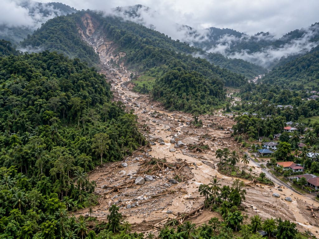
- A debris flow is a fast-moving mixture of water, soil, rock and vegetation that travels down steep channels.
- It is not a landslide: it flows, travels far, and can reach areas well beyond the source slope.
- In Malaysia, debris flows occur in steep catchments where upstream slopes exceed 35 degrees.
- Developers need assessment before building below, within or at the outlet of such catchments.
- Cost is scoped per site, driven by catchment size, terrain and investigation depth.
Introduction
Malaysia’s steep, heavily vegetated catchments can generate debris flows under intense rainfall. Unlike a landslide that fails and largely stays put, a debris flow mobilises sediment, boulders and vegetation and carries it downstream — often far beyond the slope that started it. The critical point for developers is that the hazard may not exist on the site at all. It exists upstream. This article explains what debris flow is, when an assessment is needed, how it is carried out, and what drives cost. It is general guidance only; every catchment requires site-specific engineering judgement.
What Is a Debris Flow?
A debris flow is a rapidly moving mass of water mixed with sediment, boulders and organic material, travelling down a channel under gravity. Natural slopes steeper than 35 degrees upstream have been identified as capable of triggering landslides and debris flows in Malaysian terrain.
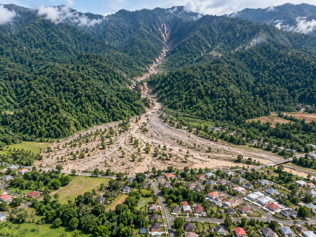
Material accumulating along a channel — dead trees, boulders, pebbles, sand and gravel — can form temporary natural dams. When these release, the flow arrives in surges with additional volume and energy, which is why debris flows cause damage well outside the obvious steep zone.
Assessing it therefore requires more than slope hazard assessment alone. Terrain mapping and hydrological assessment establish where a flow could originate, how far it could run out, and what it would carry.
Why and When Is an Assessment Needed?
A debris flow hazard assessment identifies the source area, the flow path and the runout zone — the three things that determine whether a development site is exposed. Commission one when:
- The site sits below a steep catchment, at the outlet of a stream or gully, or on an alluvial fan or debris cone.
- Upstream slopes exceed 35 degrees.
- Existing drawings or imagery show old debris deposits, boulder fields or channel-fan features.
- There is visible channel accumulation — fallen trees, boulders or sediment that could dam and release.
- Logging, deforestation or land clearing has occurred upstream.
- An asset crosses a steep catchment: pipelines, highways, transmission lines and access roads are all exposed.
- Planning approval is sought for hillside or upland development.
Note that the last two relate to linear infrastructure, where the hazardous reach may occupy only a short section of a very long corridor.
Who Needs It?
Developers and landowners proposing residential, resort or industrial development below steep catchments. Consultants and engineers needing runout and impact inputs for design. Architects fixing siting and platform levels. Contractors assessing access road and earthwork exposure. Asset owners are a major category — highway concessionaires, pipeline operators, power utilities with hillside tower platforms, and plantation operators.
How Does the Assessment Process Work?
1. Desk study and terrain screening
Historical imagery, terrain models and IFSAR-derived data are reviewed to map catchment boundaries, slope gradient, flow accumulation and drainage networks — identifying which catchments warrant field work.
2. Remote sensing and LiDAR
High-resolution LiDAR produces DSM, DTM, change detection maps and classified point clouds, from which debris-flow pathways and drainage instability layers are derived. This is the most efficient way to screen large or inaccessible catchments.
3. Field geological and geomorphological mapping
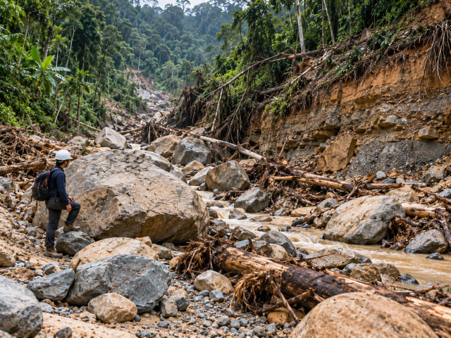
Field teams map source areas, channel morphology, debris deposits and active processes, and record the type and volume of material available for transport.
4. Hazard modelling and zoning
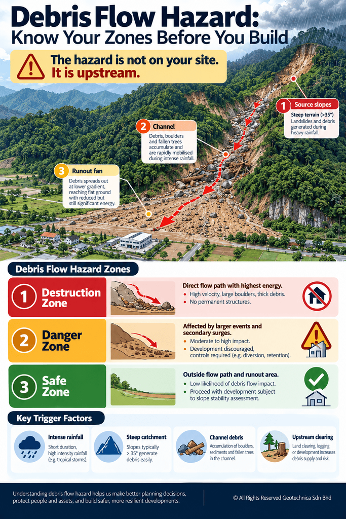
Source, path and runout are combined into a hazard map. The output typically distinguishes a destruction zone, a danger zone and a safe zone — the core deliverable for development planning.
5. Mitigation, warning and monitoring
Structural measures may include channel works, check dams and drainage control. Non-structural measures include land-use regulation, early warning systems and community-based disaster risk management. Monitoring tracks channel condition and rainfall thresholds.
Malaysia-Specific Considerations
Rainfall — up to roughly 4,500 mm annually plus intense storm events — is the primary trigger. Where heavy rain coincides with a steep catchment and abundant channel debris, the conditions for a debris flow are met.
Terrain and geology shape the risk. Debris flow studies in Malaysian forest reserves have covered granite terrain and sedimentary formations across elevation ranges from about 75 m to 726 m — a range that spans the vegetated mid-slope terrain typical of upland development. Contributing factors identified in local assessments include steep slope gradient, water seepage, fast-flowing streams, and logging or deforestation near the catchment.
Debris flow also frequently accompanies other hazards. Compound flood-and-landslide events have required combined on-ground and underwater-bed modelling to understand the full mechanism.
Hazard Zones and What They Mean for Development
| Zone | Meaning | Development implication |
|---|---|---|
| Destruction zone | Direct path and highest impact energy of the flow | No habitable or permanent structures |
| Danger zone | May be affected by larger events or secondary surges | Development strongly discouraged; engineering controls and warning systems required |
| Safe zone | Outside predicted flow paths and runout | Development may proceed, subject to confirming slope stability within the site |
Cost and Deliverables
Debris flow assessment is scoped per catchment. No responsible consultant quotes from a rate table, because a single gully and a multi-branch mountain catchment differ by an order of magnitude in scope. Cost drivers to expect:
- Catchment area and number of channels assessed.
- Extent of LiDAR or remote sensing required.
- Terrain and access difficulty for field mapping.
- Complexity of runout modelling and the number of zones to map.
- Monitoring or early warning requirements, if included.
Where the site forms part of a long linear asset, budget per hazardous reach rather than per kilometre. Judge proposals on methodology, the registration of professionals signing off, and the deliverable list — not lowest fee.
You should receive a technical report with conclusions; source-path-runout hazard maps with destruction, danger and safe zones; recommended mitigation with risk-based prioritisation; and monitoring or warning protocols where residual risk remains.
Malaysian Requirements, Standards and Regulations
Geological terrain mapping is regularly required for planning applications under Section 21 of the Town and Country Planning Act 1976 (Act 172), and along linear infrastructure by authorities including JMG, JKR, DOE and PLANMalaysia. Debris flow hazard and disaster management assessments have been carried out at state level by JMG, and hazard rating uses schemes such as the Slope Information Management System (SIMS) in slope inventory management. Works should be led or reviewed by registered professionals — Board of Engineers Malaysia, Board of Geologists Malaysia and IGRSM for professional geospatialists. Specific clause references and limiting values must be verified against current published documents before being relied upon.
Common Mistakes
- Assessing only the development site and ignoring the upstream catchment.
- Assuming a flat site is safe — runout can extend well beyond steep terrain.
- Treating channel debris as a minor maintenance issue rather than a hazard source.
- Relying on slope stability analysis alone, without hydrological or runout modelling.
- Overlooking small tributary gullies that feed the main channel.
- Building without an early warning or monitoring provision where residual risk remains.
Practical Checklist
Before appointing: identify the catchment above the site; note the highest adjacent terrain; photograph and date any channel debris or previous flow evidence; gather existing reports and imagery; verify consultant registration; agree the deliverable list.
During assessment: confirm the full catchment is reviewed, not just the site; confirm source, path and runout are all covered; confirm channel debris and potential dam sites are recorded; confirm rainfall triggers are considered.
After reporting: keep development out of the destruction zone; apply conditions to the danger zone; assign mitigation owners and dates; establish a channel inspection cycle; keep the report with the asset records.
Frequently Asked Questions
What is a debris flow?
A rapidly moving mixture of water, sediment, boulders and vegetation travelling down a steep channel. It differs from a landslide in that it flows rather than slides, and can travel far beyond its source.
How is debris flow risk assessed in Malaysia?
Through desk study and terrain screening, LiDAR and remote sensing, field geological and geomorphological mapping, then hazard modelling that produces destruction, danger and safe zone mapping.
Who needs a debris flow assessment?
Developers proposing sites below steep catchments or on debris fans, their consultants and engineers, plus asset owners — highway concessionaires, pipeline operators, utilities and plantation operators.
Can a debris flow be prevented?
Not eliminated. Risk can be reduced through avoidance, land-use regulation, channel and drainage works, check dams, early warning systems and monitoring.
Myth: if my site is flat, debris flow is not a concern
Reality: runout extends well beyond steep terrain. Flat ground at the outlet of a catchment or on a debris fan can sit directly in the flow path.
Why Choose Geotechnica?
Geotechnica integrates the capabilities debris flow assessment requires: geohazard and risk assessment including debris flow analysis and root-cause failure investigation; engineering geological and terrain mapping; LiDAR, aerial photogrammetry and geophysics; and geotechnical services including soil investigation and instrumentation. We have delivered debris flow hazard mapping and zoning, LiDAR-derived debris-flow pathway and susceptibility layers for state authorities, and debris flow analysis using IFSAR for infrastructure corridors. CIDB and MOF registered, nationwide coverage. Talk to us about your catchment.
Conclusion
The hazard in a debris flow is usually uphill of the site, and it arrives fast. Identify the catchment before you design, keep development out of the destruction zone, and put mitigation and warning in place where residual risk remains. Do not build on the fan and hope.
References
1- Engineering Geology and Geological Disaster Management – Department of Mineral and Geoscience Malaysia (JMG). https://www.jmg.gov.my/en/expertise-engineering-geology-disaster.html
2- Landslide Threat at Hotspot Areas, Critical Slope Monitoring and Debris Flow Hazard Mapping – Department of Mineral and Geoscience Malaysia (JMG). https://www.jmg.gov.my/component/rsfiles/download-file/files?Itemid=437&path=kenyataan-media%2F2023%2FANCAMAN%20TANAH%20RUNTUH%20DI%20KAWASAN%20HOTSPOT%20STATUS%20PEMANTAUAN%20CERUN%20KRITIKAL%20SERTA%20PEMETAAN%20BAHAYA%20ALIRAN%20PUING%20BERIKUTAN%20MUSIM%20MONSUN%20TIMUR%20LAUT%202023.pdf
3- Geological Investigation Following Debris Flow and Muddy Water Overflow in Bentong, Pahang – Ministry of Natural Resources, Environment and Climate Change / JMG. https://www.jmg.gov.my/component/rsfiles/download-file/files?Itemid=437&path=kenyataan-media%2F2023%2FNRECC%20JALANKAN%20SIASATAN%20GEOLOGI%20SUSULAN%20KEJADIAN%20ALIRAN%20PUING%20DAN%20LIMPAHAN%20AIR%20BERLUMPUR%20DIBENTONGPAHANG.pdf
4- Garis Panduan Perancangan Pembangunan di Kawasan Bukit dan Tanah Tinggi – PLANMalaysia. https://mytownnet.planmalaysia.gov.my/ver2/gp/GPP_TANAH_TINGGI.pdf
5- CERUN 1: Guidelines on Slope Maintenance in Malaysia – Jabatan Kerja Raya Malaysia (JKR). https://jpedia.jkr.gov.my/images/b/b1/Guidelines_of_slope_maintenence.pdf
This article had been technically reviewed by P.Geol. Gs. Hairil Azwan, Geohazard Specialist and Managing Director at Geotechnica Sdn. Bhd., with 15 years of professional experience in geology, geotechnical engineering and geospatial technology.
Next Review: 10 February 2027

