

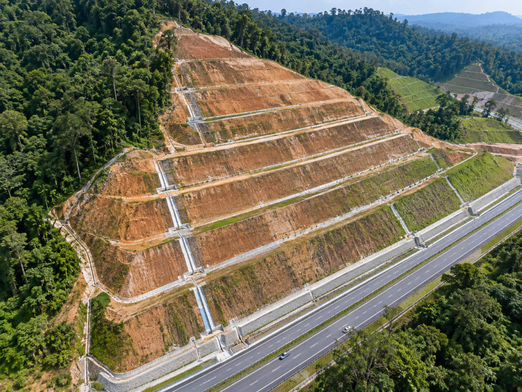
- Slope stability analysis calculates whether a slope can resist failure, expressed as a factor of safety (FOS).
- It compares driving forces against resisting forces, or models stress and deformation directly.
- Soil slopes use limit equilibrium or finite element methods; rock slopes need kinematic analysis.
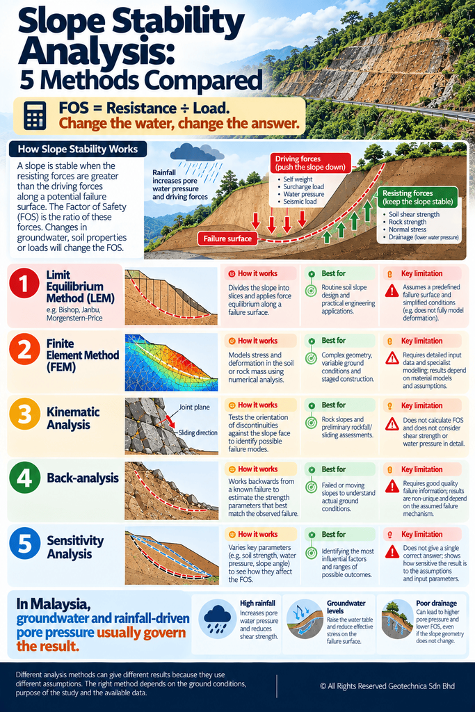
- In Malaysia, groundwater and rainfall-driven pore pressure usually govern the result.
- Analysis cost is scoped per slope; the number of sections and investigation depth drive it.
Introduction
Assessment tells you whether a slope is a hazard. Analysis tells you by how much. Slope stability analysis converts geology, groundwater and ground investigation data into a number that engineers can design against: the factor of safety. Get the inputs right and it is a powerful decision tool. Get them wrong and it produces a confident answer that means nothing. This article explains what the analysis involves, which method suits which slope, and where Malaysian conditions change the numbers. It is general guidance only; every slope requires site-specific engineering judgement.
What Is Slope Stability Analysis?
Slope stability analysis evaluates whether a slope can resist failure, identifying the factor of safety (FOS) and informing the appropriate mitigation plan. Soil slopes are typically analysed by comparing driving forces against resisting forces along a potential failure surface, or by modelling stress and deformation in the ground. Rock slopes are analysed structurally, testing discontinuity orientation against the face geometry.
The FOS is not an abstract number. It is the ratio of available resistance to applied load, and it changes with groundwater level, rainfall, loading and time. Analysis results are therefore conditional: they are valid for the parameters, water conditions and geometry assumed. Change the drainage and the FOS changes with it.
Why and When Is It Needed?
Analysis is required to demonstrate that a slope is adequate for its purpose, and to size mitigation when it is not. Commission it when:
- Designing a new cut slope, embankment or platform.
- Proposing loading above or below an existing slope.
- An inspection or checklist has identified distress, seepage or movement.
- A mitigation scheme — drainage, reinforcement, retaining structures — needs verification.
- A failure has occurred and the mechanism must be established.
- An authority or asset owner requires design justification for submission.
Who Needs It?
Consultants and engineers need it as the core design output. Developers need it to manage risk and secure approvals on sloped land. Contractors need it for temporary works and safe sequencing during earthworks. Architects need it to fix platform levels and siting. Asset owners — highway concessionaires, pipeline operators, utilities, quarries and plantation operators — need it to prioritise and design remediation across slope inventories.
How Does the Process Work?
1. Define the problem and geometry
Establish the slope profile, proposed and existing geometry, and the consequence of failure. This sets the analysis sections and the design criteria.
2. Characterise the ground
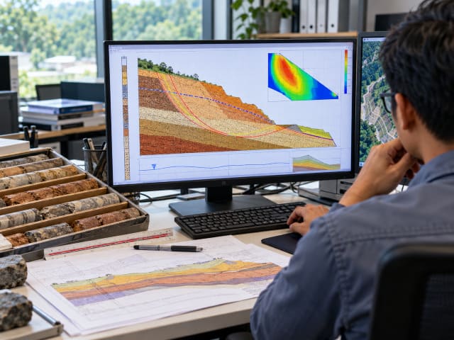
Boreholes with in-situ and laboratory testing provide soil and rock properties; geophysics extends that picture across the site. Parameters include strength, unit weight and stiffness.
3. Establish the groundwater regime
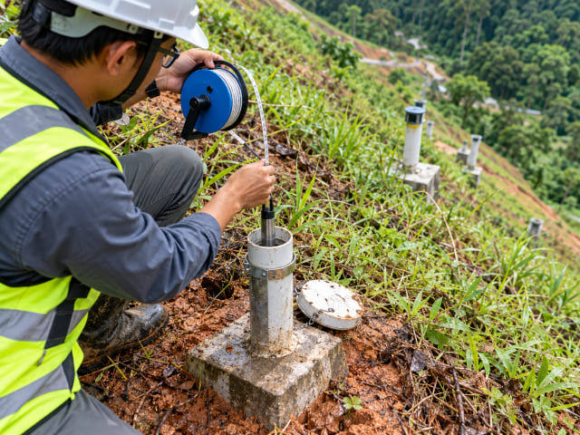
Water pressure is usually the single most influential input. Groundwater level, seepage paths and rainfall response must be characterised, not assumed.
4. Identify the critical failure mechanism
For soil, this means locating the most critical failure surface. For rock, it means structural mapping and kinematic analysis of discontinuity orientation to test planar, wedge and toppling modes.
5. Analyse
Methods are selected to suit the slope — see the comparison table below. Drained and undrained conditions are assessed separately where timing matters, and sensitivity checks identify which parameter dominates the result.
6. Verify and design
Where a slope has already failed or is moving, back-analysis is used to derive and verify parameters. Results then feed mitigation design, monitoring and, where required, re-assessment after construction.
Malaysia-Specific Considerations
Malaysia’s rainfall — up to roughly 4,500 mm annually plus intense storms — means groundwater conditions dominate most analyses. A slope analysed conservatively on paper can still fail when drainage is blocked or a storm raises pore pressures faster than any design assumption anticipated.
Materials matter equally. Tropical weathering produces deep residual soils over granitic terrain, while sequences such as phyllite, slate, shale and sandstone also host instability. A documented Malaysian case is instructive: analysis at an institutional site returned FOS below JKR’s recommended values, with ineffective drainage and fill materials consisting of predominantly clay identified as contributors. In rock, kinematic analysis and XRD testing have been used to identify sliding, wedge and toppling potential alongside intense weathering and deformation.
Choosing the Right Analysis Method
| Method | How it works | Best for | Limitation |
|---|---|---|---|
| Limit equilibrium | Compares driving and resisting forces along an assumed failure surface | Routine soil slope design and checking | Limited insight into deformation |
| Finite element / finite difference | Models stress and deformation in the ground | Complex geometry, staged construction | Requires more parameters and calibration |
| Kinematic analysis | Tests discontinuity orientation against face geometry | Rock slopes: planar, wedge, toppling | Depends on systematic structural mapping |
| Back-analysis | Works backward from an observed failure to derive parameters | Failed or moving slopes | Valid only if the mechanism is correctly identified |
| Sensitivity analysis | Varies key parameters to test their effect on FOS | Understanding which input governs | Cannot compensate for poor input data |
Cost and Deliverables
Analysis is scoped per slope. No responsible consultant quotes from a rate table, because a single homogeneous cut and a multi-section site with complex stratigraphy differ by an order of magnitude. Cost drivers to expect:
- Number of analysis sections and slope lengths assessed.
- Borehole numbers and depth, and extent of laboratory testing.
- Geophysical lines where the subsurface profile is uncertain.
- Method complexity — limit equilibrium versus finite element.
- Structural mapping and kinematic analysis for rock slopes.
- Drained, undrained, seismic and staged construction scenarios.
- Mitigation design output, if included.
Match the analysis method to the decision. A feasibility check does not need finite element modelling; a staged excavation with deformation constraints may. Judge proposals on methodology, the registration of professionals signing off, and the deliverable list, not lowest fee.
You should receive a technical report with conclusions; a defined mechanism and critical failure surface; FOS results under stated conditions; parameter sources and assumptions; mitigation recommendations; and sensitivity discussion where inputs are uncertain.
Malaysian Requirements, Standards and Regulations
JKR’s slope engineering guidance sets the practical benchmark for slope design and stability review in Malaysia, including acceptance criteria for analysis results. Where slopes form part of a development, geological terrain mapping is regularly required for planning applications under Section 21 of the Town and Country Planning Act 1976 (Act 172), and along linear infrastructure by authorities including JMG, JKR, DOE and PLANMalaysia. SIMS-based hazard rating is widely used in slope inventory management. Works should be led or reviewed by registered professionals — Board of Engineers Malaysia, Board of Geologists Malaysia and IGRSM for professional geospatialists. Specific clause references, parameter values and acceptance criteria must be verified against current published documents before being relied upon.
Common Mistakes
- Analysing without characterising groundwater properly.
- Using textbook parameters instead of site-specific testing.
- Applying a soil analysis approach to a rock slope.
- Reporting a single FOS without stating the conditions it applies to.
- Ignoring the critical failure surface and analysing an assumed one.
- Skipping back-analysis on a slope that has already failed.
- Treating the analysis as final — drainage degrades and conditions change.
Practical Checklist
Before analysis: confirm the design criteria and required acceptance standard; confirm the consequence of failure; verify that investigation covers the critical section; confirm the groundwater model.
During analysis: confirm the failure mechanism is identified, not assumed; check drained and undrained cases; run sensitivity on water level and strength; back-analyse any existing failure.
After reporting: confirm results state the conditions they apply to; verify mitigation is designed against the same parameters; build drainage maintenance into the O&M regime; set re-assessment triggers.
Frequently Asked Questions
What is slope stability analysis?
The calculation of whether a slope can resist failure, expressed as a factor of safety. It compares driving and resisting forces along a failure surface, or models stress and deformation directly.
How is it carried out in Malaysia?
Ground investigation and testing establish parameters, groundwater is characterised, the critical mechanism is identified, and limit equilibrium, finite element or kinematic methods are applied depending on whether the slope is soil or rock.
Who needs a slope stability analysis?
Consultants and engineers for design, developers for approvals and risk management, contractors for temporary works and sequencing, and asset owners prioritising remediation across slope inventories.
Why did a slope fail if the FOS was adequate?
Because the FOS applies to the conditions assumed. Blocked drainage, raised groundwater, loading changes or a mechanism not considered can reduce the real FOS well below the calculated figure.
Myth: one analysis lasts the life of the slope
Reality: FOS changes with groundwater, drainage condition, loading and time. Analyses need periodic review, and re-assessment when conditions change.
Why Choose Geotechnica?
Geotechnica integrates the inputs slope stability analysis depends on: geohazard and risk assessment including landslide hazard analysis and root-cause failure investigation; engineering geological, terrain and rock slope mapping with kinematic analysis; LiDAR, aerial photogrammetry and geophysics; and geotechnical services including soil investigation and instrumentation. We apply limit equilibrium and finite element methods alongside back-analysis on failed slopes, and have delivered stability analysis, mitigation design, AFC drawings and site supervision for slope rectification works. CIDB and MOF registered, nationwide coverage. Talk to us about your slope.
Conclusion
Slope stability analysis is only as good as the water level, the parameters and the mechanism behind it. Characterise the ground properly, model the water honestly, and state the conditions your FOS applies to. A number without its assumptions is not engineering — it is arithmetic.
References
1- Guidelines for Slope Design – Jabatan Kerja Raya Malaysia (JKR). https://jpedia.jkr.gov.my/images/e/ee/Design_Guideline.pdf
2- Slope Remedial Works in Malaysia – Jabatan Kerja Raya Malaysia (JKR), Cawangan Kejuruteraan Cerun. https://crr.kkr.gov.my/en/dokumen/umum/WJ.1.2020.93
3- Guidelines on Slope Maintenance in Malaysia – Jabatan Kerja Raya Malaysia (JKR), Cawangan Kejuruteraan Cerun. https://crr.kkr.gov.my/en/dokumen/umum/WJ.1.2006.127
4- Engineering Geology and Geological Disaster Management – Department of Mineral and Geoscience Malaysia (JMG). https://www.jmg.gov.my/en/expertise-engineering-geology-disaster.html
5- Garis Panduan Perancangan Pembangunan di Kawasan Bukit dan Tanah Tinggi – PLANMalaysia. https://www.planmalaysia.gov.my/main/article/garis-panduan-perancangan
This article had been technically reviewed by P.Geol. Gs. Hairil Azwan, Geohazard Specialist and Managing Director at Geotechnica Sdn. Bhd., with 15 years of professional experience in geology, geotechnical engineering and geospatial technology.
Next Review: 10 February 2027

