

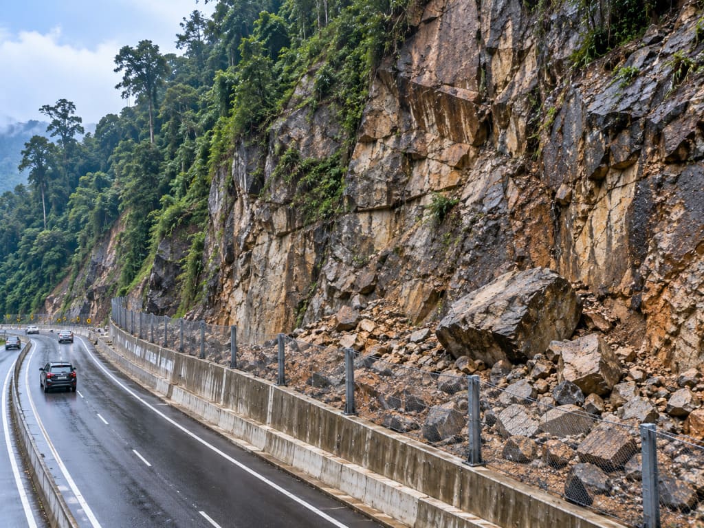
- A rockfall hazard is the likelihood of rock detaching from a slope and falling, bouncing or rolling.
- It is governed by discontinuities — joints, bedding, foliation and faults — not by soil strength.
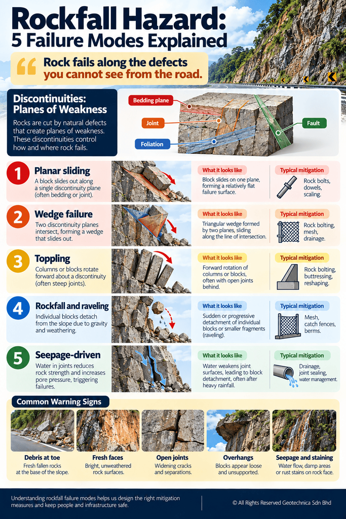
- Malaysian rock slopes fail by planar sliding, wedge failure, toppling and rockfall.
- Warning signs include open joints, fresh rock faces, debris at the toe and seepage.
- Assessment cost is scoped per location; face height, access and scope drive it.
Introduction
Malaysia’s rock slopes sit above highways, access roads, transmission corridors and hillside developments. Unlike soil slopes, rock fails along defects within the rock mass, and a face can release without obvious warning. Several rock slope failures have been recorded along Malaysian highways since 2009 without casualties — which is precisely why structured assessment matters: the outcome depends on whether the hazard was rated and mitigated, not on luck. This article explains what rockfall hazard is, when assessment is needed, how it works and what drives cost. It is general guidance only; every rock slope requires site-specific engineering judgement.
What Is a Rockfall Hazard?
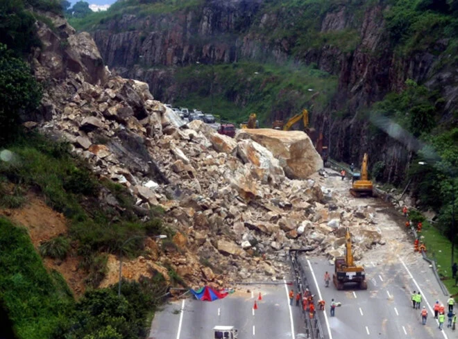
A rockfall hazard is the likelihood that rock will detach from a slope face and fall, bounce or roll downslope, together with the consequence for anything below.
In rock, stability is governed by planes of discontinuity. Primary structures include bedding and unconformities; secondary structures include foliation, joints and faults. These planes are the weak regions of a rock mass, and where they intersect and daylight on the face, blocks can release as falls, slides, wedges or toppling.
Assessing rockfall therefore centres on structural mapping and kinematic analysis — establishing which failure mechanisms are geometrically possible — rather than on soil strength parameters. It is not a visual inspection, though inspection often initiates it.
Why and When Is an Assessment Needed?
Commission a rockfall hazard assessment when:
- Development, highway or infrastructure sits below, above or adjacent to a rock face.
- Rock debris is present at the toe, or the face shows fresh, unweathered breakage.
- Open joints, overhangs or vegetation growing from joints are visible.
- Seepage or staining appears along discontinuities.
- A slope register has flagged the rock slope for specialist review, or the face lies outside the normal maintenance authority’s work-order route.
- The slope is aged or undocumented, or adjacent excavation or blasting is proposed.
Who Needs It?
Developers and landowners with rock cut slopes or outcrops on site; consultants and engineers needing kinematic inputs for design; contractors planning access, benching or blasting; architects fixing siting relative to rock faces. Asset owners are a major category — highway concessionaires, quarry and mining operators, power utilities with hillside tower platforms, and pipeline operators whose rights-of-way cross rock terrain.
How Does the Assessment Process Work?
1. Desk study and aerial review
Historical imagery, terrain models and IFSAR-derived data identify rock faces, lineaments and potential release zones.
2. Rock slope and structural mapping
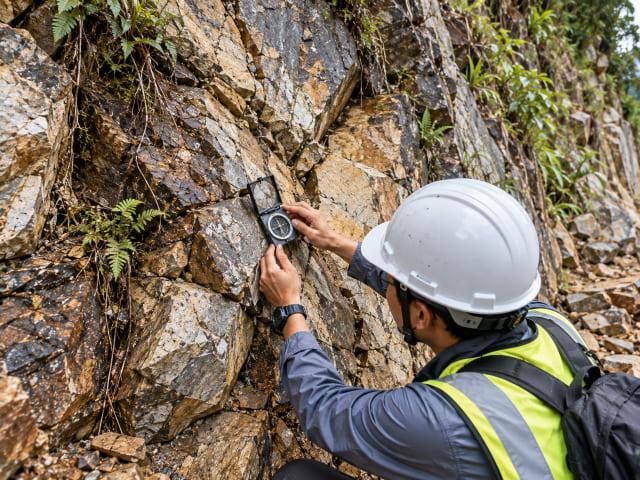
The orientation, spacing, persistence and condition of discontinuities are recorded, along with weathering grade, groundwater and seepage.
3. Kinematic analysis
Discontinuity data are tested against the slope geometry for planar sliding, wedge and toppling mechanisms to establish which failure modes are possible.
4. Investigation and testing
Where required, boreholes and geophysics support the assessment, with laboratory testing including XRD where weathering and deformation must be characterised.
5. Hazard and risk rating
Likelihood and consequence are combined to rate each rock slope, with Very High locations called out for mitigation and hazard-risk maps produced.
6. Mitigation design and monitoring
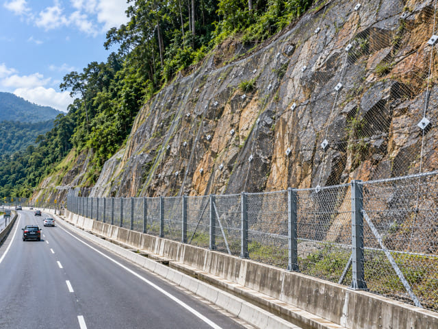
Rock bolting, mesh, scaling, catch fences and drainage, followed by instrumentation to track movement and condition so intervention is timely.
Malaysia-Specific Considerations
Malaysia’s tropical weathering produces deep residual profiles over granitic terrain, with fresh rock exposed in cuts. Sedimentary and metasedimentary sequences — phyllite, slate, shale and sandstone — also host rock slope instability.
Field assessments on Malaysian rock slopes have recorded faulting, buckling, boudinage, tension cracks and water seepage, alongside intense weathering and deformation. Heavy rainfall and seepage along joints are recurring triggers, and logging or deforestation near slopes has featured among observed contributors.
Failure Modes and What They Tell You
Identifying the governing mechanism matters, because mitigation is designed around it.
| Failure mode | Typical indicator | Mechanism | Remediation direction |
|---|---|---|---|
| Planar sliding | Discontinuity daylighting parallel to the face | Block slides along a single plane | Rock bolts, dowels, scaling |
| Wedge failure | Two intersecting discontinuities | Wedge slides along two planes | Bolting, mesh, drainage |
| Toppling | Steeply dipping joints into the slope | Forward rotation of columns | Bolting, buttressing, reshaping |
| Rockfall and raveling | Debris at toe, open joints, fresh faces | Detachment of individual blocks | Mesh, catch fences, scaling, berms |
| Seepage-driven | Water and staining along joints | Water pressure weakening discontinuity surfaces | Drainage, joint sealing |
Cost and Deliverables
Rockfall hazard assessment is scoped per rock slope. No responsible consultant quotes from a rate table, because a single low rock cut and a multi-bench high face differ by an order of magnitude. Cost drivers to expect:
- Number of rock slopes, and total face height and area.
- Access difficulty — rope access, benching or road closures.
- Extent of structural mapping and number of discontinuity readings.
- Investigation and testing, including XRD where weathering must be characterised.
- Kinematic and stability analysis complexity.
- Mitigation design, AFC drawings and site supervision, if included.
- Monitoring duration.
Match the scope to the decision you are making — pre-tender screening need not be design-grade. Judge proposals on methodology, the registration of professionals signing off, and the deliverable list, not lowest fee.
You should receive a technical report with conclusions; a hazard-risk rating per rock slope with Very High locations called out; rock slope hazard-risk maps; identified failure mechanisms with supporting kinematic analysis; mitigation recommendations; and monitoring protocols.
Malaysian Requirements, Standards and Regulations
Where a rock slope forms part of a development or cut slope, geological terrain mapping is regularly required for planning applications under Section 21 of the Town and Country Planning Act 1976 (Act 172), and along linear infrastructure by authorities including JMG, JKR, DOE and PLANMalaysia. JKR’s slope engineering guidance sets the practical benchmark for slope design and review in Malaysia, and SIMS-based hazard rating is widely used in slope inventory management. Works should be led or reviewed by registered professionals — Board of Engineers Malaysia, Board of Geologists Malaysia and IGRSM for professional geospatialists. Specific clause references and limiting values must be verified against current published documents before being relied upon.
Common Mistakes
- Applying a soil slope assessment approach to a rock face.
- Assessing the face visually without mapping discontinuities.
- Ignoring seepage along joints.
- Assuming no recent falls means no hazard.
- Omitting kinematic analysis and missing the governing failure mode.
- Skipping monitoring after mitigation.
Practical Checklist
Before appointing: identify rock faces and access constraints; record and date visible debris, fresh breakage and seepage; locate as-built drawings or previous reports; verify consultant registration; agree the deliverable list.
During assessment: confirm discontinuity data are recorded systematically; confirm testing is included where weathering is severe; confirm the wider slope is assessed, not just the face.
After reporting: act on Very High ratings first; sequence mitigation before exposing workers below the face; assign owners and dates; set a re-inspection cycle.
Frequently Asked Questions
What is a rockfall hazard?
The likelihood of rock detaching from a slope and falling, bouncing or rolling, combined with the consequence for people and assets below. It is governed by discontinuities within the rock mass.
How is rockfall hazard assessed in Malaysia?
Through desk study and remote sensing, structural mapping of discontinuities, kinematic analysis for planar, wedge and toppling mechanisms, then hazard-risk rating, mitigation and monitoring.
Who needs a rockfall hazard assessment?
Developers below rock faces, their consultants and contractors, plus highway concessionaires, quarry operators, utilities and pipeline operators whose assets cross rock terrain.
Can a rockfall be prevented?
Not eliminated. Risk can be reduced through scaling, rock bolting, mesh, catch fences, drainage and monitoring, prioritised by risk rating.
Myth: no falls in years means the face is safe
Reality: rock slopes can remain stable for long periods before releasing, and rainfall, seepage and excavation change conditions quickly.
Why Choose Geotechnica?
Geotechnica integrates the capabilities rock slope assessment requires: geohazard and risk assessment including rock slope hazard analysis and root-cause failure investigation; structural and rock slope mapping; LiDAR, aerial photogrammetry and geophysics; and geotechnical services including soil investigation, slope engineering and instrumentation. We have delivered rock slope hazard and risk assessment along expressways, detailed engineering design for slope stabilisation including AFC drawings and site supervision, and geological rock slope mapping for quarry and development sites. CIDB and MOF registered, nationwide coverage. Talk to us about your rock slope.
Conclusion
Rock failure is governed by defects you cannot see from the road. Map the discontinuities, identify the governing mechanism, and rate the risk before it escalates. Do not wait for the first fall.
References
1- Guidelines for Slope Design – Jabatan Kerja Raya Malaysia (JKR). https://jpedia.jkr.gov.my/images/e/ee/Design_Guideline.pdf
2- Slope Remedial Works in Malaysia – Jabatan Kerja Raya Malaysia (JKR), Cawangan Kejuruteraan Cerun. https://crr.kkr.gov.my/en/dokumen/umum/WJ.1.2020.93
3- Guidelines on Slope Maintenance in Malaysia (CERUN 1) – Jabatan Kerja Raya Malaysia (JKR), Cawangan Kejuruteraan Cerun. https://crr.kkr.gov.my/en/dokumen/umum/WJ.1.2006.127
4- Engineering Geology and Geological Disaster Management – Department of Mineral and Geoscience Malaysia (JMG). https://www.jmg.gov.my/en/expertise-engineering-geology-disaster.html
5- Garis Panduan Perancangan Pembangunan di Kawasan Bukit dan Tanah Tinggi – PLANMalaysia. https://mytownnet.planmalaysia.gov.my/ver2/gp/GPP_TANAH_TINGGI.pdf
This article had been technically reviewed by P.Geol. Gs. Hairil Azwan, Geohazard Specialist and Managing Director at Geotechnica Sdn. Bhd., with 15 years of professional experience in geology, geotechnical engineering and geospatial technology.
Next Review: 10 February 2027

