

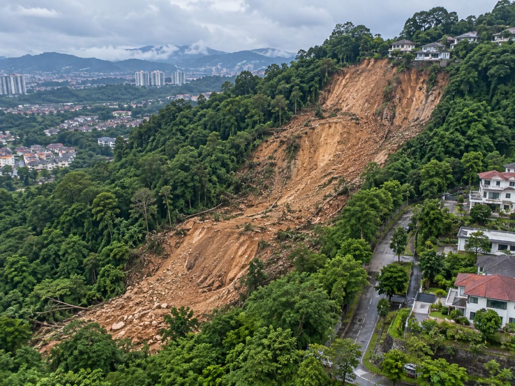
- A landslide assessment determines whether a slope can fail, how likely failure is, and what is at risk.
- It combines desk study, terrain mapping, remote sensing, subsurface investigation and stability analysis.
- Outputs include a hazard-risk rating, factor of safety (FOS) and prioritised mitigation.
- In Malaysia, landslides cluster on cut and embankment slopes, with rainfall the dominant trigger.
- Cost is quoted per site, driven by assessment level, area, terrain and investigation scope.
Introduction
Malaysia’s landslides occur mostly on cut and embankment slopes in mountainous and hillside areas, with heavy rainfall the dominant trigger. As development pushes onto steeper, more marginal ground — sometimes onto dormant landslides that have not moved in decades — the difference between a contained problem and a disaster is usually whether the slope was rated before failure. This article covers what landslide assessment is, when to commission it, what drives cost, and who should do it. It is general guidance only; every slope needs site-specific engineering judgement.
What Is a Landslide Assessment?
A landslide assessment evaluates slope stability and landslide potential through field investigation, laboratory testing and computer modelling, using geology, hydrology and topography to derive a factor of safety and an appropriate mitigation plan.
Three terms are often confused. Hazard is the likelihood and magnitude of an event. Risk combines that hazard with consequence — the vulnerability of assets, property and people. Susceptibility maps where landslides are likely to occur across a wider area, typically a corridor-scale output.
It is not a visual walkover or the installation of monitoring instrumentation, though both often form part of it.
Why and When Is It Needed?
Risk is only manageable once likelihood, consequence and vulnerability are assessed together. That determines whether mitigation is structural (stabilisation, retaining structures, drainage) or non-structural (land-use regulation, early warning systems).
Commission an assessment when:
- Planning approval or platform design is proposed on hilly terrain.
- The site sits on, below or above a cut slope or embankment.
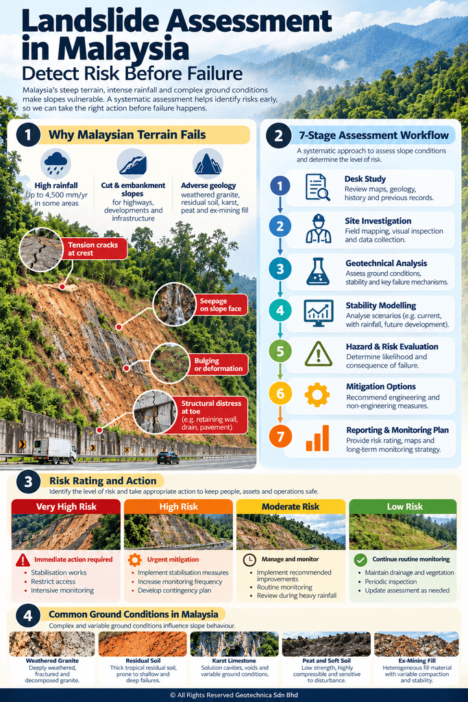
- Precursory signs appear — tension cracks, seepage, bulging or distress to drains and retaining structures.
- A pipeline, road or transmission asset crosses challenging terrain.
- The hazard source lies outside your right-of-way, where normal work-order maintenance may not apply.
- A slope is due for periodic re-rating, or a failure has occurred and root cause is needed.
Who Needs It?
Developers on hillside land need it for planning approval and liability; consultants and engineers for design input; contractors for buildability and temporary works; architects for siting. Asset owners are the largest repeat category — highway concessionaires, pipeline and utility operators, utilities with hillside tower platforms, quarries and plantations. On national pipeline networks, multi-slope programmes are routinely assessed in batches of 13 to 52 locations along one corridor.
How Does the Process Work?
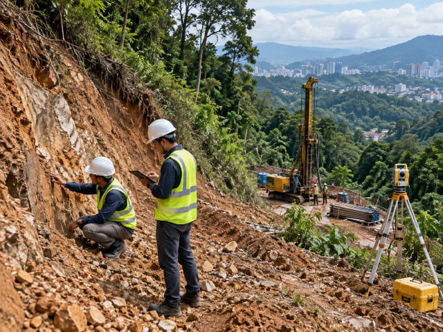
1. Desk study
Maps, historical imagery and IFSAR-derived terrain models establish terrain units, slope gradient, flow accumulation and lineaments, setting the scope.
2. Geological terrain mapping
Surface geology, landforms, active geomorphological processes and instability features are mapped — commonly required on linear projects by JMG, JKR, DOE and PLANMalaysia.
3. Remote sensing and LiDAR
Airborne or UAV LiDAR produces DSM, DTM, change detection maps, orthophotos and classified point clouds. Our surveys include roughly 40 km² across Hulu Langat and Bukit Antarabangsa and 170 km² at Gunung Jerai, Kedah.
4. Subsurface investigation
Boreholes with in-situ and laboratory testing, plus non-invasive geophysics — resistivity, seismic refraction, MASW and GPR — which resolve groundwater, fracture zones and voids without excavation.
5. Analysis
Soil slopes use limit equilibrium and finite element analysis to derive FOS. Rock slopes require structural mapping and kinematic analysis to identify sliding, wedge and toppling mechanisms.
6. Hazard and risk rating
Ratings may follow an established scheme such as the Slope Information Management System (SIMS), or a purpose-built model of twelve causal and triggering parameters.
7. Mitigation and monitoring
Interim and permanent measures, followed by instrumentation and real-time monitoring so intervention is timely.
Malaysia-Specific Considerations
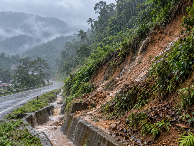
Rainfall — up to roughly 4,500 mm annually plus intense storms — is the primary trigger, and compound flood-and-landslide events have required combined on-ground and underwater-bed modelling.
Weathered granitic terrain is a recurring setting, while phyllite, slate, shale and sandstone sequences host instability, often with clay-rich fill and poor drainage implicated. In rock, faults, buckling and tension cracks accompany active movement. In catchments steeper than 35°, debris flow can develop, with hazard maps distinguishing destruction, danger and safe zones. Peat, soft clay, limestone and karst, ex-mining land and reclaimed fill each interact differently with slope works.
Methods: Choosing the Right Approach
No single method fits every site. Suitability depends on data coverage, the scale of the area and how much interpretation is qualitative; complex sites need a multi-approach investigation.
| Method | Reveals | Best for | Limitation |
|---|---|---|---|
| Satellite / IFSAR imagery | Terrain, water accumulation, settlement-prone zones | Corridor-scale screening | Needs field validation |
| Airborne / UAV LiDAR | DSM, DTM, change detection, orthophotos | Large or mountainous areas | Cost scales with area |
| Geological terrain mapping | Terrain activity, instability, slope gradient | Authority submissions | Needs experienced geologists |
| Resistivity / seismic / MASW / GPR | Groundwater, fracture zones, voids | Non-invasive subsurface insight | Interpretation-driven |
| Boreholes + lab testing | Soil and rock properties, stratification | Design-grade FOS analysis | Point data only |
| Instrumentation | Movement, failure points | Active or mitigated slopes | Requires duration and maintenance |
Cost and Deliverables
Landslide assessment is scoped per site. No responsible consultant quotes from a rate table, because two hills a kilometre apart can differ by an order of magnitude in scope. Cost drivers to expect:
- Assessment level — desktop screening versus detailed geotechnical assessment.
- Extent, particularly area in km² where LiDAR is required.
- Terrain, access difficulty, and number and depth of boreholes.
- Geophysical lines and monitoring duration, if included.
- Number of risk-rated locations; multi-location programmes are priced per location.
Match the assessment level to the decision you are making — over-scoping a feasibility study wastes budget, while under-scoping a design study is where money is lost later. Judge proposals on methodology, the registration of professionals signing off and the deliverable list, not lowest fee.
You should receive a technical report with conclusions; hazard-risk ratings per slope with Very High locations called out; hazard or debris-flow zone maps; FOS results with mitigation requirements; drainage and remediation recommendations with risk-based prioritisation; monitoring protocols; and GIS datasets.
Malaysian Requirements, Standards and Regulations
Geological terrain mapping is regularly required for planning applications under Section 21 of the Town and Country Planning Act 1976 (Act 172), and along linear infrastructure by JMG, JKR, DOE and PLANMalaysia. JKR’s slope engineering guidance sets the practical FOS benchmark in Malaysian slope analysis, and SIMS-based hazard rating is widely used for slope inventories. Where a slope lies outside a right-of-way, standard work-order regimes may not apply. Works should be led or reviewed by registered professionals — Board of Engineers Malaysia, Board of Geologists Malaysia and IGRSM.
Common Mistakes
- Treating a visual walkover as an assessment.
- Ignoring drainage, a repeatedly identified contributor to failure.
- Assuming a long-stable slope is safe — active movement has been found on slopes with infrastructure already built above them.
- Skipping kinematic analysis on rock slopes.
- Rating hazard without assessing consequence.
- Omitting post-mitigation monitoring.
Practical Checklist
Before appointing: define the decision and stage; list downslope assets; gather existing reports and imagery; verify consultant registration; agree the deliverable list and rating scheme.
During assessment: confirm access and safety, terrain mapping coverage, that boreholes and geophysical lines tie to the analysis, that groundwater is characterised, and that interim measures exist for anything actively moving.
After reporting: act on Very High ratings first; assign owners and dates; build drainage maintenance into the O&M regime; set a re-rating cycle.
Frequently Asked Questions
What is a landslide assessment?
A structured evaluation of whether a slope can fail, combining field investigation, testing and modelling to derive a factor of safety and hazard-risk rating.
How is it carried out in Malaysia?
Typically desk study, geological terrain mapping, LiDAR where scale requires it, boreholes with geophysics, then stability and kinematic analysis, rating and mitigation recommendations.
Who needs one?
Developers, consultants, engineers and contractors on or near sloped terrain, plus asset owners — highway concessionaires, pipeline operators, utilities, quarries and plantations.
Can it stop my slope failing?
No. It converts unquantified exposure into a rated risk with prioritised mitigation, enabling intervention before failure.
Myth: a slope standing 20 years is safe
Reality: rainfall, drainage failure, excavation and vegetation loss change ground conditions, and dormant landslides can be reactivated.
Why Choose Geotechnica?
Geotechnica integrates the full assessment stack: slope hazard and risk assessment services including landslide hazard analysis, QRA/sQRA, debris flow and root-cause failure analysis; engineering geological and terrain mapping; LiDAR, aerial photogrammetry and geophysics; and soil investigation, slope engineering and instrumentation.
We surveyed 170 km² at Gunung Jerai and roughly 40 km² across Hulu Langat and Bukit Antarabangsa, and delivered ground change detection and landslide susceptibility mapping along a 512 km pipeline right-of-way. CIDB and MOF registered, nationwide coverage. Talk to us about your site.
Conclusion
In Malaysian terrain, detection beats response. Landslides concentrate on cut and embankment slopes, rainfall is the dominant trigger, and the difference between a contained problem and a disaster is usually whether the slope was rated before failure. Do not wait for the first crack.
References
1- Guidelines for Slope Design – Jabatan Kerja Raya Malaysia (JKR). https://jpedia.jkr.gov.my/images/e/ee/Design_Guideline.pdf
2- Engineering Geology and Geological Disaster Management – Department of Mineral and Geoscience Malaysia (JMG). https://www.jmg.gov.my/en/expertise-engineering-geology-disaster.html
3- National Slope Master Plan: Early Warning and Real-Time Monitoring System – Jabatan Kerja Raya Malaysia (JKR). https://epsmg.jkr.gov.my/images/6/6d/Sectoral_report_-_volume_2.pdf
4- Garis Panduan Pemetaan Geologi Terain (Geological Terrain Mapping), JMG.GP.06 – Department of Mineral and Geoscience Malaysia (JMG). https://elib.jmg.gov.my/cgi-bin/koha/opac-detail.pl?biblionumber=21271
5- CERUN 1: Guidelines on Slope Maintenance in Malaysia – Jabatan Kerja Raya Malaysia (JKR). https://jpedia.jkr.gov.my/images/b/b1/Guidelines_of_slope_maintenence.pdf
This article had been technically reviewed by P.Geol. Gs. Hairil Azwan, Geohazard Specialist and Managing Director at Geotechnica Sdn. Bhd., with 15 years of professional experience in geology, geotechnical engineering and geospatial technology.
Next Review: 10 February 2027

